

The 2010 Chile Earthquake: Crustal deformation detected by ALOS/PALSAR data
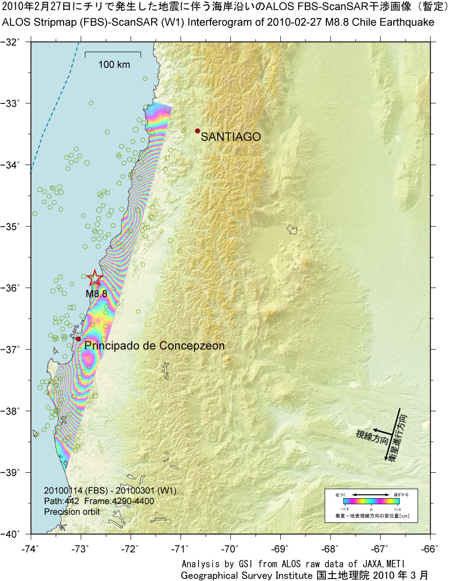
Crustal deformation by InSAR analysisCreate: Mar. 12, 2010, Update: Mar. 12, 2010 Japanese version of this page InSAR analysis using ScanSAR dataA great earthquake with a moment magnitude of 8.8 (USGS) that occurred on 27 February, 2010 (UTC: 06:34) struck the coastal zone in the middle of Chile. The area subjected to crustal deformation associated with this earthquake is expected to be vast, thus we have to spend much time and effort to grasp the whole picture of the surface displacement field with observations by a fine beam (high resolution) mode which is a normal operation type for ALOS/PALSAR.
The ALOS/PALSAR can operate a ScanSAR mode by which a wide range image of about 350 km can be acquired at a time, which is approximately 5 times as wide as the fine beam mode. Thus the observation with the ScanSAR mode is efficient to map such a vast crustal deformation area more quickly. However a ScanSAR interferometry has not been feasible so far. After the mainshock, observations with the ScanSAR mode were made. We developed a ScanSAR interferomtric technique, and succeeded in obtaining the interferogram (preliminary result). FBS-ScanSAR InterferometrySatellite and SensorPALSAR sensor onboard "Daichi" (ALOS) satellite launched by Japan Aerospace Exploration Agency on January 24, 2006
|
 [PNG: 1.43MB]