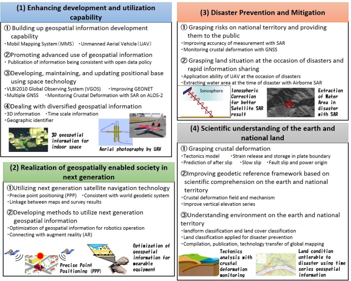
GSI is actively promoting research and development projects contributing to planning and implementing administrative measures for development and utilization of surveying and geospatial information in a precise manner, with the following key themes:
Research and development to enhance development and utilization capability
Research and development to create a geospatially enabled society in the next generation
Research and development for disaster prevention and mitigation
Research for scientific understanding of the earth and national land
Some files are available in PDF format. To view PDF files, Adobe System's free "Adobe Reader" software must be installed. Please visit the following link to download the free software.