Maps & Geospatial Information
|
GSI Activities
International Committee
 |
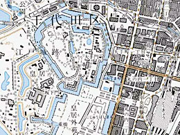
The whole land of Japan is covered by about 4,300 sheets of national base map at a scale of 1:25,000. Preparation and updating of these topographical maps are essential for understanding the topography of the land as it is.
Map data are also compiled and made available as digital maps for ready use on the computer in DVD to be fed as the base information in Geographic Information System (GIS). The digital maps are increasingly indispensable as information infrastructure to the IT society of today and tomorrow. Geospatial information, which clarifies various characteristics of the Earth surface and contributes to the progress of geography and environmental studies, is developed.
Topographic map of 1:25,000
Compilation of topographic map
|