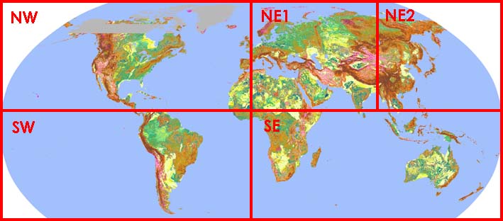
Download site for the automated terrain classification map using SRTM 30
Original article
Junko Iwahashi and Richard J. Pike (2007)
Automated classifications of topography from DEMs by an unsupervised nested-means algorithm and a three-part geometric signature, Geomorphology, 86, 409-440.
If you intend to use the data for a publication, please cite the above paper, Iwahashi and Pike (2007).
Automated classifications of topography from DEMs by an unsupervised nested-means algorithm and a three-part geometric signature, Geomorphology, 86, 409-440.
If you intend to use the data for a publication, please cite the above paper, Iwahashi and Pike (2007).
Downloading place of data

GIF images
Original GIS data in ArcGIS grid format
Please get the original GIS data in ArcGIS grid format.
120E-centered for Asia and Oceania (38 MB)
40E-centered for Europe and Africa (38 MB)
80W-centered for America (38 MB)
(Data spacing: 1 km; map projection: Robinson)
120E-centered for Asia and Oceania (38 MB)
40E-centered for Europe and Africa (38 MB)
80W-centered for America (38 MB)
(Data spacing: 1 km; map projection: Robinson)
Legend
PDF file
Please get the A4 size PDF file.
Europe and Africa Robinson; central meridian: 40E (10.7 MB)
Asia and Oceania Robinson; central meridian: 120E (17.8 MB)
North and South America Robinson; central meridian: 80W (24.2 MB)
Europe and Africa Robinson; central meridian: 40E (10.7 MB)
Asia and Oceania Robinson; central meridian: 120E (17.8 MB)
North and South America Robinson; central meridian: 80W (24.2 MB)
Program and the kernel file
Please get the program and the kernel file for automated classification of topography using a DEM in Arc/INFO GRID format.
ACT.aml (Arc Workstation AML)
laplacian.ker (kernel file of the Laplacian filter)
ACT.aml (Arc Workstation AML)
laplacian.ker (kernel file of the Laplacian filter)

