Crustal Deformation of Benkulu and Pagai Island Observed by SAR
|
Released:2007-10-02 Last update: 2007-10-08 Japanese version of this page Interferogram of Bengkulu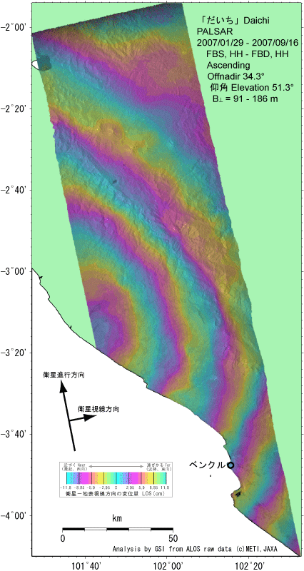
Although it is more than 100 kilometers from the epicenter to Bengkulu, the crustal deformation is significant. Relative to below right of the images, we can count five cycles of phase, which show about 60 cm of movements toward the satellite, at the center of the fluctuation where is located at the 75 kilometers northwest of Bengkulu. This is caused by the crustal movement accompanied by a reverse fault approaching the focal region. It is imagined that the source region extends rather north from epicenter. Using the data of crustal deformation, the location, the direction, the size and the slip of the earthquake source fault will be estimated.
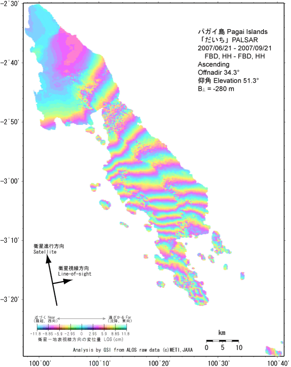
Interferograms of Pagai Islands (Pulau Pagai Selatan, Pulau Pagai Utara)
The maximum crustal deformation is approximately 1.8m which is caused by the movement of earthquake source fault of Southern Sumatra Earthquake (Mw8.4) on September 12, 2007. There are the South Pagai Island (Pulau Pagai Selatan) and the North Pagai Island (Pulau Pagai Utara) near the earthquake source fault. The fourteen fringes of phase can be seen between the south end of the South Pagai Island and the north end of the North Pagai Island. This means that the former has moved 1.8m toward the satellite relative to the latter. Two discontinuity of the phase were found in the Pagai Islands (Pulau Pagai). There must be surface faults on the ground. But it seems that they are not the surface earthquake fault which caused the earthquake.
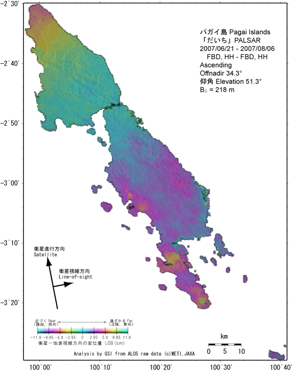
The data on Sep. 21 include a few kilometers scale disturbance which cause pixel position change, and the coherence is a little low. The left figure below is the Interferogram before the earthquake. The land part of image should have been colored entirely in light blue if there were no crustal deformation and other factors. It shows whether there were crustal movements or not, and we recognize the error on coherence image between the left figure and right one. One of the reasons why it has not been painted in light blue wholly is probably distribution of water vapor. At least, the crustal deformation like a precursory slip has not been observed in this term. Though there are some small differences between the two upper interferograms, we observe significant deformation signals and phase discontinuities whose amount exceeds the differences. Satellite and SensorPALSAR sensor onboard "Daichi" (ALOS) satellite launched by Japan Aerospace Exploration Agency on January 24, 2006
|