Disaster Measures
|
GSI Activities
International Committee
 |
The archipelago of Japan is often struck by natural disasters including earthquakes, floods, and eruptions of volcanoes, which could be disastrous. It is one of important tasks of GSI to provide data for disaster prevention and mitigation as well as for formulation of countermeasures against those hazards.
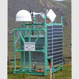
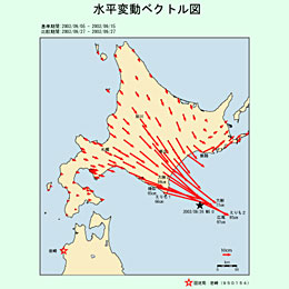
Through these efforts GSI meets the requirements as a designated national organ under the Disaster Measures Basic Law. Monitoring crustal deformationResearches on prediction of earthquakes and volcanic eruptions are conducted fully utilizing the nationwide GNSS-based control station network, aerial photographs and satellite images, etc. These tools are efficiently applied for understanding crustal movements throughout the country and the situations at the site once a disaster occurs, thus facilitating disaster mitigation efforts and prompt and appropriate responses.
REGMOS
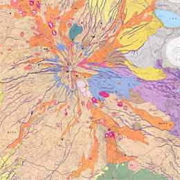
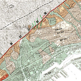
Crustal movement as identified Thematic mapsThematic maps are helpful source of data for hazard mapping.
Land Condition Maps, Volcanic Land Condition Maps and Active Fault Maps provide detailed landform history and ground terrain.
Volcanic Land Condition Map
Active Fault Map |