Coastal Changes in Sumatra Island, caused by 2004 Earthquake and Tsunami
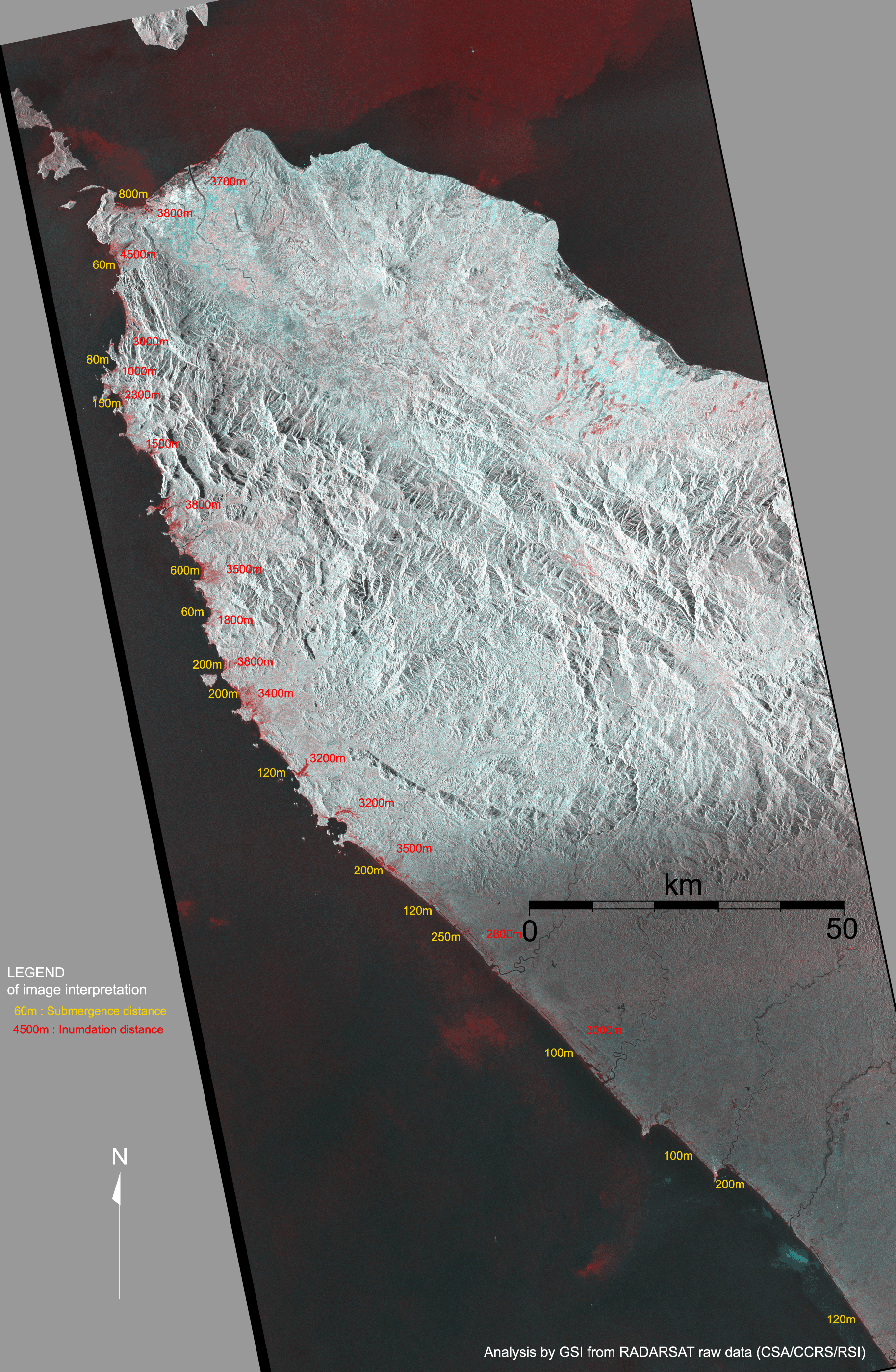
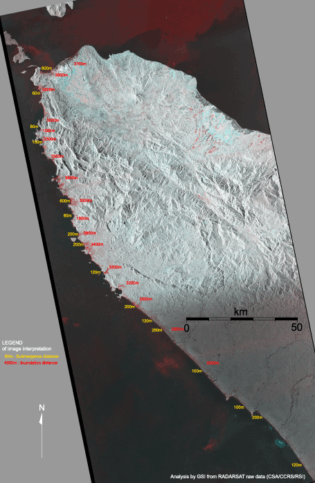
Tsunami Inundation Area of Northern Sumatra Island Inferred from Satellite Synthetic Aperture Radar Images (Canadian RADARSAT)
Click on each image for larger view! |
 |
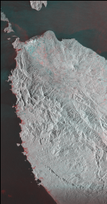
| 2003-07-22 |
2004-12-31 |
2003-07-22 |
2005-02-17 |
| Tide: -11cm |
Tide: -10cm |
Tide: -11cm |
Tide: 2cm |
The images are derived from comparisons of intensity of reflected microwave observed by Canadian RADARSAT satellite before the earthquake and after the earthquake. An area colored in red is a region where the reflective intensity is decreased. The red areas are distributed along the west coast of Northern part of Sumatra Island, Indonesia. The image indicates Tsunami inundation area, coastal erosion and a subsidence caused by a crustal deformation due to the M9 earthquake.
Analysis by GSI from RADARSAT raw data (CSA/CCRS/RSI)
|