For full functionality of this site it is necessary to enable JavaScript.
To Page Text
Text Size
Standard
Enlarge
JAPANESE
Sitemap
MENU
GSI HOME
Disaster Measures
GSI copes with natural disasters
Miyakejima Volcano_the Eruption since 2000
Aerial photos of Miyake Island and Kouzu Island
Index map of aerial photo of Kouzu Island (PM 1:23-1:47 [9. Nov.1999])
Index map of aerial photo of Kouzu Island (PM 1:23-1:47 [9. Nov.1999])
GSI Home
GSI Activities
About GSI
Policy Planning
Public Survey
Geodetic Survey
Maps & Geospatial
Information
Disaster Measures
Research & Development
International Activities
The Science Museum of Map and Survey
GSI Web Site
Gazetteer
International Training
Global Map
Bulletin
Crustal Movement
Index map of aerial of Kouzu Island (PM 1:23-1:47.1999/11/09)
: center of photo
: clickable (
C5-2
,
C5-4
,
C7-2
,
C7-4
,
C7-6
)
Go to top


 : center of photo
  : clickable (
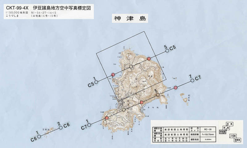