

Volcanic deformation at Tokachidake detected by ALOS-2 and ALOS-4 data
|
Released: September 14, 2026 , update: September 28, 2026 Japanese version of this page SAR Interferograms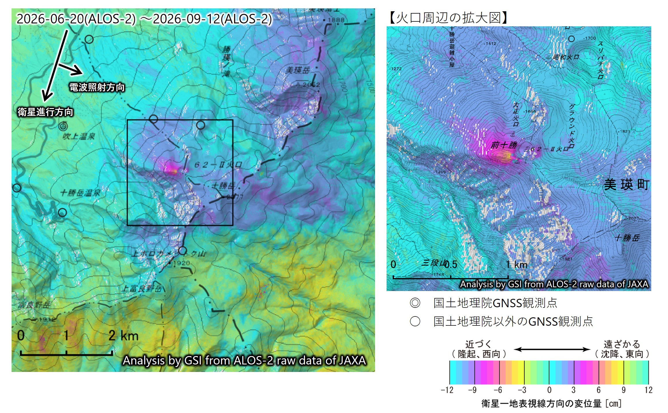
Fig.1 SAR interferograms (1st: 2026-06-20, 2nd: 2026-09-12)
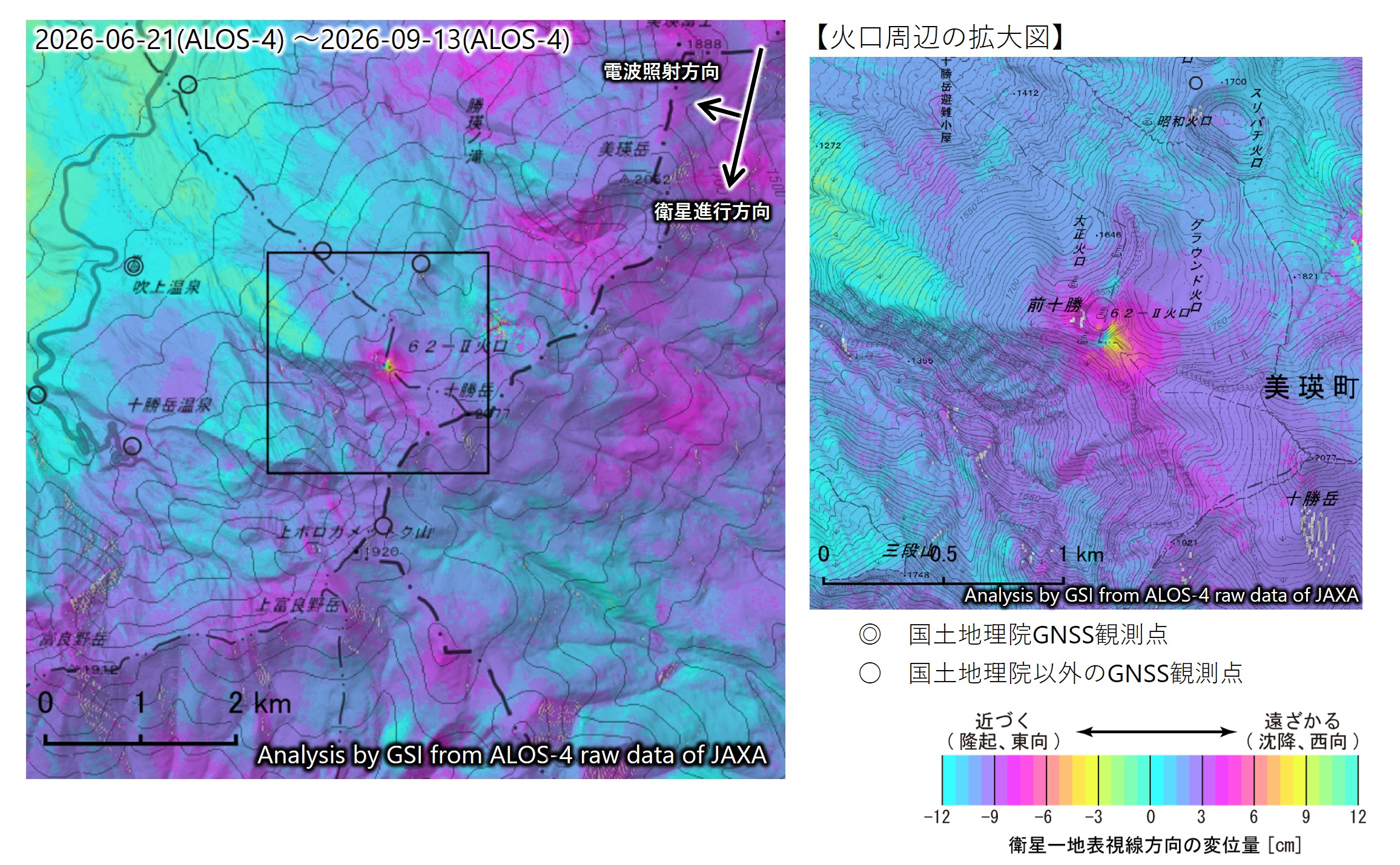
Fig.2 SAR interferograms (1st: 2026-06-21, 2nd: 2026-09-13)
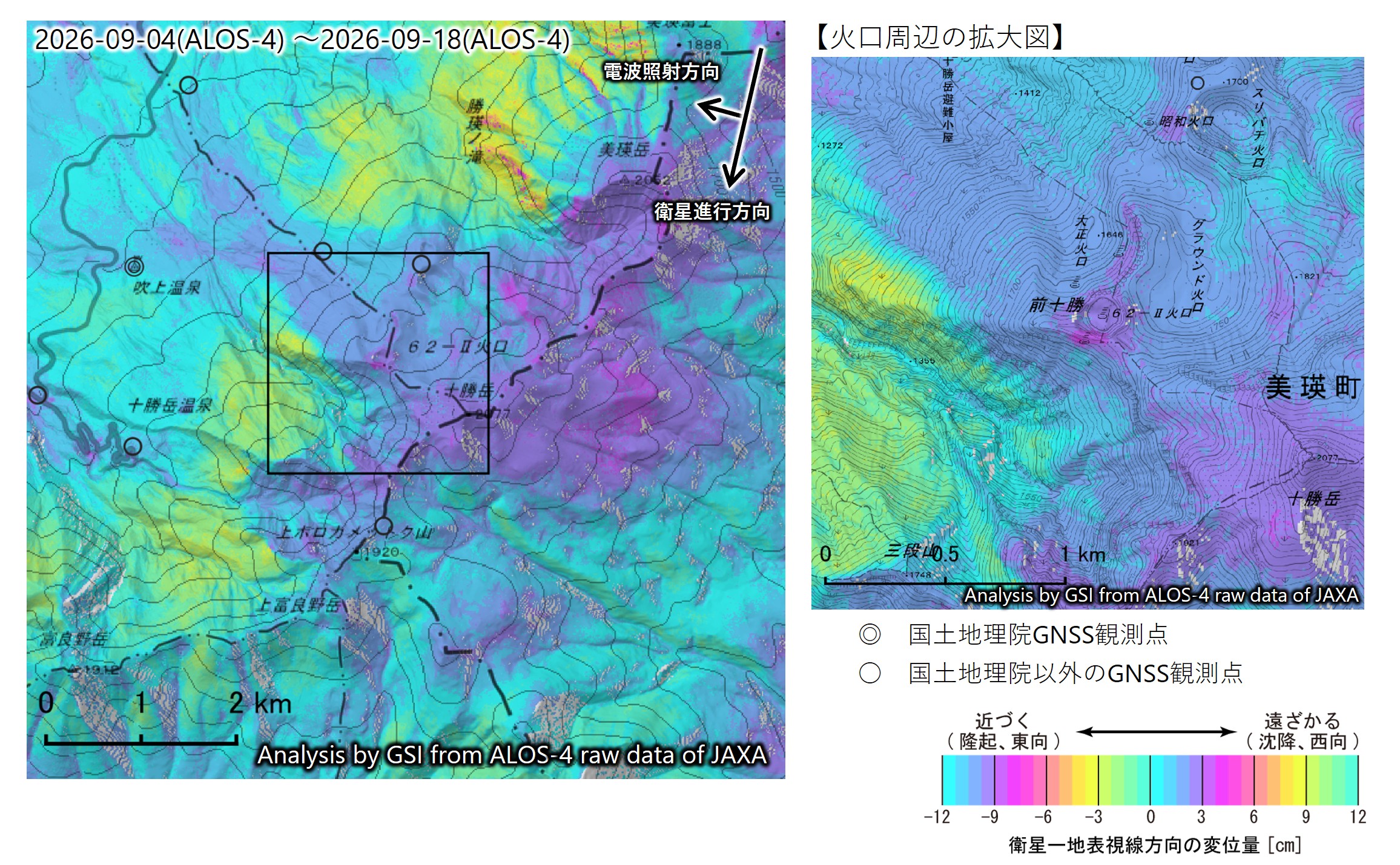
Fig.3 SAR interferograms (1st: 2026-09-04, 2nd: 2026-09-18)
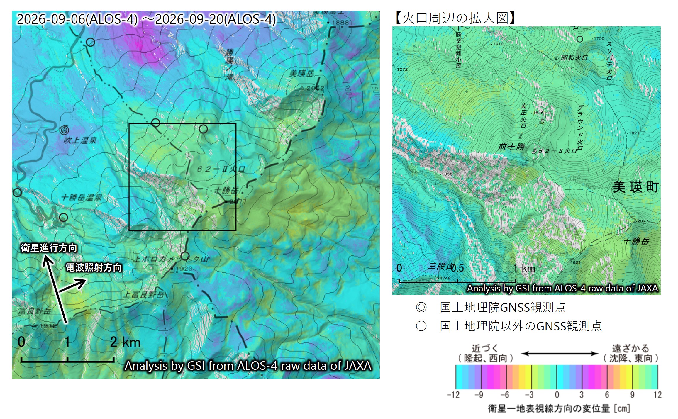
Fig.4 SAR interferograms (1st: 2026-09-06, 2nd: 2026-09-20)
Analysis by GSI from ALOS-2 and ALOS-4 data of JAXA.
The numerical weather model was provided from JMA based on the agreement. Copyrights and CreditsCopyright. Geospatial Information Authority of Japan. ALL RIGHTS RESERVED.
We welcome links from your website to this website. When using materials on this website, we ask that proper credit be given. ContactGSI SAR Group
Space Geodesy Division Geodetic Department  |