

The 2021 Qinghai Earthquake: Crustal deformation detected by ALOS-2 data
Crustal Deformation Observed by Synthetic Aperture Radar (SAR) |

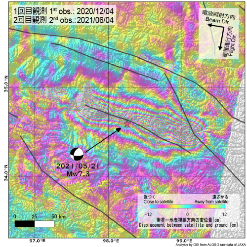
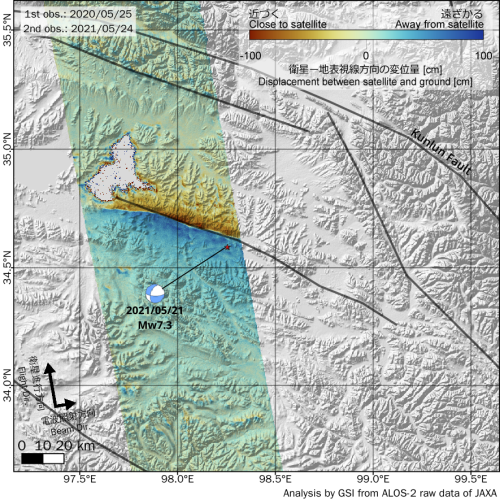
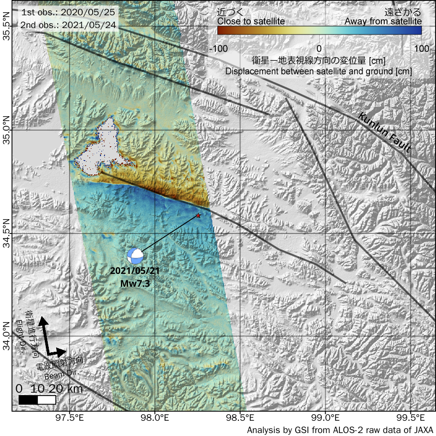
| Fig. # |
Date | Time (UTC) |
Flight Dir. |
Beam Dir. |
Obs. Mode*1 |
Incidence Angle (around epicenter) |
Bperp |
|---|---|---|---|---|---|---|---|
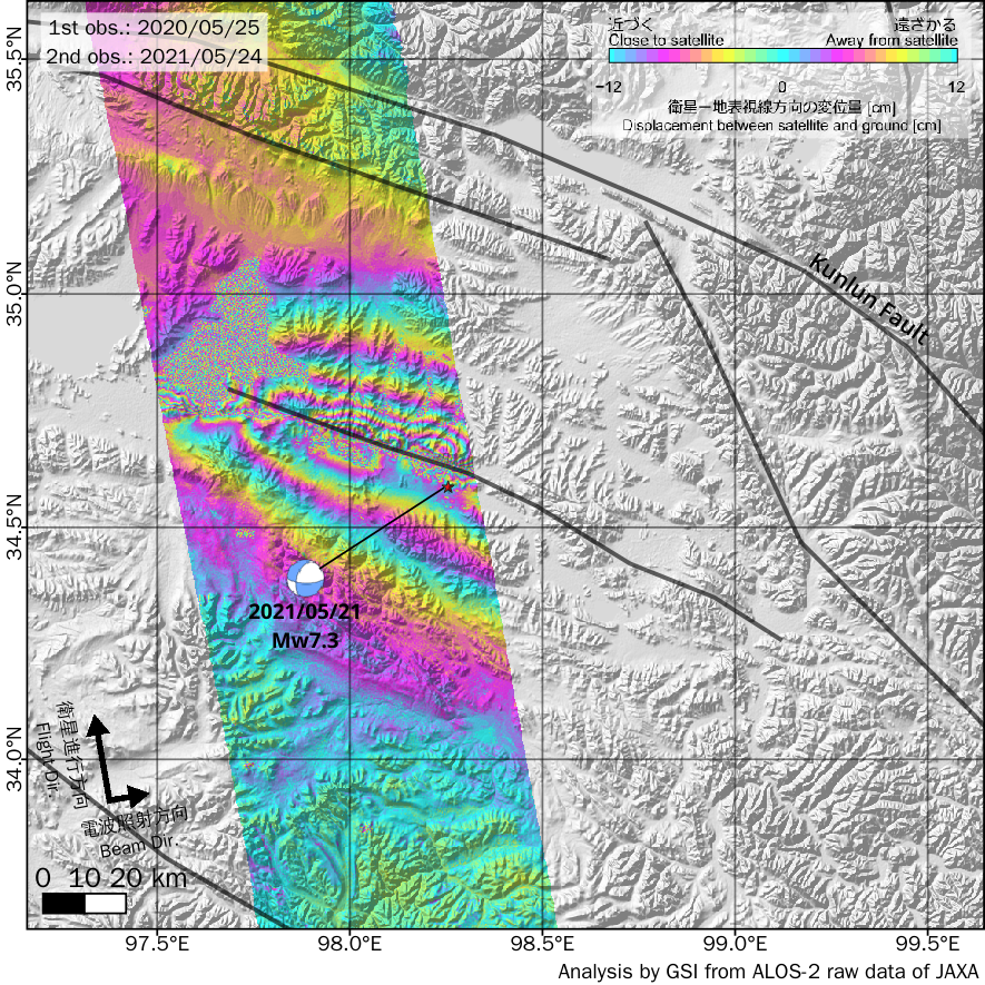
| 1 | 2020-12-04 2021-06-04 |
5:29 | Des. | Right | W-W (350km) |
40° | 173m |
| 2,3 | 2020-05-25 2021-05-24 |
17:23 | Asc. | Right | F-F (10m) |
37° | -196m |
*1 F: Stripmap (Fine), W: ScanSAR (Wide)
(cf. ALOS-2 Project / PALSAR-2 (JAXA))
Analysis by GSI from ALOS-2 data of JAXA.
These results were obtained through the activity of the SAR analysis working group of the Coordinating Committee for Earthquake Prediction.
The 2021 Qinghai Earthquake
| Date-Time | May 21, 2021, 18:04(UTC) |
|---|---|
| Hypocenter Location |
34.586°N, 98.255°E, Depth:10.0 km (USGS, as of May 25, 2021) |
| Magnitude | M=7.3 (USGS, as of May 25, 2021) |
Satellite
ALOS-2 (Advanced Land Observing Satellite 2) launched by Japan Aerospace Exploration Agency on May 24, 2014
Copyrights and Credits
Copyright. Geospatial Information Authority of Japan. ALL RIGHTS RESERVED.
We welcome links from your website to this website. When using materials on this website, we ask that proper credit be given.
We welcome links from your website to this website. When using materials on this website, we ask that proper credit be given.
Contact
Geography and Crustal Dynamics Research Center
Crustal Deformation Research
MUNEKANE Hiroshi: Head of Division
Space Geodesy Research
KOBAYASHI Tomokazu: Head of Division
Crustal Deformation Research
MUNEKANE Hiroshi: Head of Division
Space Geodesy Research
KOBAYASHI Tomokazu: Head of Division
