

Crustal activity in the northern Izu islands related with Miyakejima 2000 eruption
The Exhibition of IUGG2003Time series of baseline length across Mt. Usu along the eruptionMt. Usu volcano erupted on March 31st, 2000. Geographical Survey Institute had established three GPS permanent stations around the volcano in 1994. These stations has been involved in GEONET to monitor the crustal deformation. GEONET detected an inflation of the volcano on March 28th, when seismic activity under the volcano became very active. GSI started more frequent monitoring of crustal deformation and every 6 hours data was analysed rather than 24 hours data as the standard process. The sence of the deformation changed from inflation to deflation on March 30th. This change sujested the source of deformation moved to more shallow part of the crust. This crustal deformation data supported the decision to announce emergency volcanic information to make people evacuate from the risk of eruption. Just after people completed their evacuation, Mt. Usu volcano erupted from the west and northwest part of the volcano. Deflation of the volcano continued after the eruption for about one week. The deflation seemed to stop in the middle of April 2000 while volcanic activty calmed down, too.
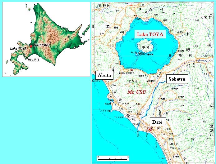
Figure 1. The location of Mt. Usu and Lake Toya 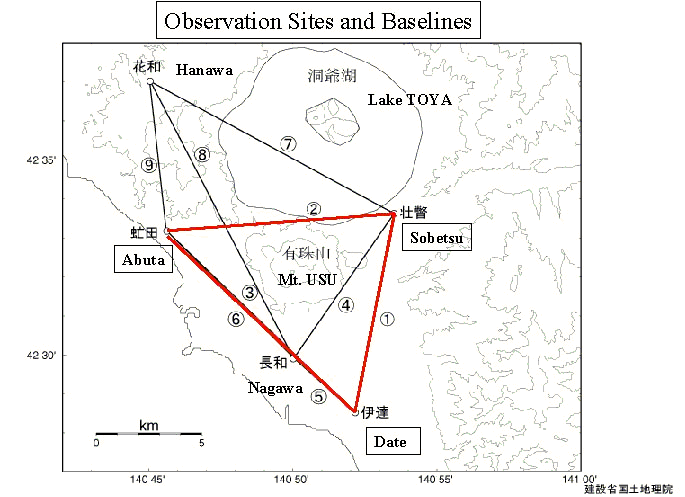
Figure 2. GEONET stations surrounding Usu volcano 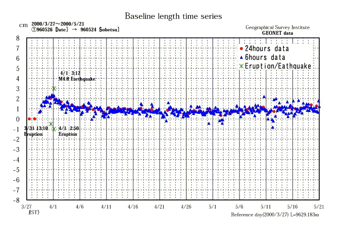
Figure 3-1. Time series of baseline length : Date---Sobetsu 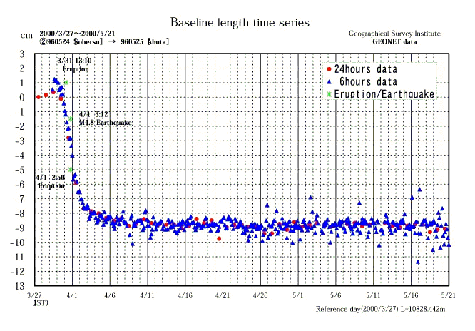
Figure 3-2. Time series of baseline length : Sobetsu---Abuta 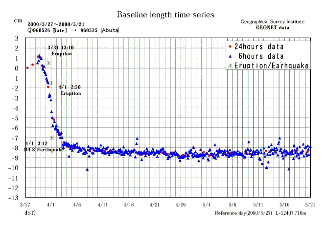
Figure 3-3. Time series of baseline length : Date---Abuta |