

The 2018 Papua New Guinea Earthquake: Crustal deformation detected by ALOS-2 data
Crustal Deformation Observed by Synthetic Aperture Radar (SAR)Released: Mar. 1, 2018, updated: Aug. 13, 2018, Japanese version of this page
SummaryA large earthquake (Mw 7.5, USGS) occurred in Papua New Guinea on February 25, 2018 (UTC). To measure the crustal deformation caused by this earthquake, we applied interferometric analysis using ALOS-2/PALSAR-2 data.
Results obtained from the data analysis are summarized as follows.
[Update on August 13, 2018] A descending interferogram to which ionospheric noise compensation by the split spectrum method (Gomba et al., 2016) has been applied ( Fig. 3) and two new ascending interferograms observed by the Fine [10m] mode were added. SAR Interferograms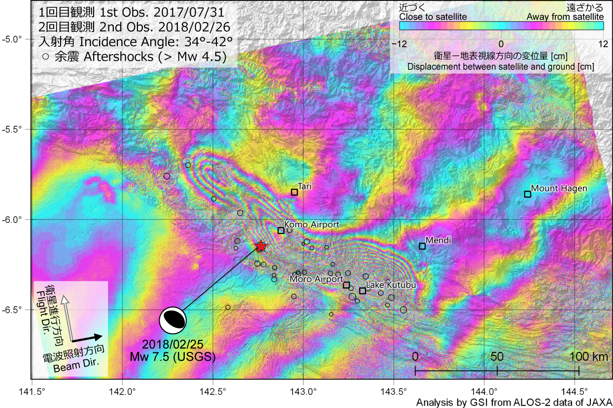 Fig.1 Ascending SAR interferogram [PNG: 2.0MB] 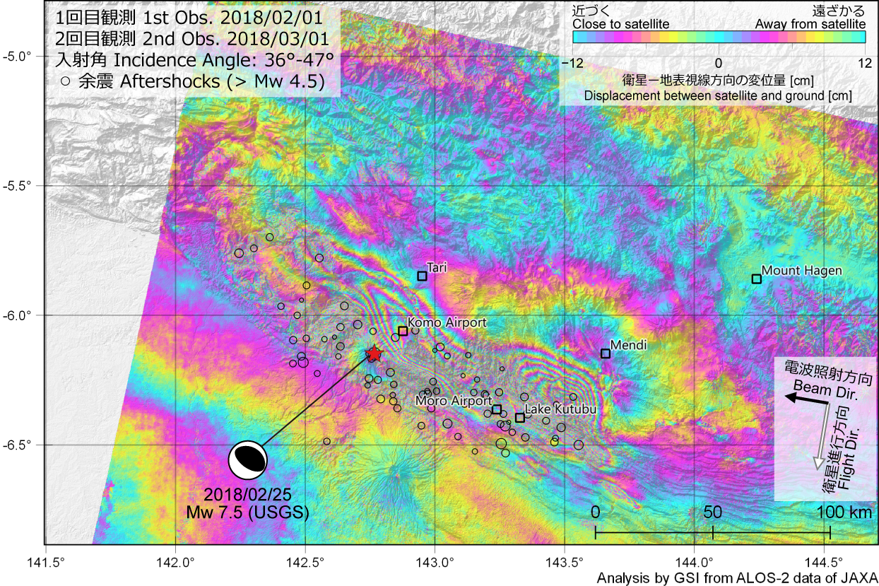 Fig.2 Descending SAR interferogram [PNG: 1.9MB] 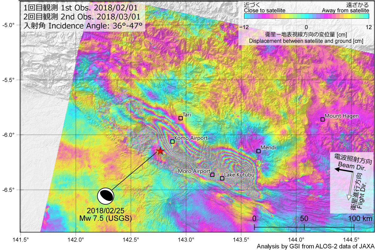 Fig.3 Descending SAR interferogram (Ionospheric noise compensation applied) [PNG: 1.9MB] 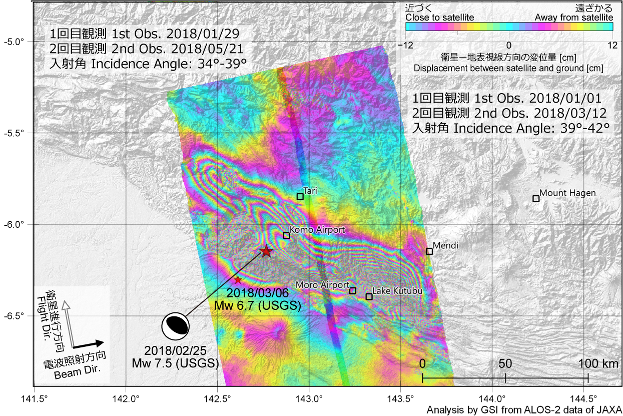 Fig.4 Ascending SAR interferogram (Fine [10m] mode) [PNG: 1.4MB] 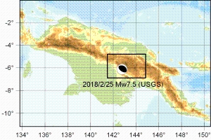 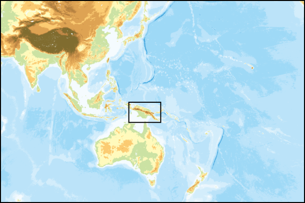 Area of interest
*1 W: ScanSAR (Normal), F:Fine[10m] (cf. ALOS-2 Project / PALSAR-2 (JAXA)) Analysis by GSI from ALOS-2 data of JAXA. These results were obtained through the activity of the SAR analysis working group of the Coordinating Committee for Earthquake Prediction. The 2018 Papua New Guinea Earthquake
SatelliteALOS-2 (Advanced Land Observing Satellite 2) launched by Japan Aerospace Exploration Agency on May 24, 2014
Copyrights and CreditsCopyright. Geospatial Information Authority of Japan. ALL RIGHTS RESERVED.
We welcome links from your website to this website. When using materials on this website, we ask that proper credit be given. ContactYARAI Hiroshi : Head of Division
MORISHITA Yu : Chief Researcher 
|