

Seismic fault model for the earthquake May 26th, 2003 at Miyagi offshore
The Exhibition of IUGG2003Fault model estimated from co-seisimic crustal movement observed by GEONETA great earthquake hit southern Sanriku coast on May 26th, 2003. This earthquakes caused a lot of damages on the buildings and facilities in Miyagi and its surrounding prefectures. Co-seisimic crustal deformation was detected by GEONET. GSI estimated a fault model for this earthquake by inversion using the deformation data. The fault estimated from crustal deformation data is high angle reverse fault with slight strike slip. The moment magnitude(Mw) of this earthquake is 6.9 from this estimation. This model is consistent to the model estimated from seisimgram records. The fault locates under the plate boundary, in the Pacific plate subducting under the North-eastern Japan.
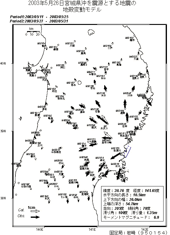
Figure 1. Fault model for the Miyagi offshore earthquake on May 26th, 2003 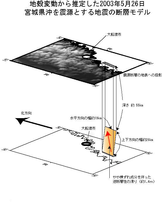
Figure 2. N38.76, E141.65, L=26.0km, W=26.0km, depth=54.7km, strike=205deg., dip=79deg., rake=109deg., slip=1.35m, Mw=6.9 |