

The Western Tottori Prefecture Earthquake
The Exhibition of IUGG2003AbstractThe Western Tottori Earthquake (Mj 7.3) occurred on October 6, 2000 in western Japan (Fig. 1). The coseismic crustal deformations associated with the earthquake were detected by permanent and campaign GPS measurements, leveling and SAR interferometry. The fault parameters of the earthquake are estimated by inverting coseismic displacements. SAR interferogram using RADARSAT data clearly shows the coseismic displacements spreading around the focal region large part of which are covered by vegetation. This is an encouraging example of application of C-band SAR interferometry for the detection of crustal deformations in the area covered by vegetation like Japan.
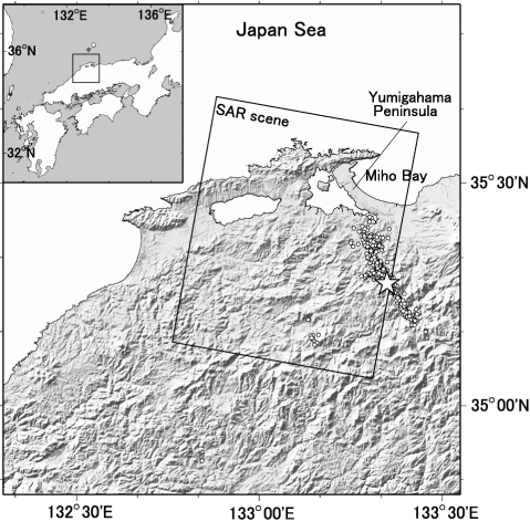
Figure 1. Location map of the Western Tottori Earthquake. The rectangular indicates the position of the RADARSAT SAR imagery (see RADARSAT SAR interferometry). GEONET observation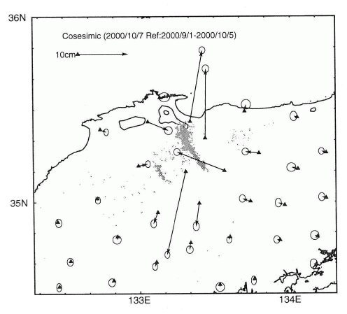
Figure 2. Coseismic displacemnet vectors of the Western Tottori Earthquake. The nationwide permanent GPS network GEONET (GPS Earth Observation Network) detected coseismic displacements associated with the earthquake (Fig.2). The coseismic deformation pattern shows a left-lateral strike slip source mechanism, which is consistent with seismic data analysis results. The fault parameters of the earthquake are estimated by inversion of coseismic displacement measured with GPS and leveling (Fig. 3) (Sagiya et. al., 2002). The moment magnitude estimated from geodetic inversion is 6.7, which is consistent with seismic data.
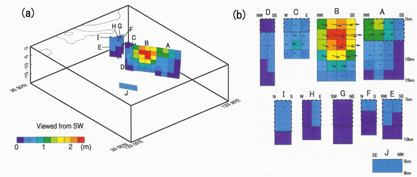
Figure 3. (a) Bird's view plot of the estimated slip distribution. Viewed from the southwest. (b) Detailed slip distribution of each segment. Arrows show the displacemnet of the near-side of the fault relative to the far-side. (after Sagiya et. al., 2002) RADARSAT SAR interferometry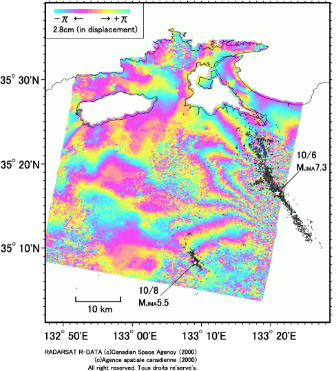
Figure 4. Differential SAR interferogram by RADARSAT for the period from September 17, 2000 to October 11, 2000. Loss of coherence caused by vegetation is one of the major obstacles of InSAR applications in Japan. For this reaseon we have been used JERS-1/SAR data, because L-band microwave is less vulnerable to vegetation than C-band. Unfortunately JERS-1 ceased operation in 1998 and there are no L-band SAR satellites in orbit.
To study coseismic displacement of this earthquake we used RADARSAT data. It turns to be successful and RADARSAT SAR interferogram clearly shows coseismic deformation associated with the Western Tottori Earthquake (Yarai et. al., 2002) (Fig.4). The interferogram not only showed pattern which is consistent with the estimated fault model by Sagiya et. al. (2002) (Fig.5), but it also depicts small sized deformations associated with a large aftershock whose distribution was too small to be detected by permanent GPS network. 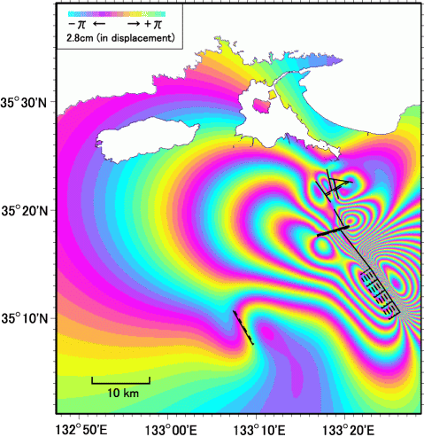
Figure 5. Simulated interferogram derived from the fault model by Sagiya et. al. (2002). |