For full functionality of this site it is necessary to enable JavaScript.
To Page Text
Text Size
Standard
Enlarge
JAPANESE
Sitemap
MENU
GSI HOME
Maps & Geospatial Information
Environmental Monitoring of Japan
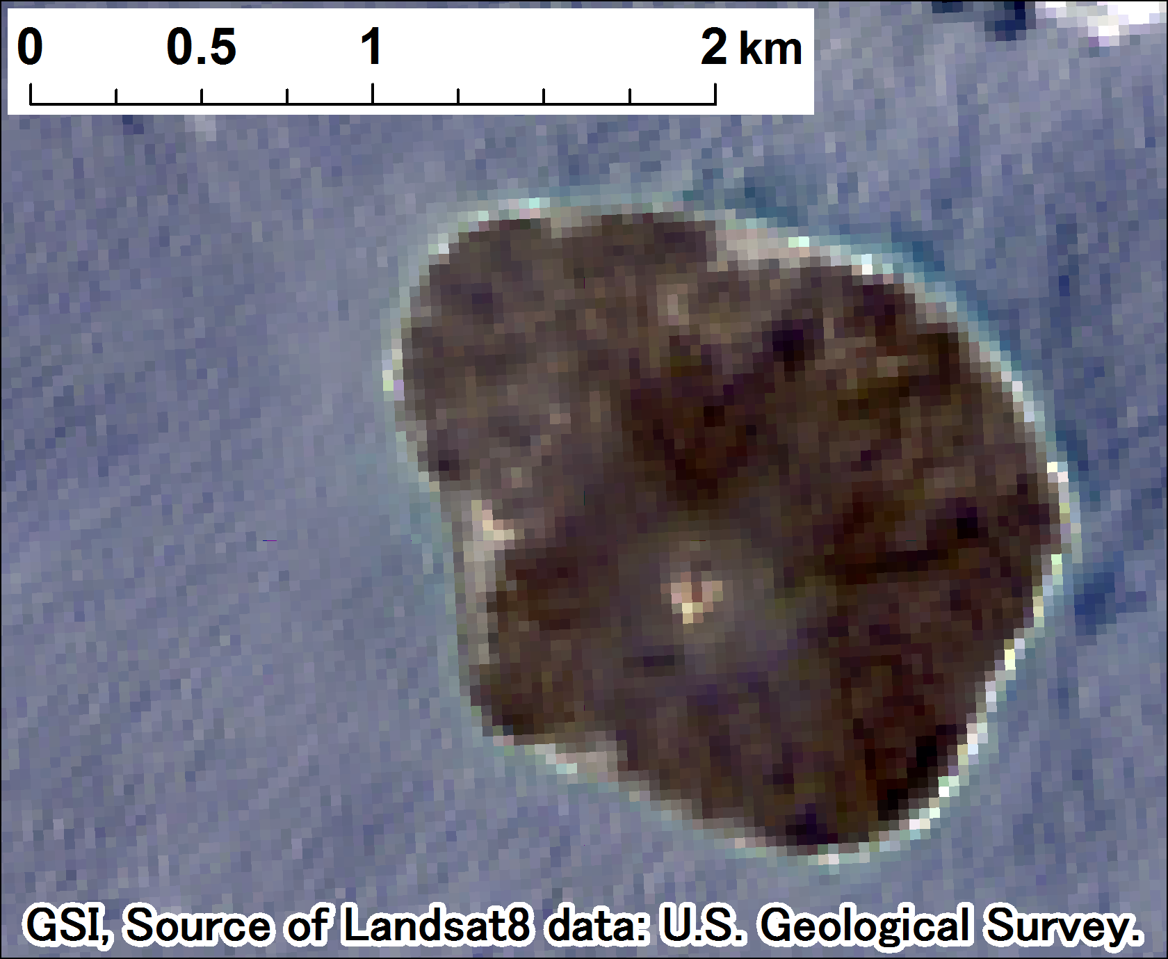
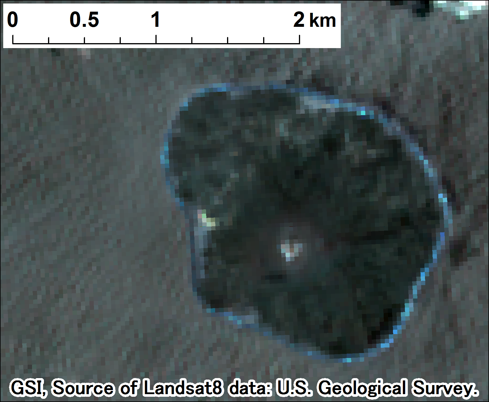
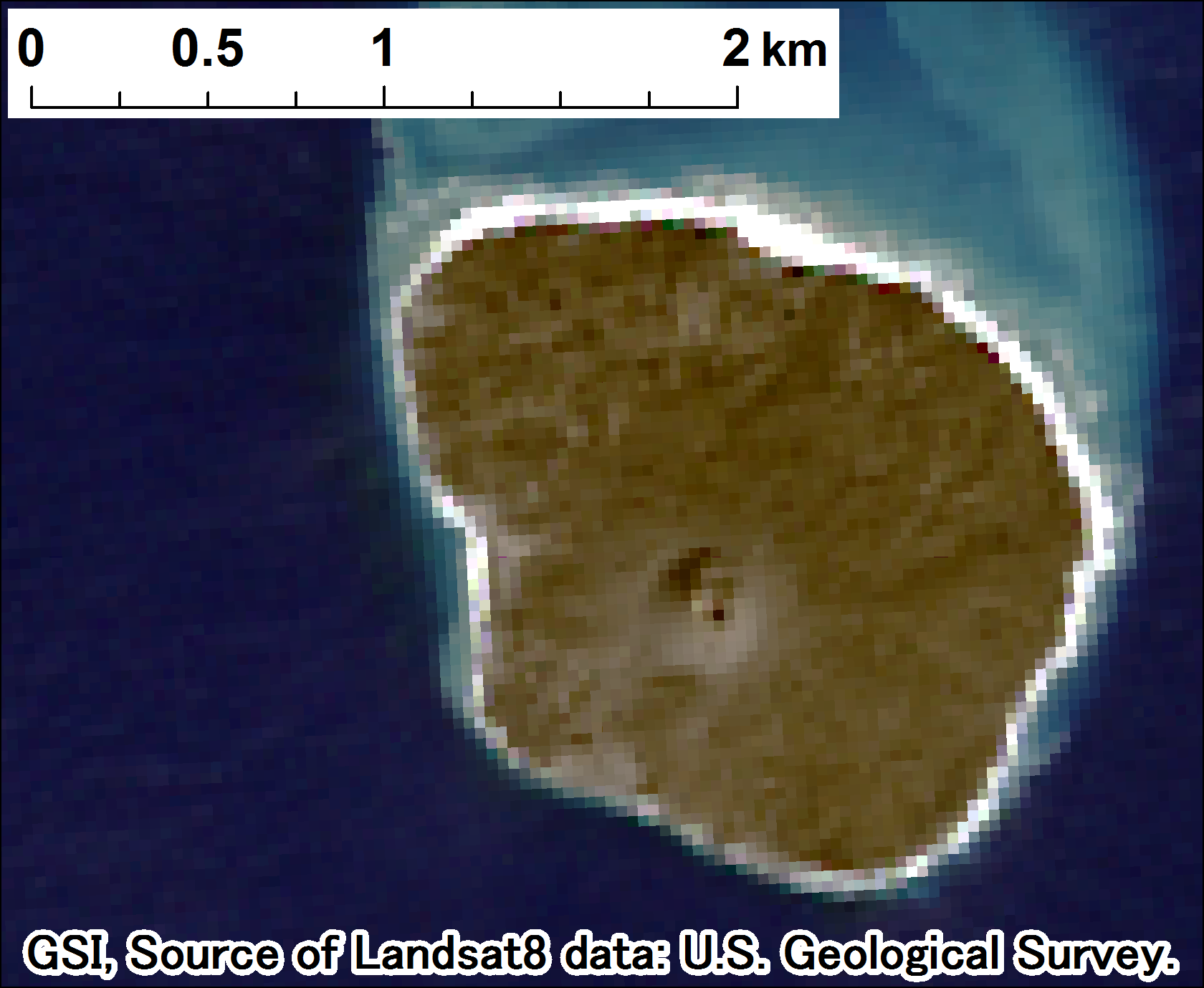
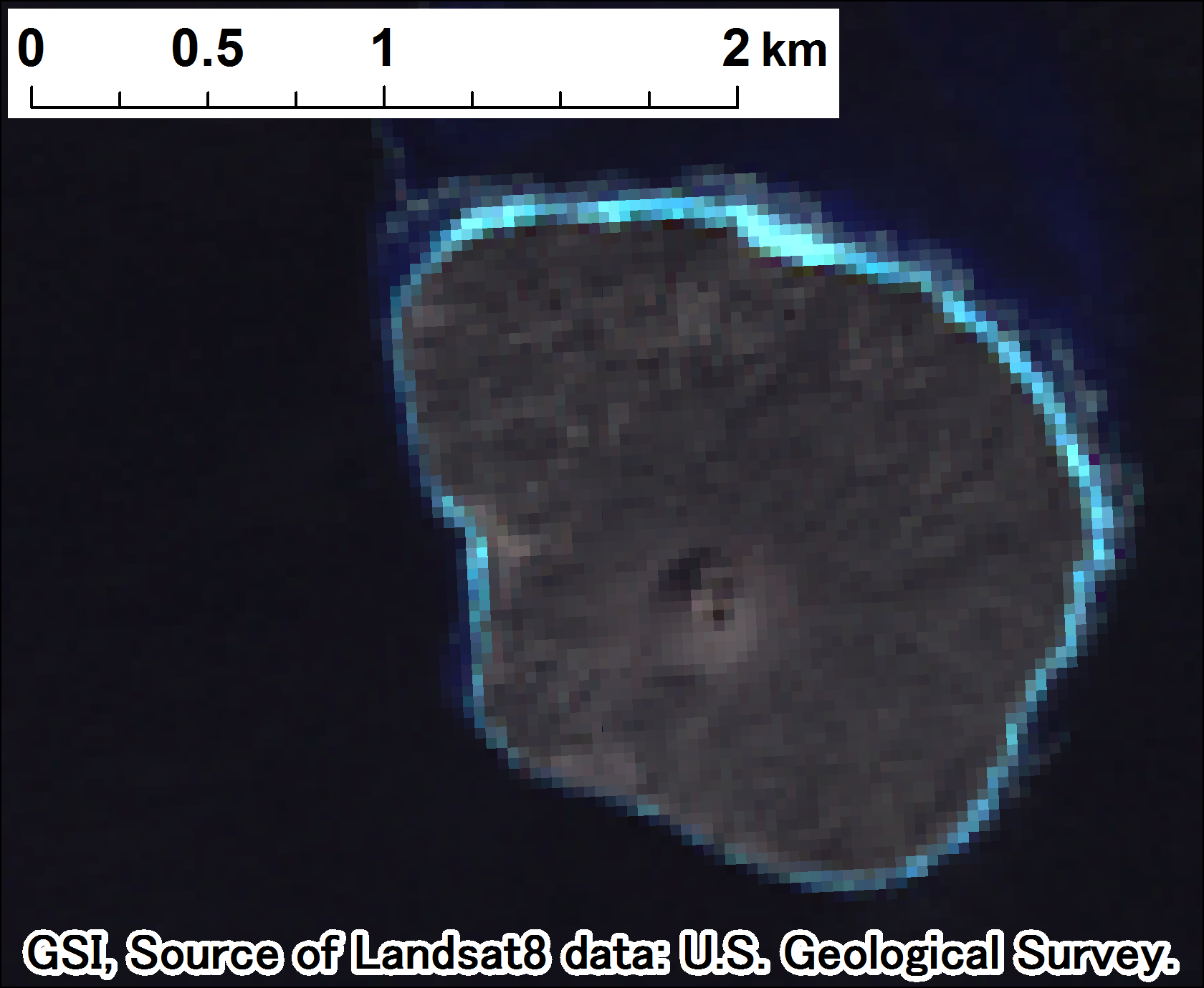
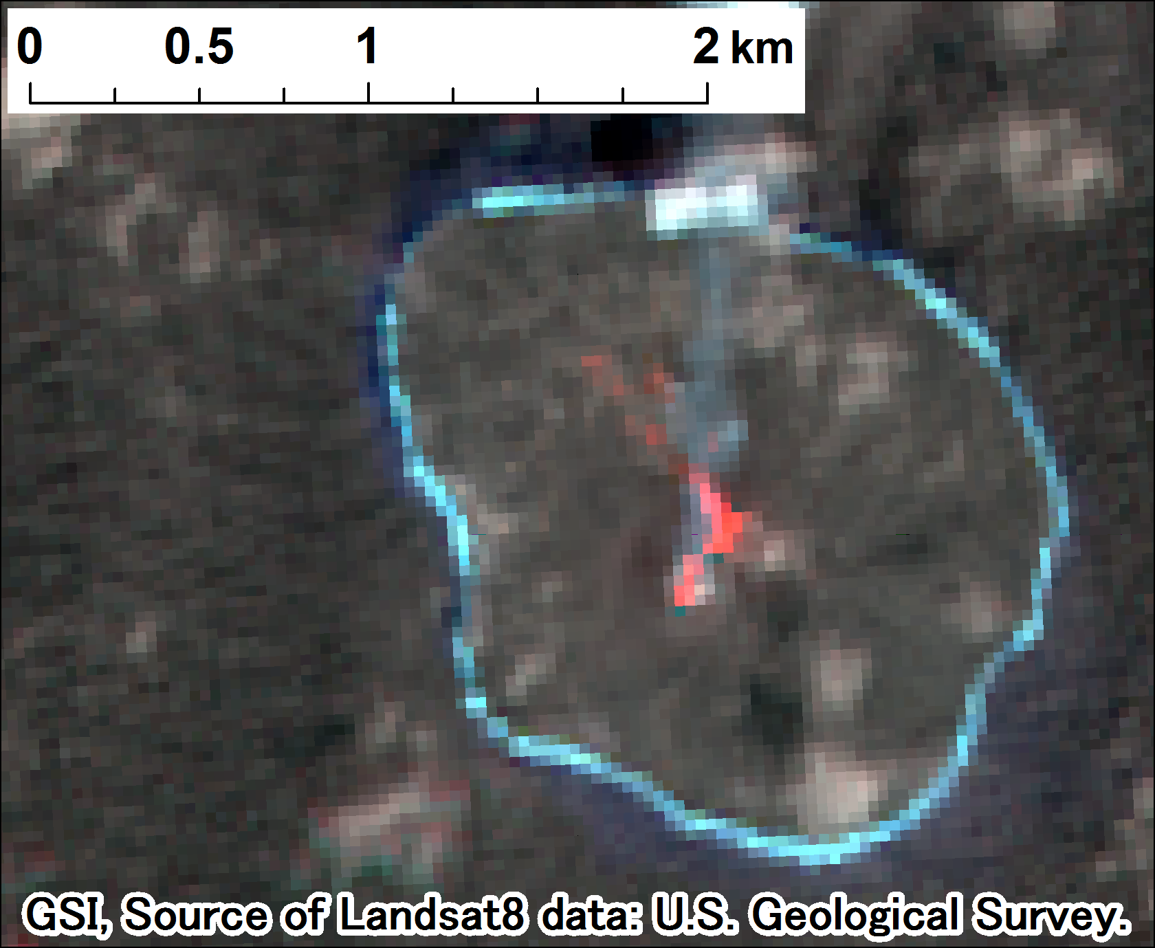
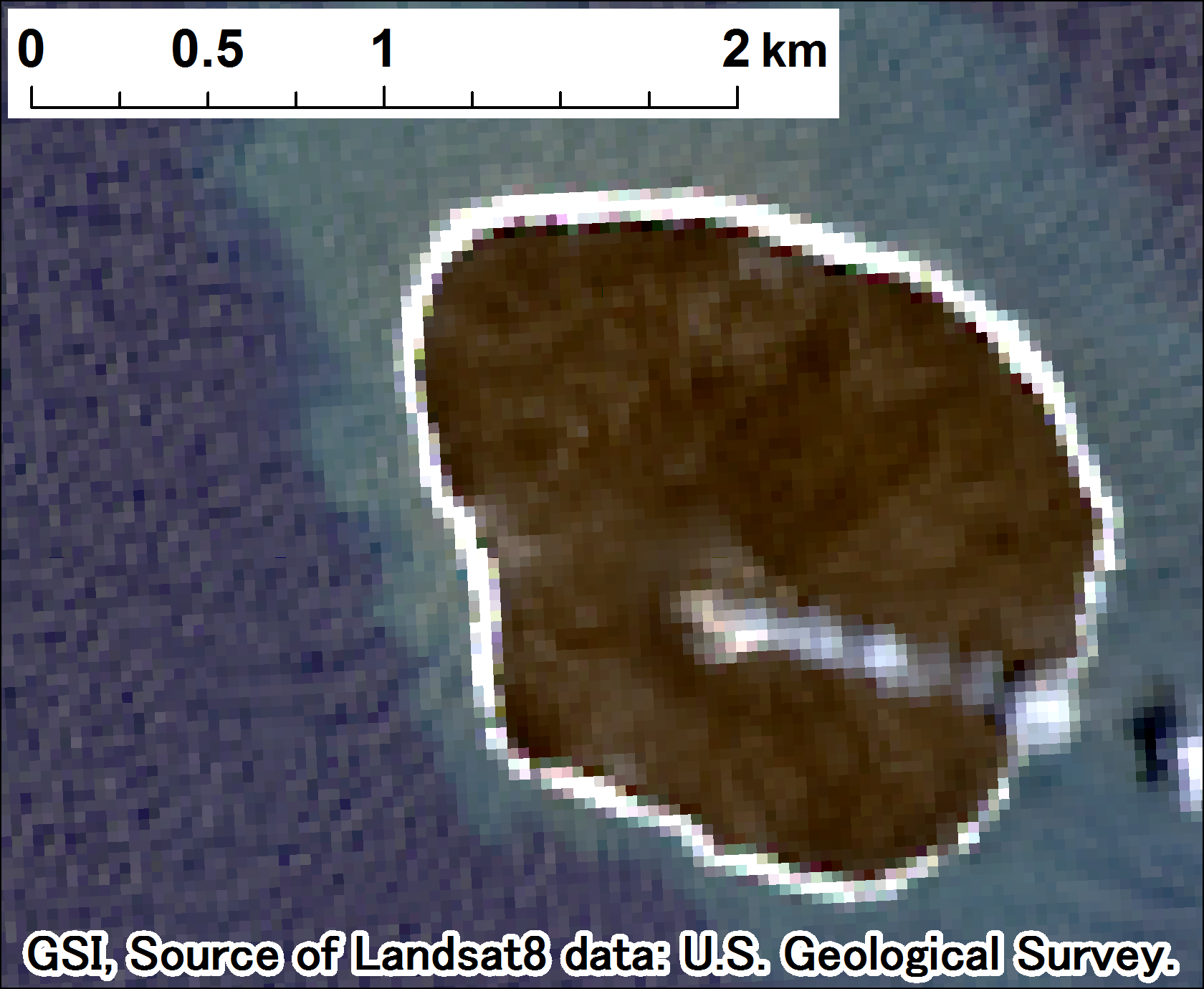
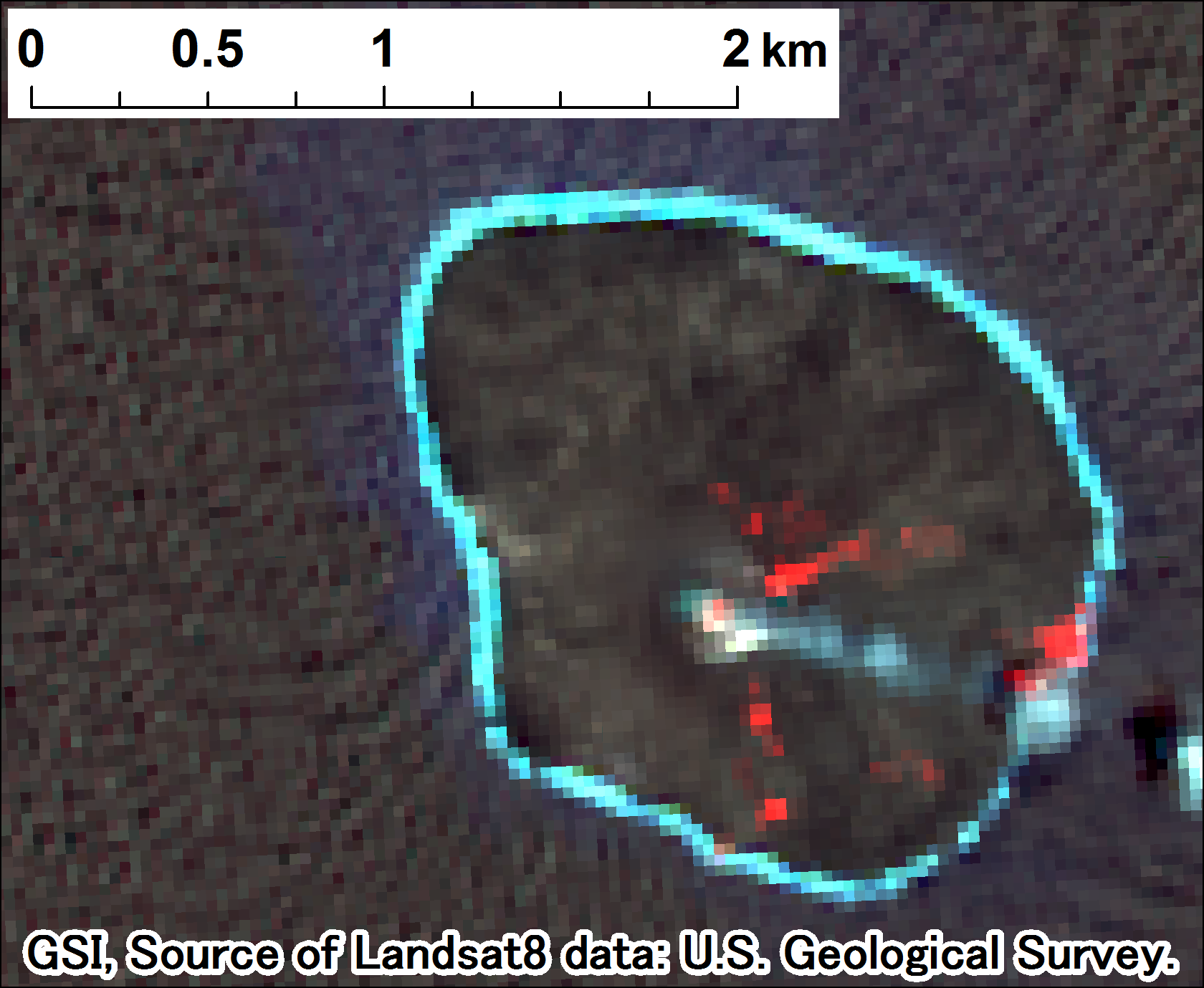
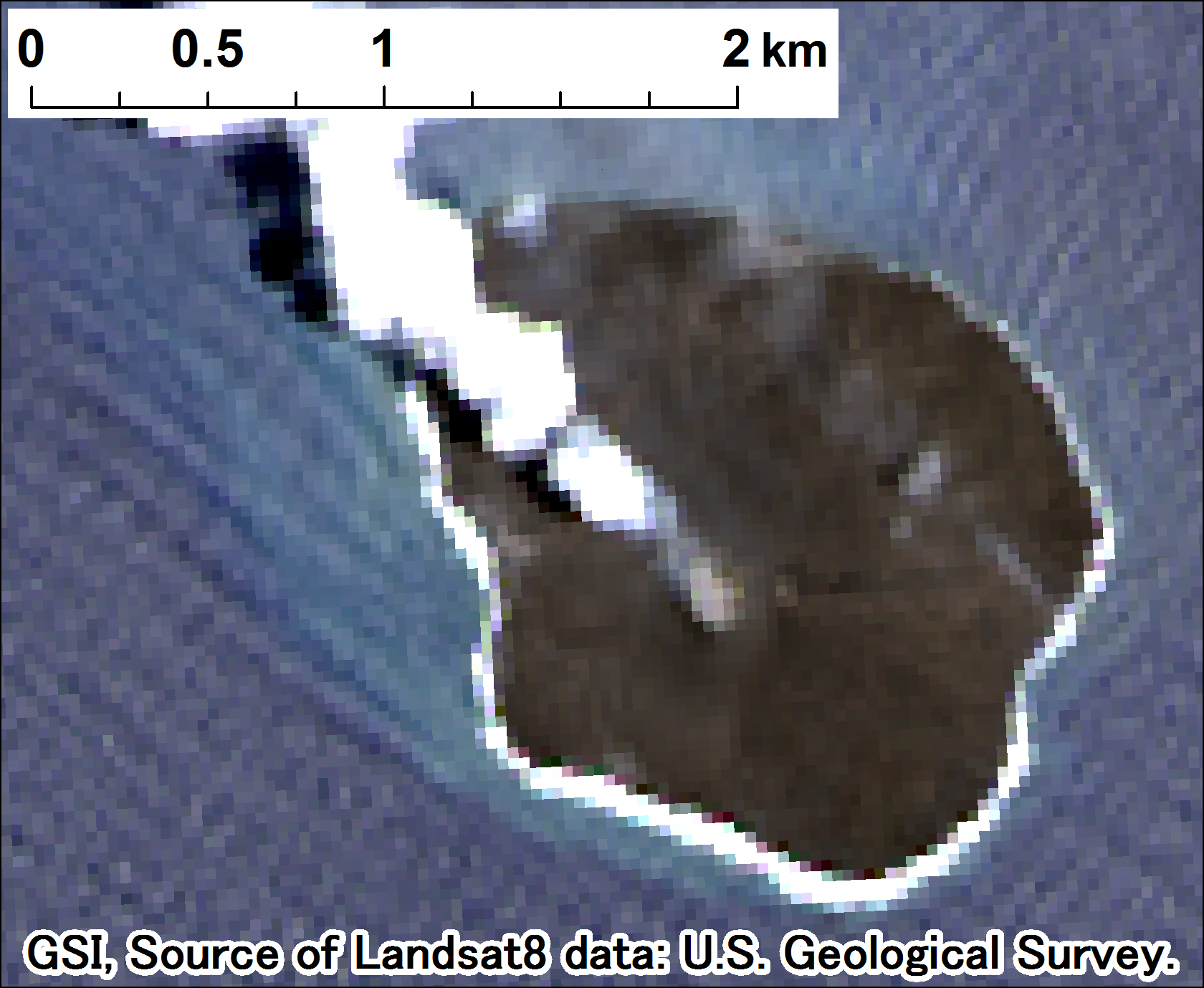
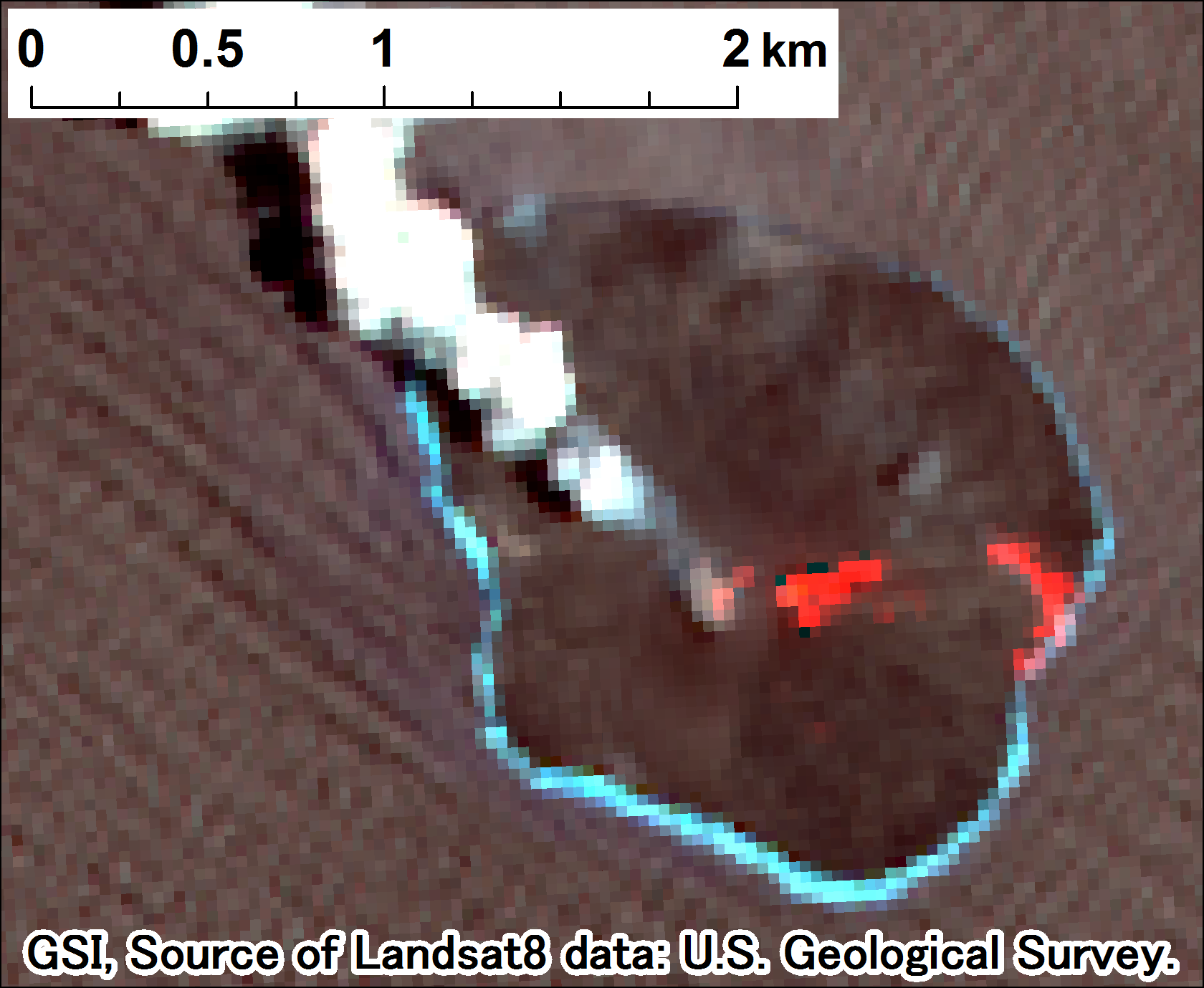
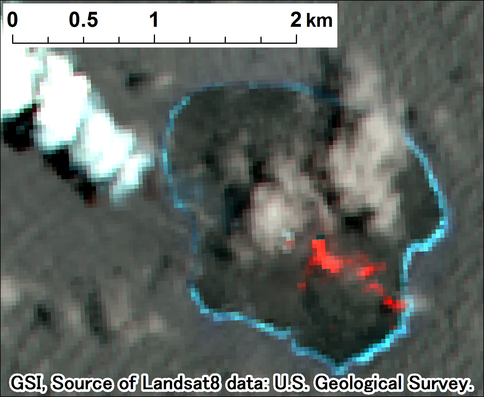
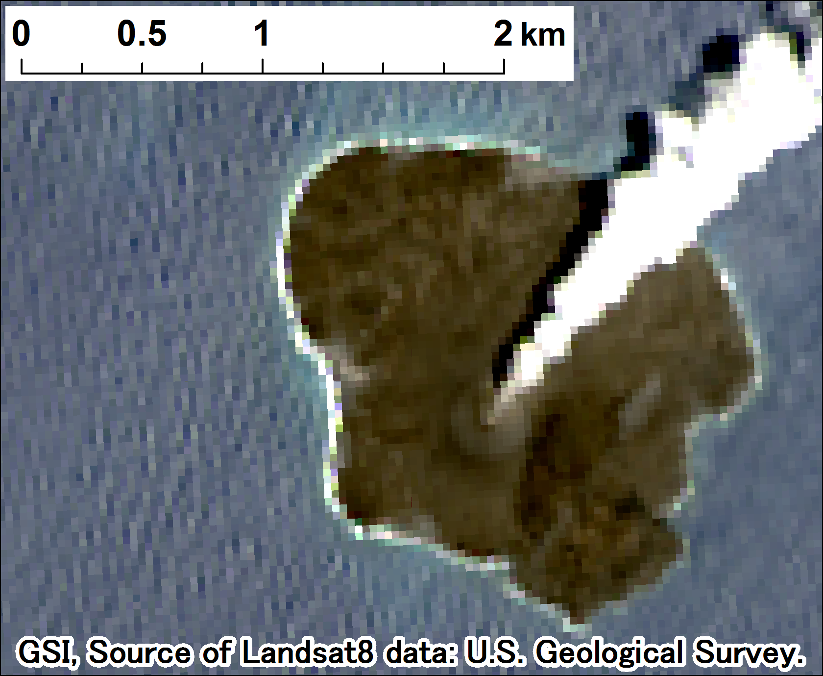
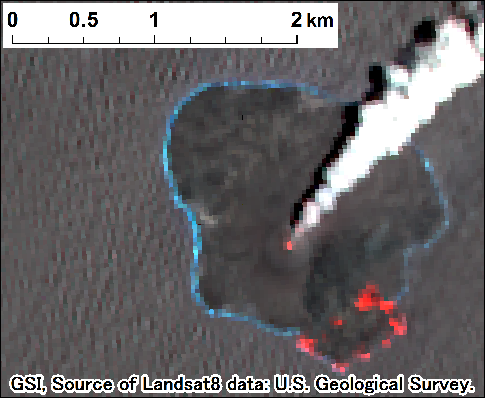
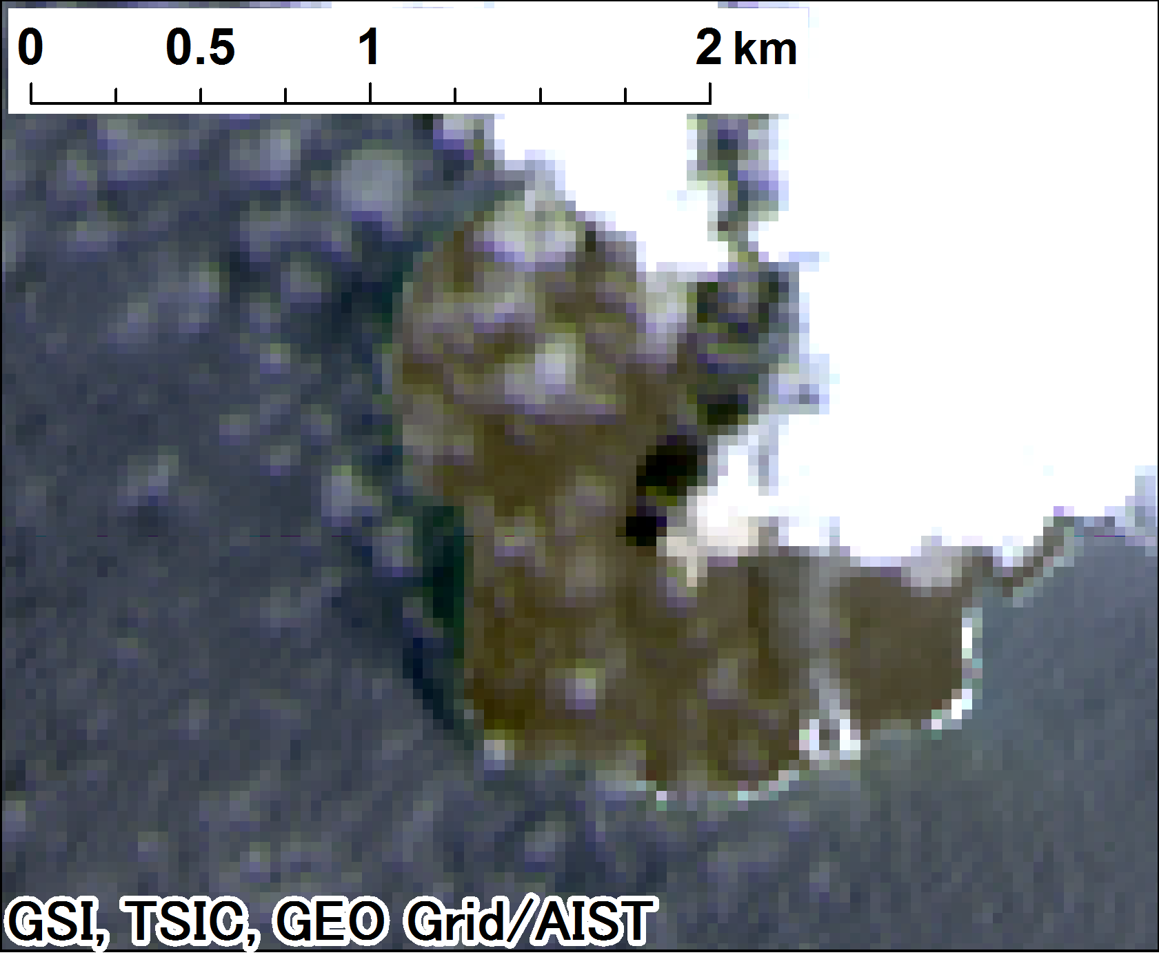
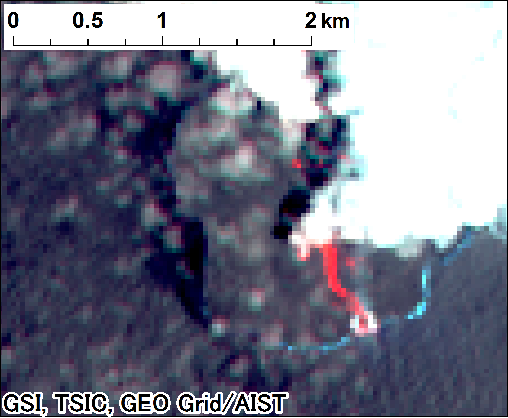
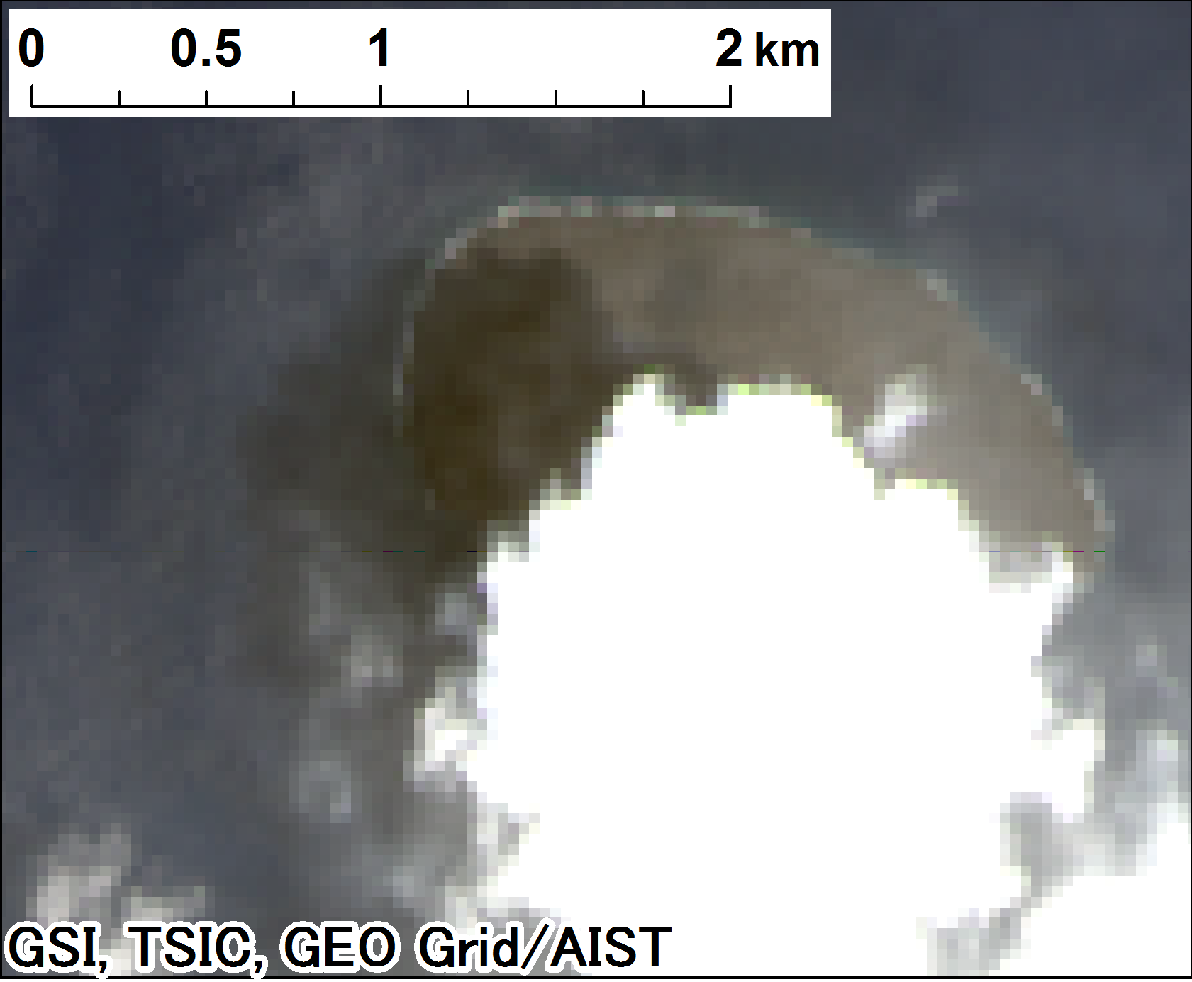
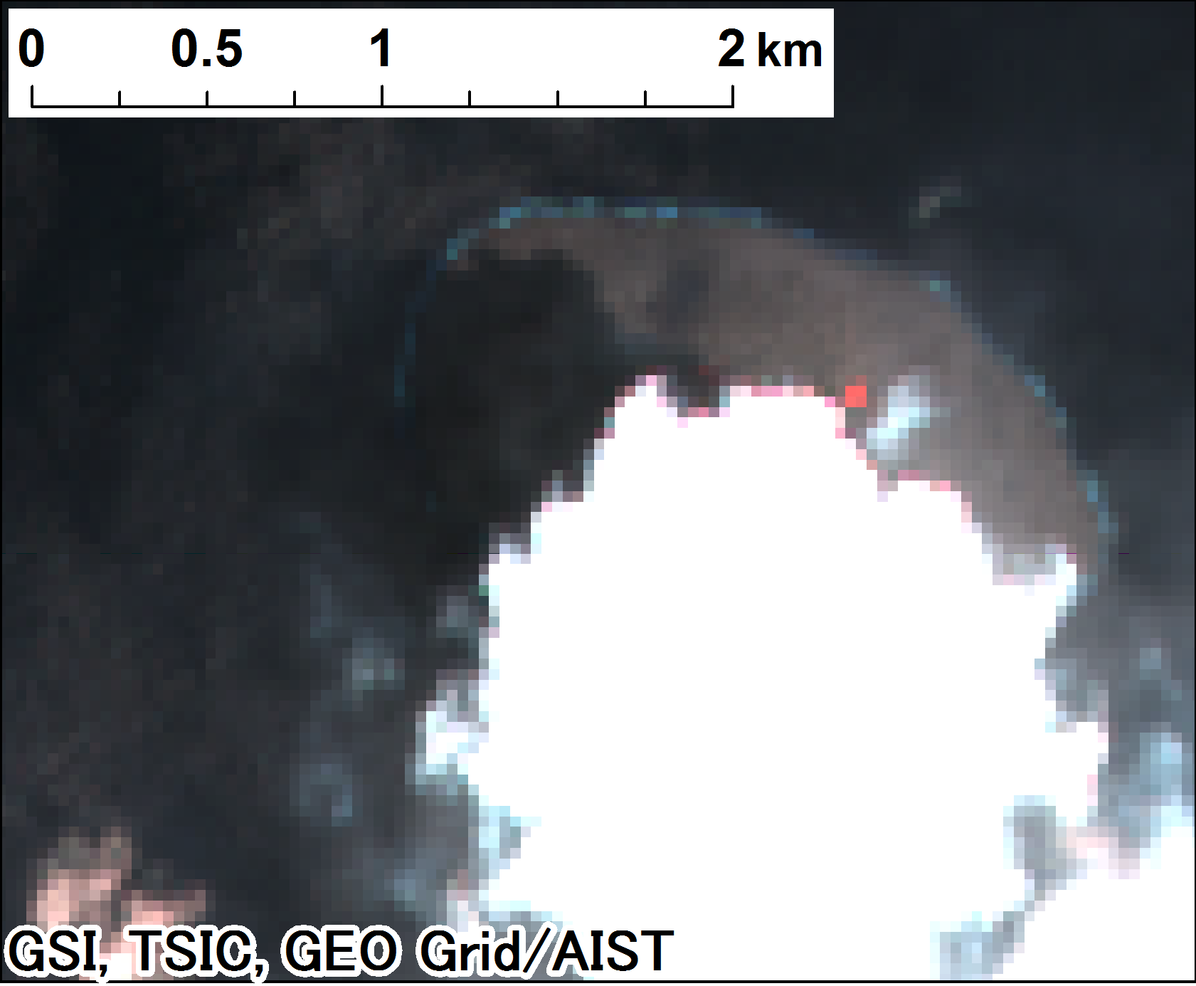
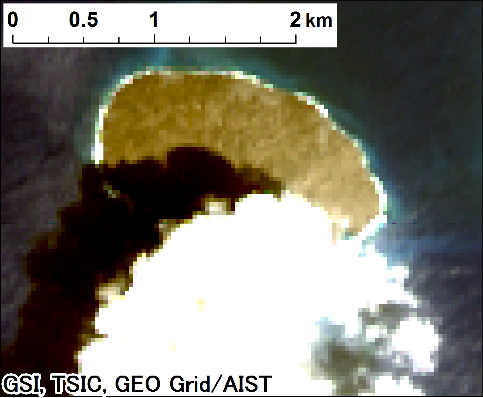
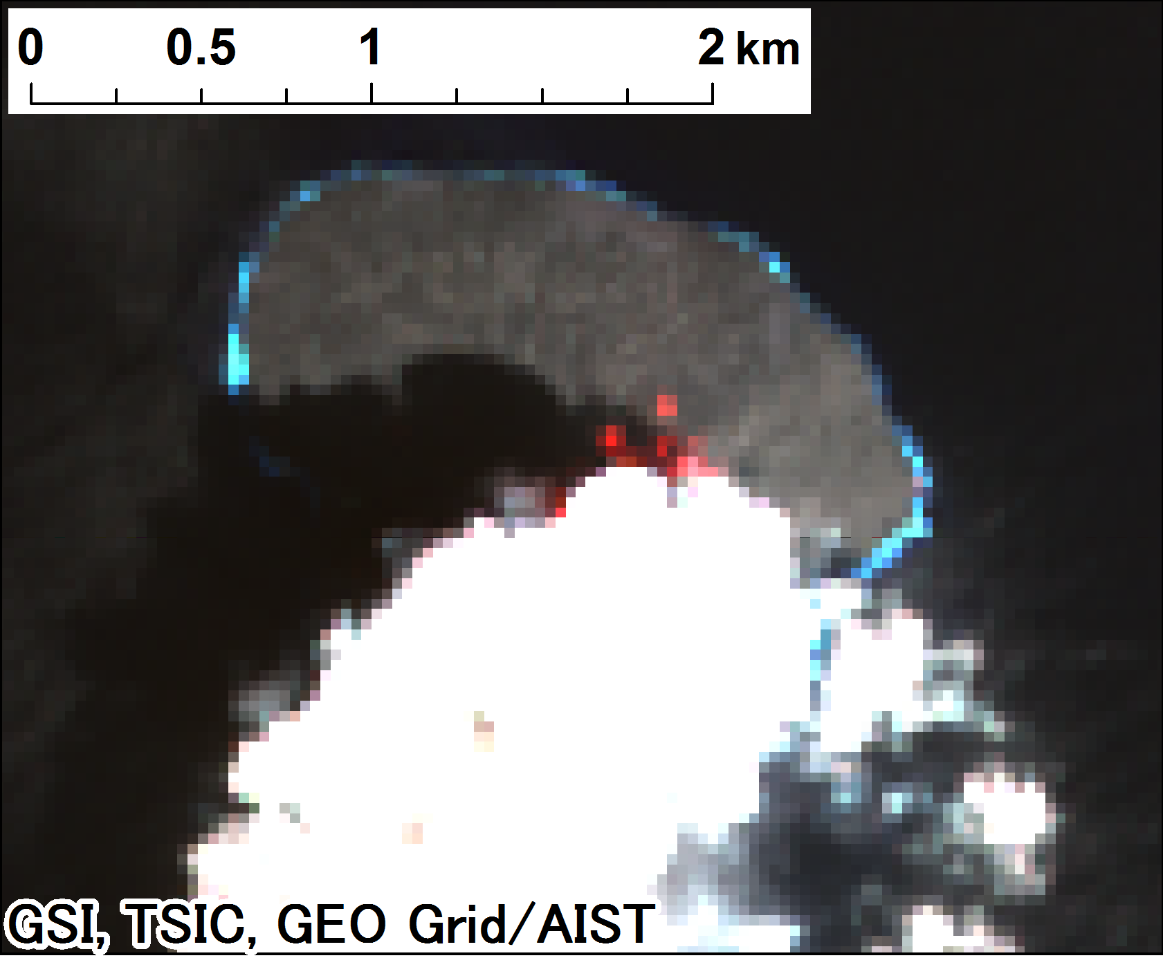
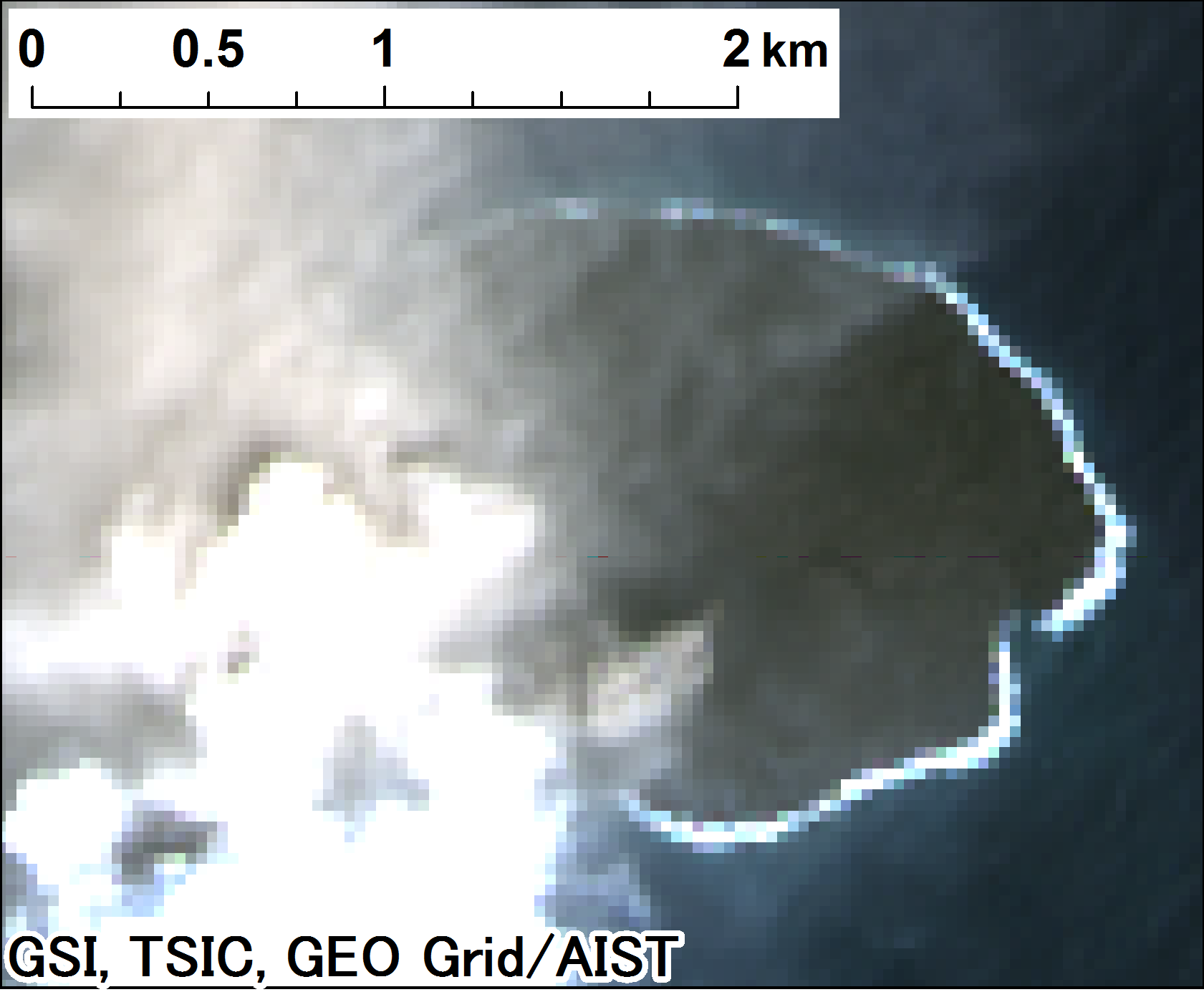
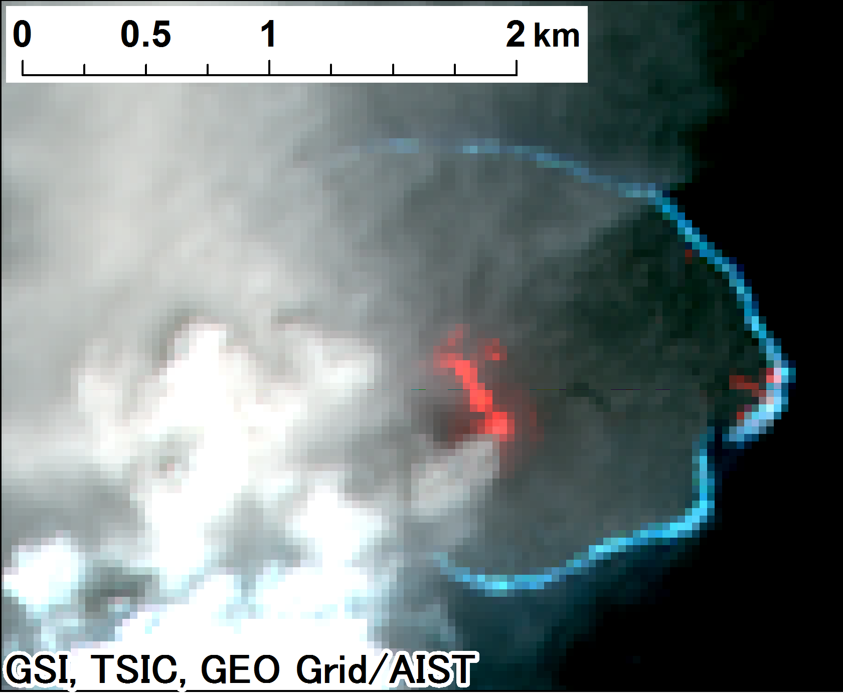
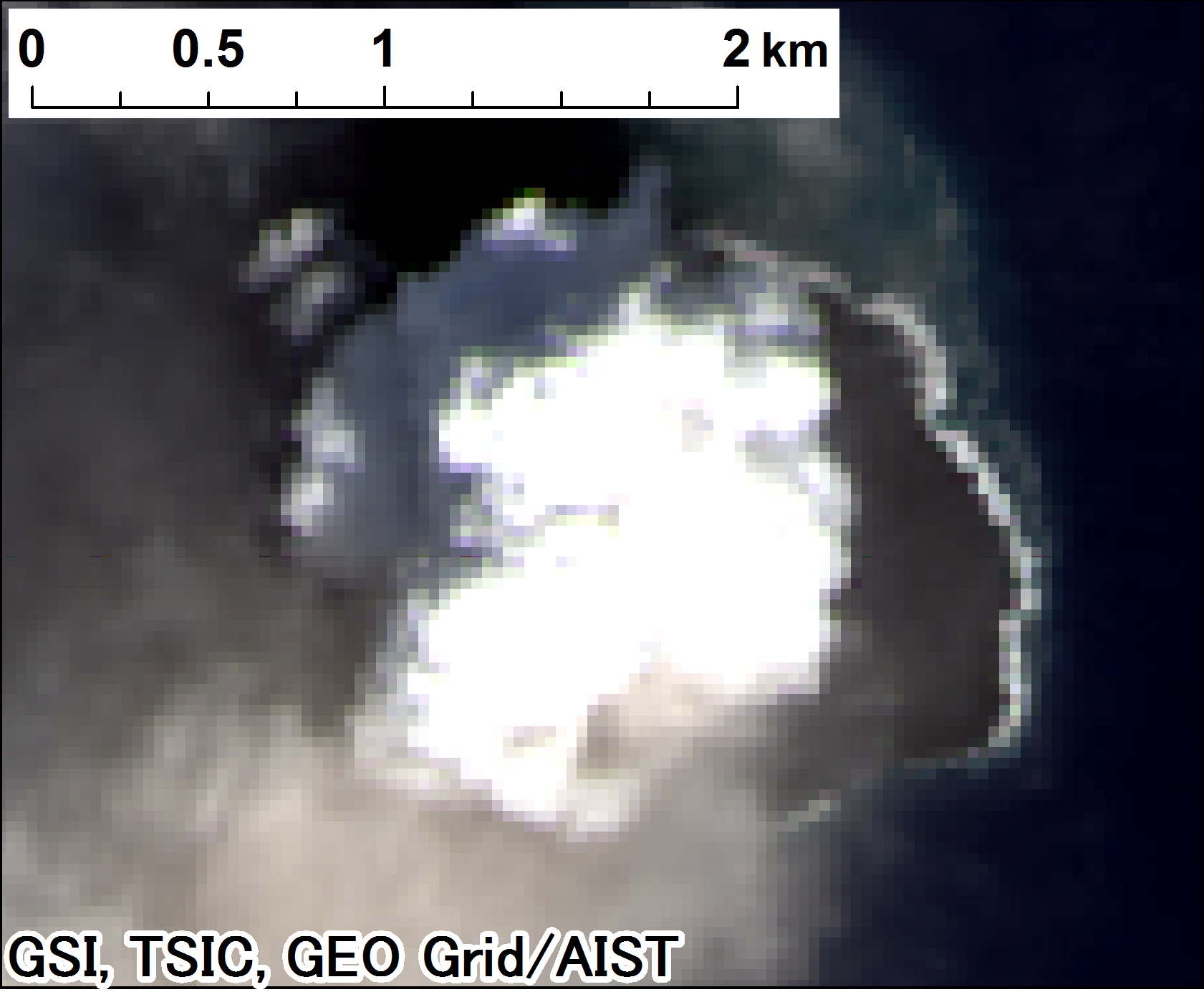
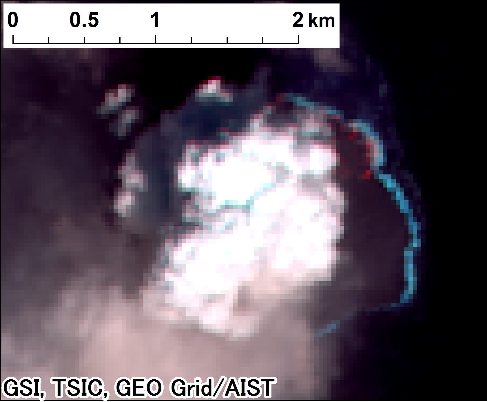
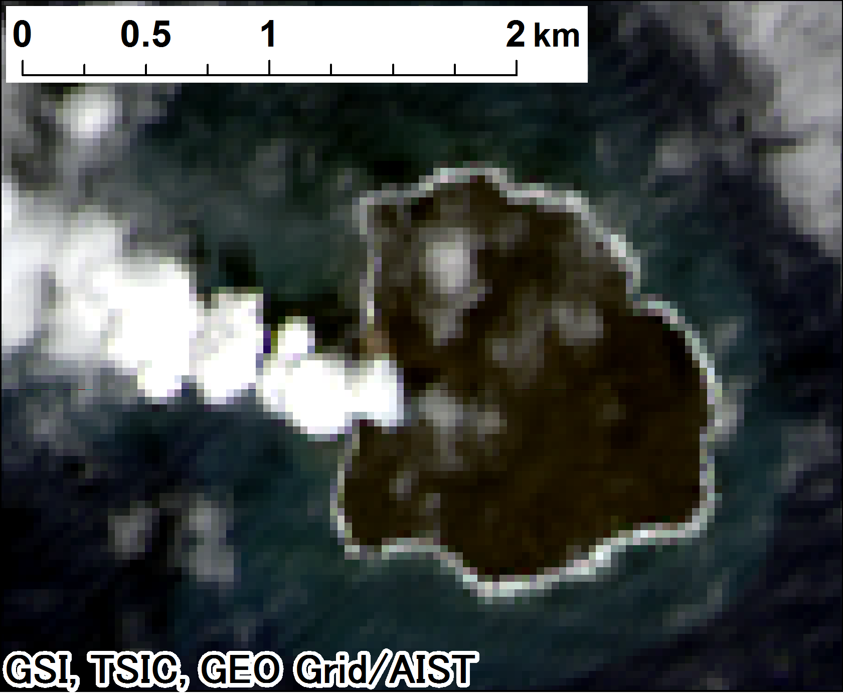
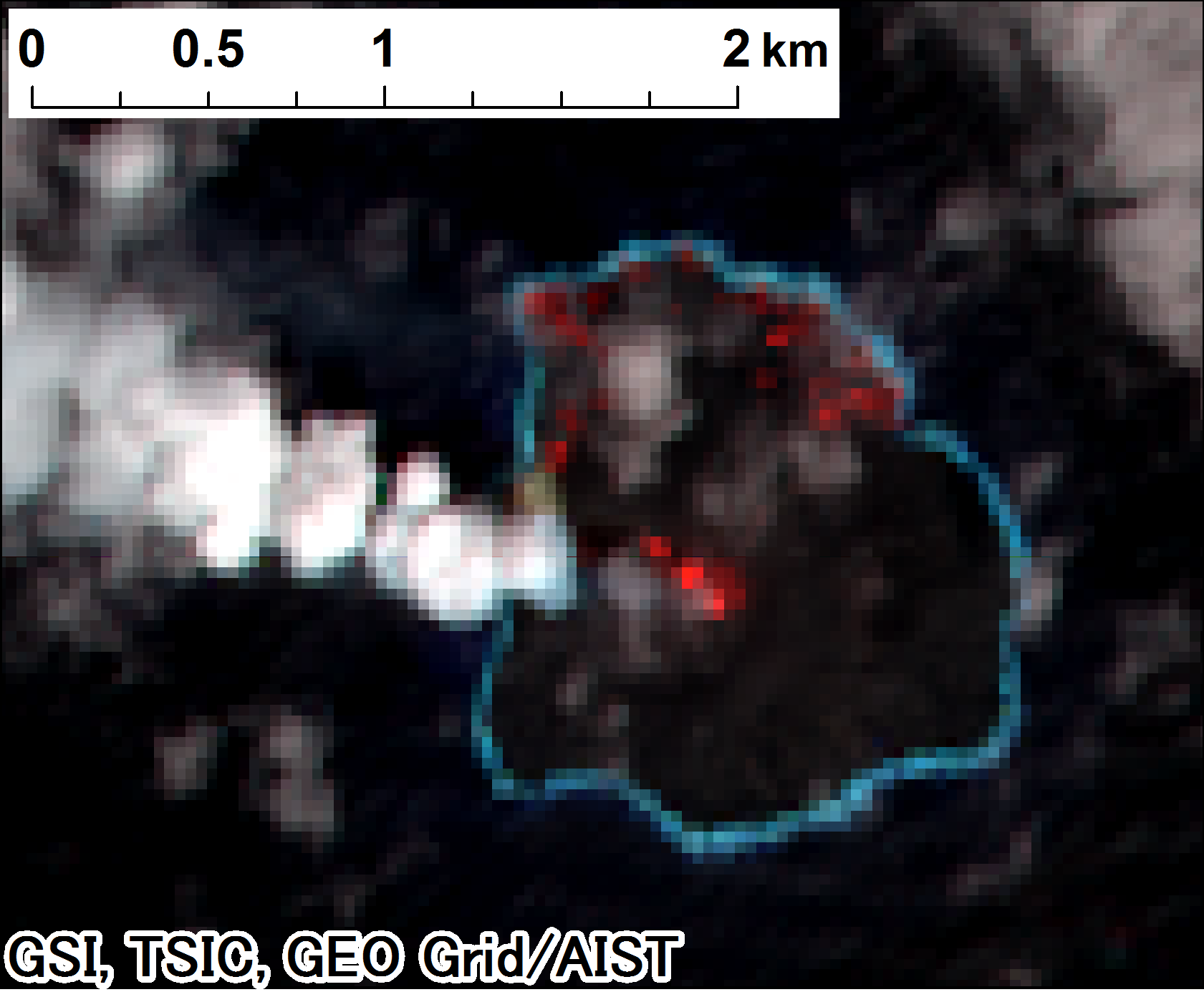
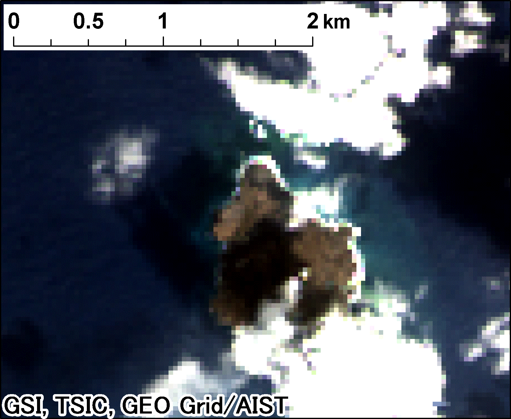
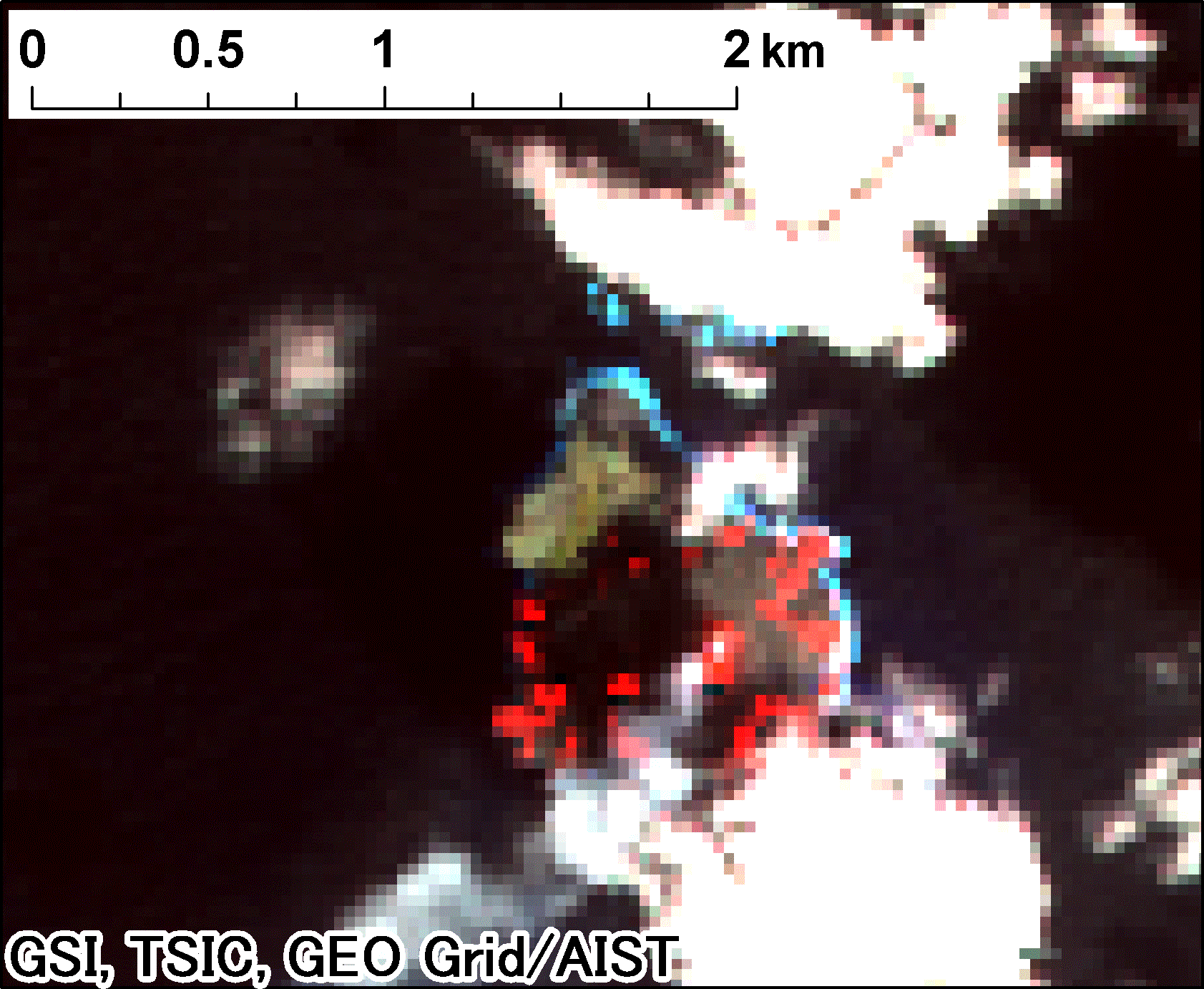
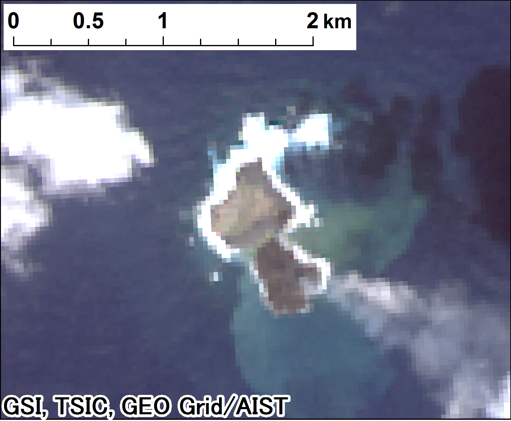
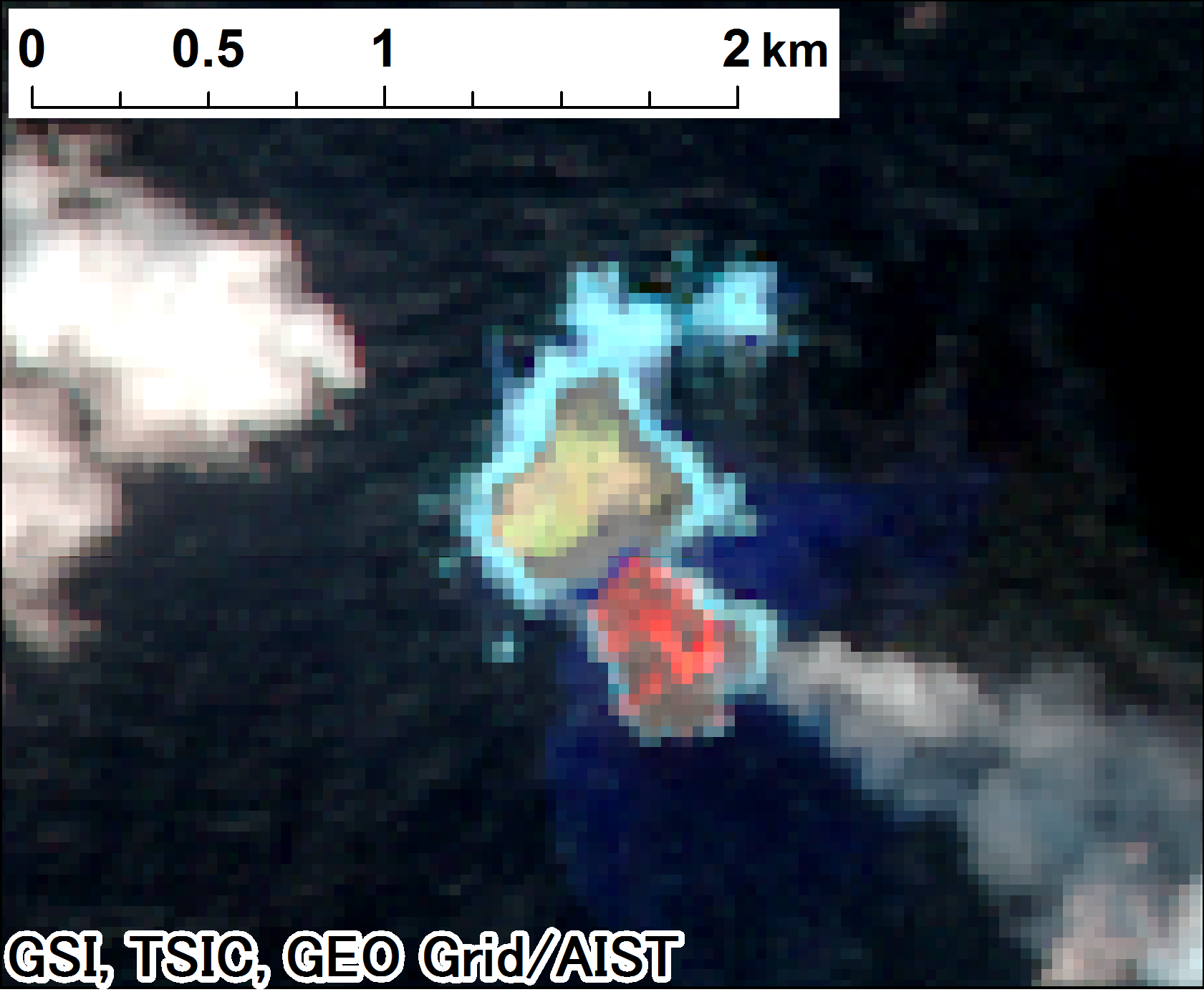
Nishinoshima eruption observed by Landsat8 since December 2013
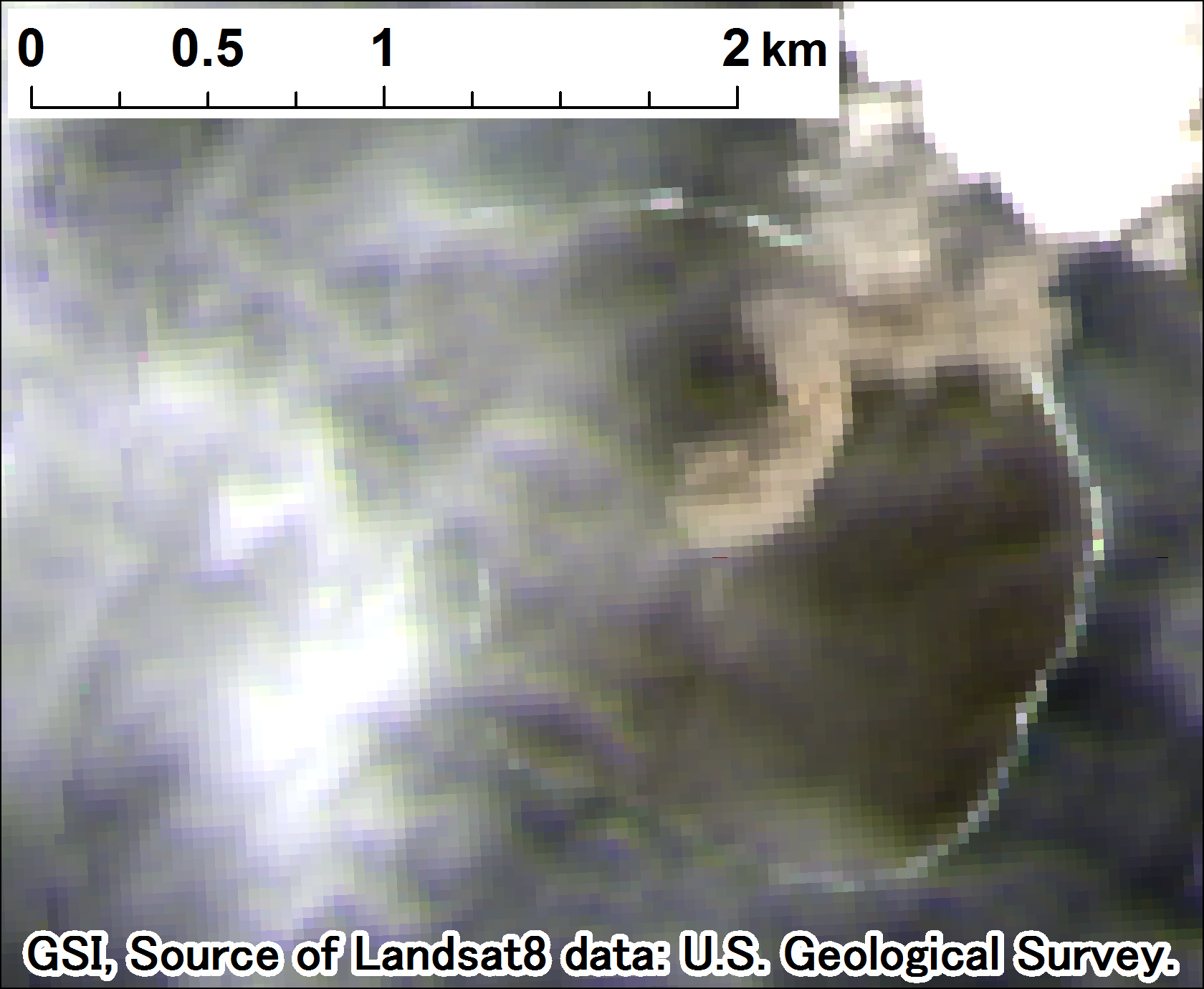
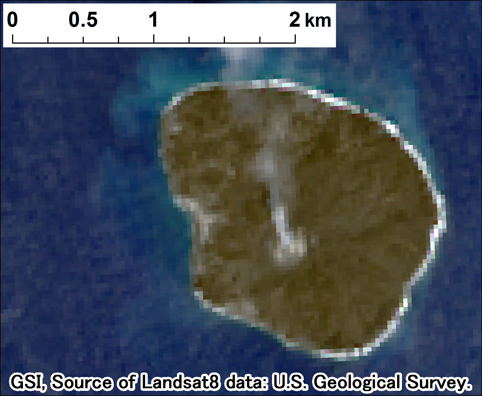
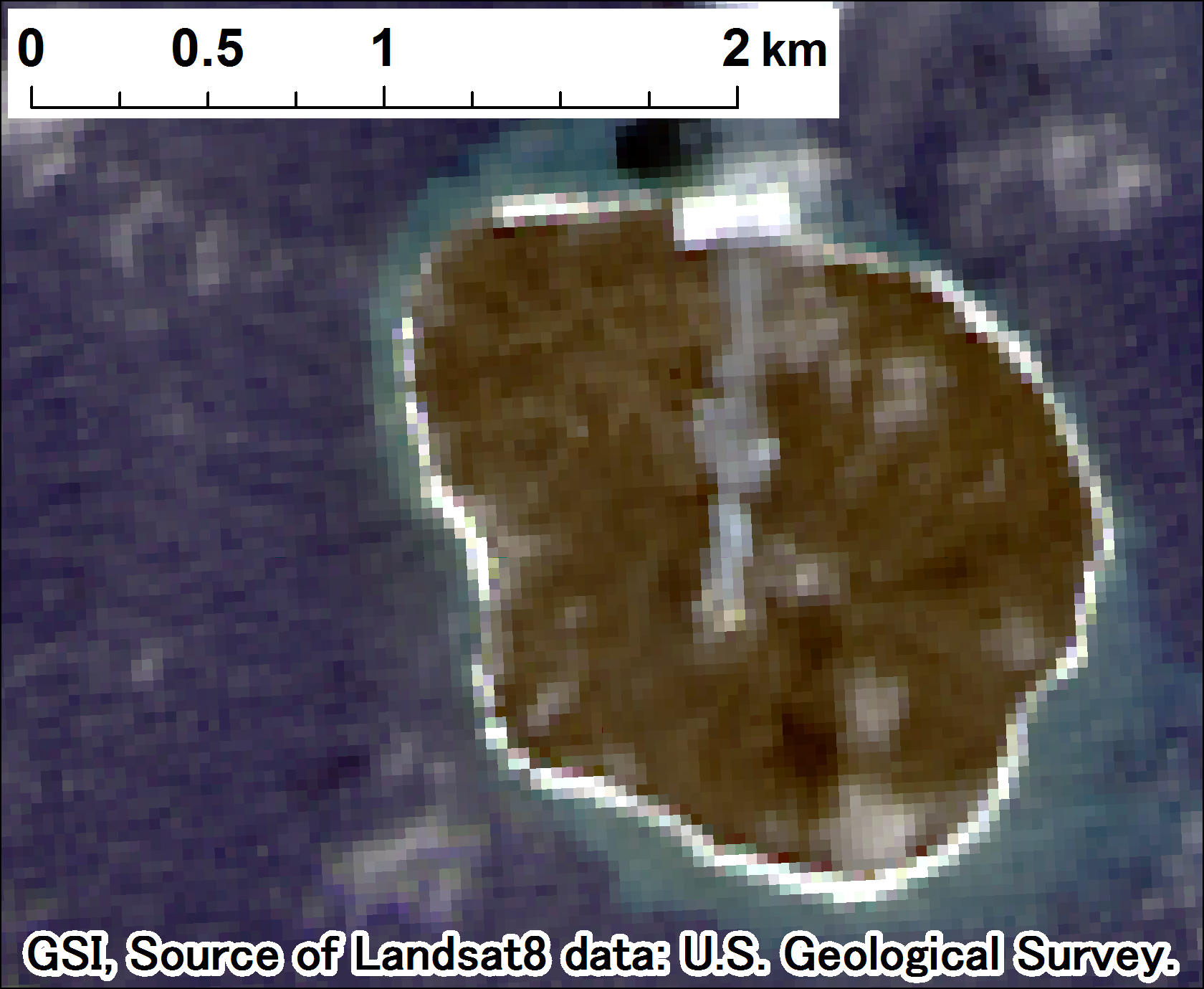
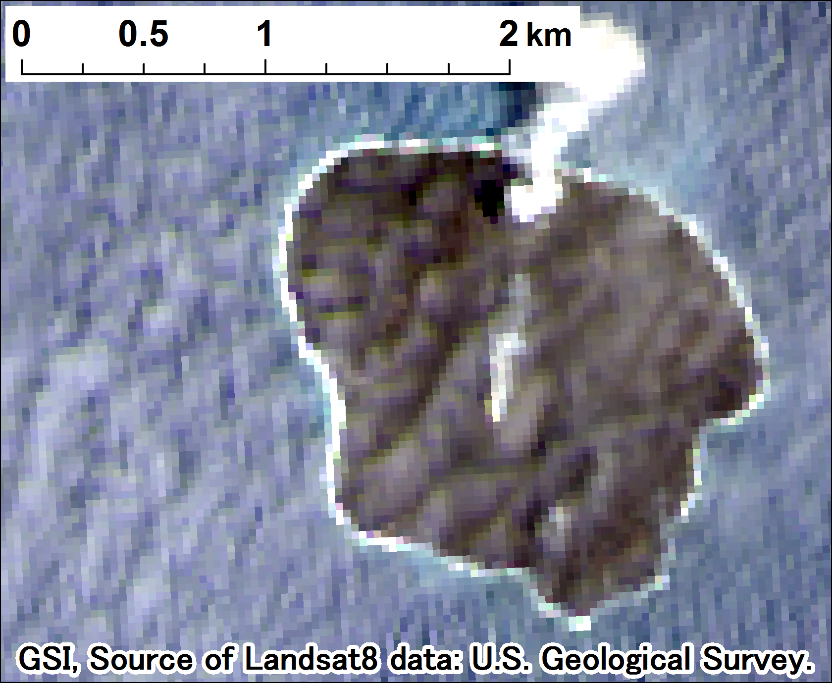
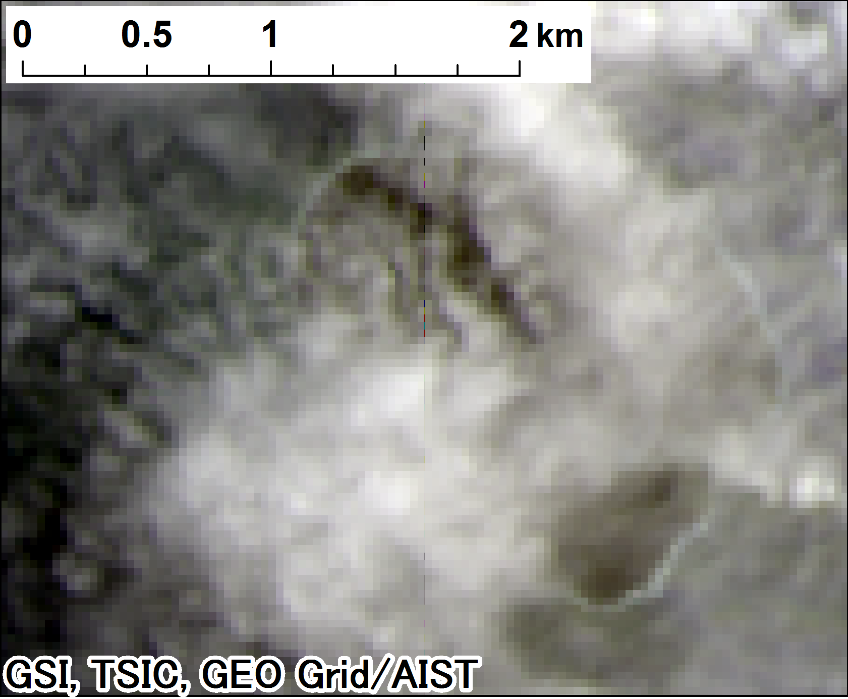
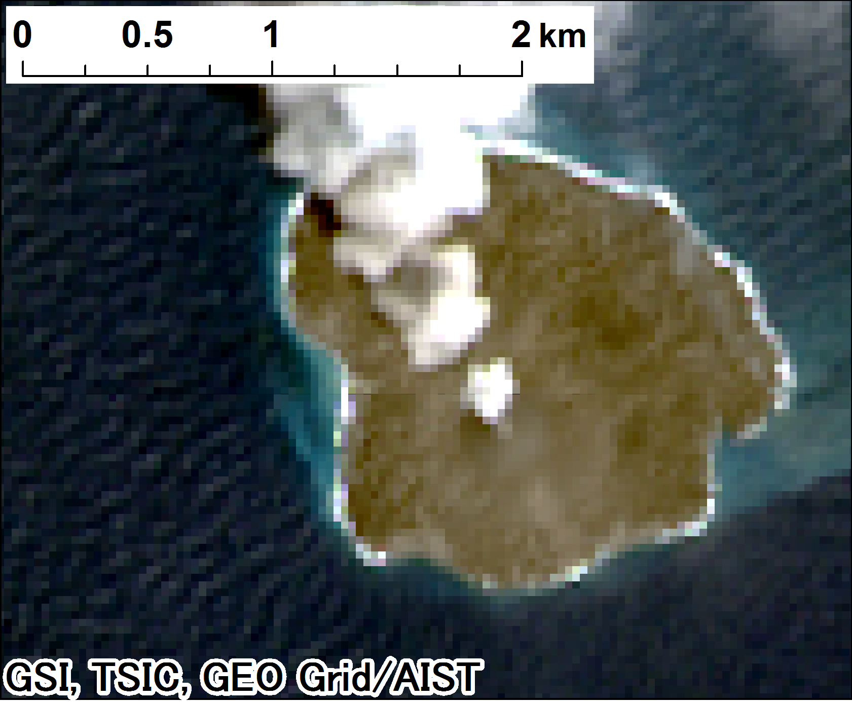
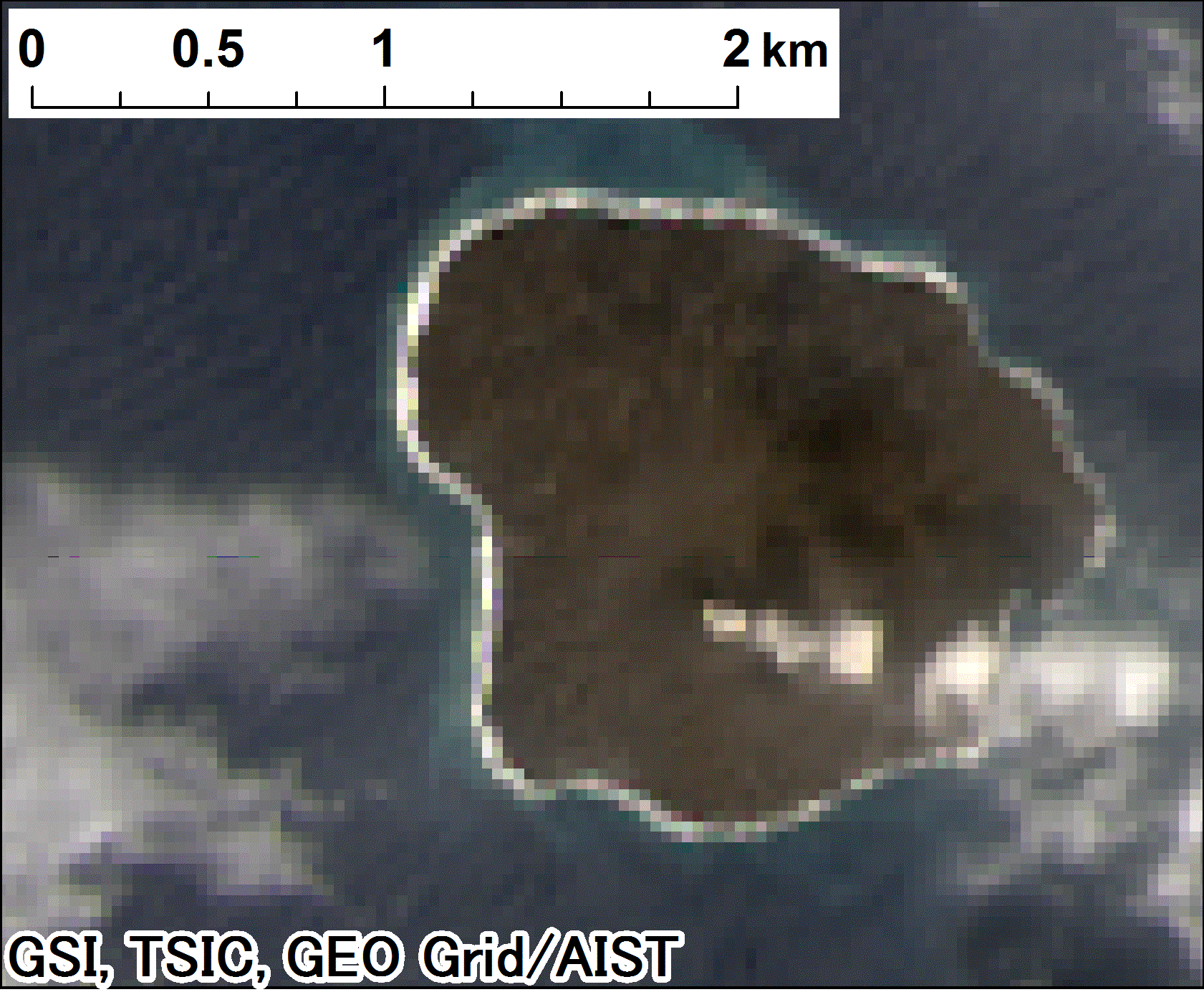
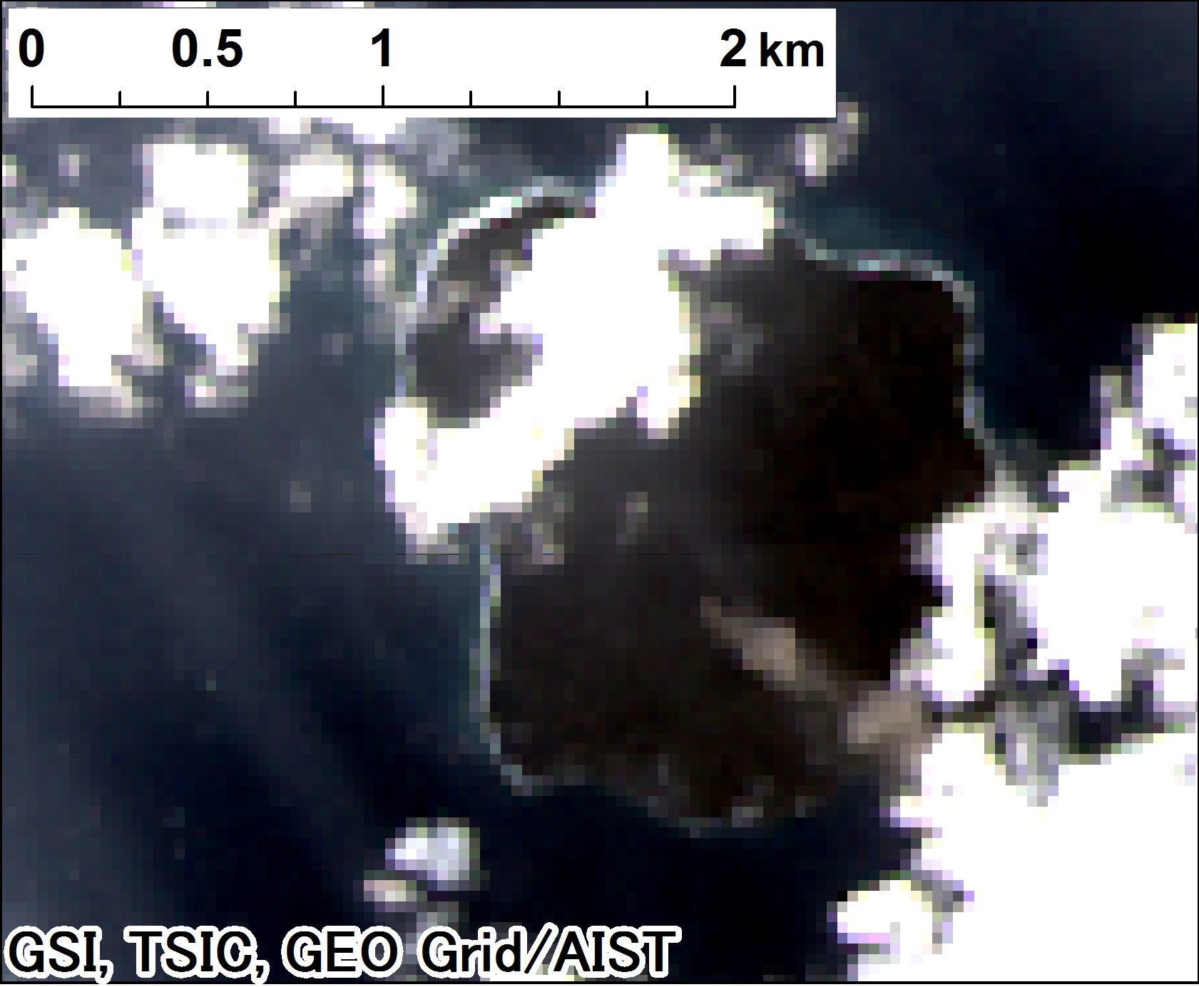
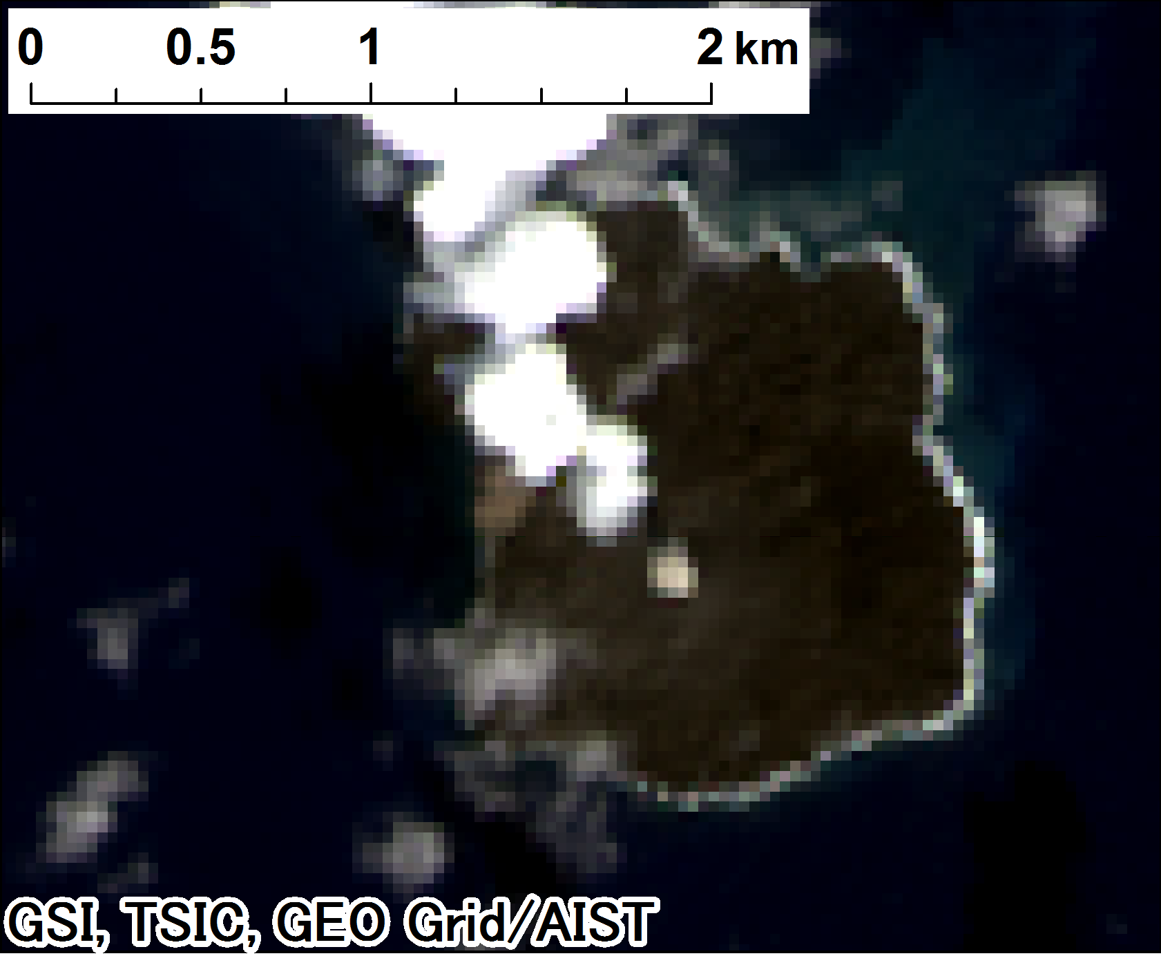
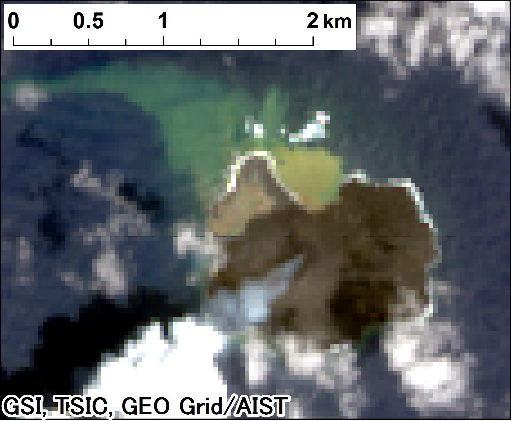
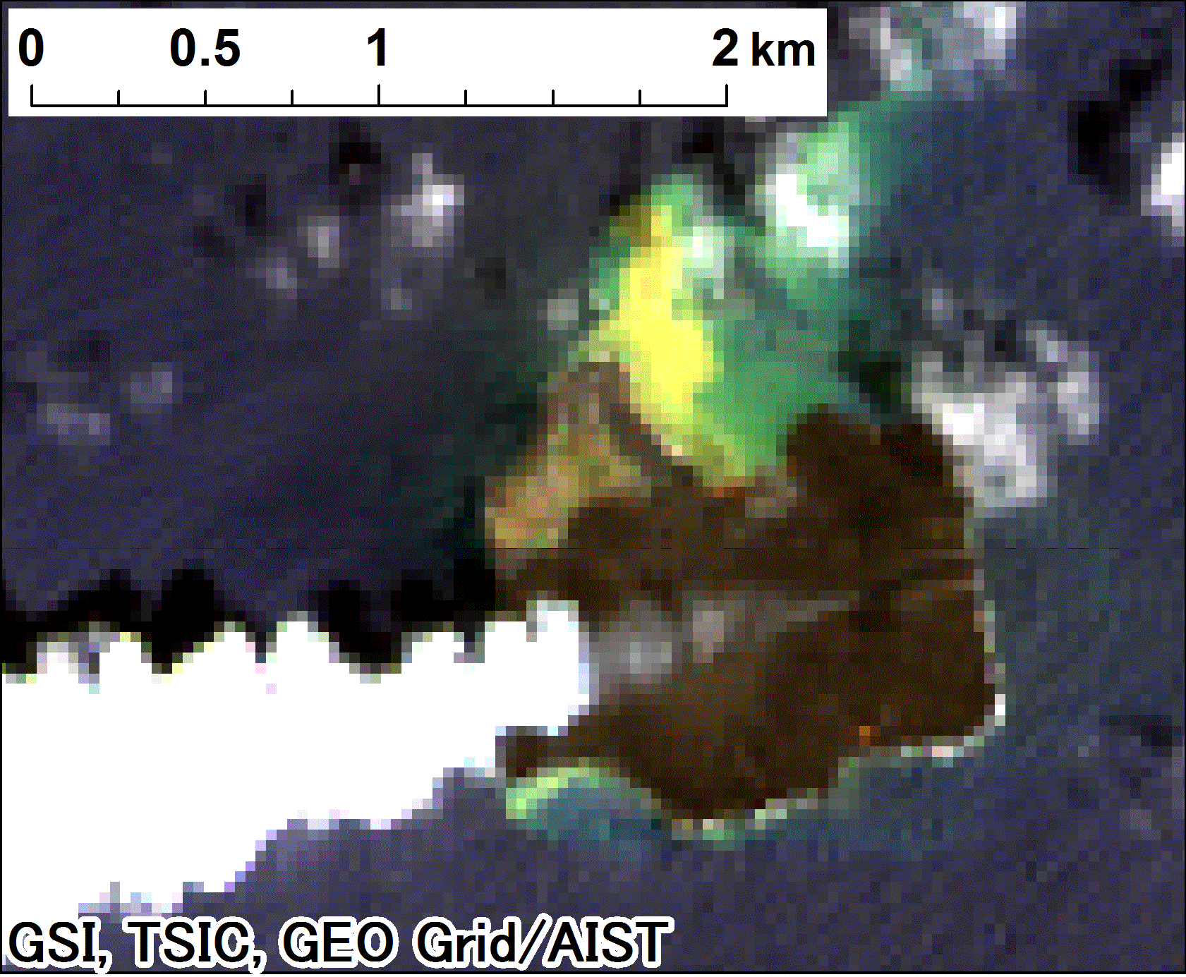
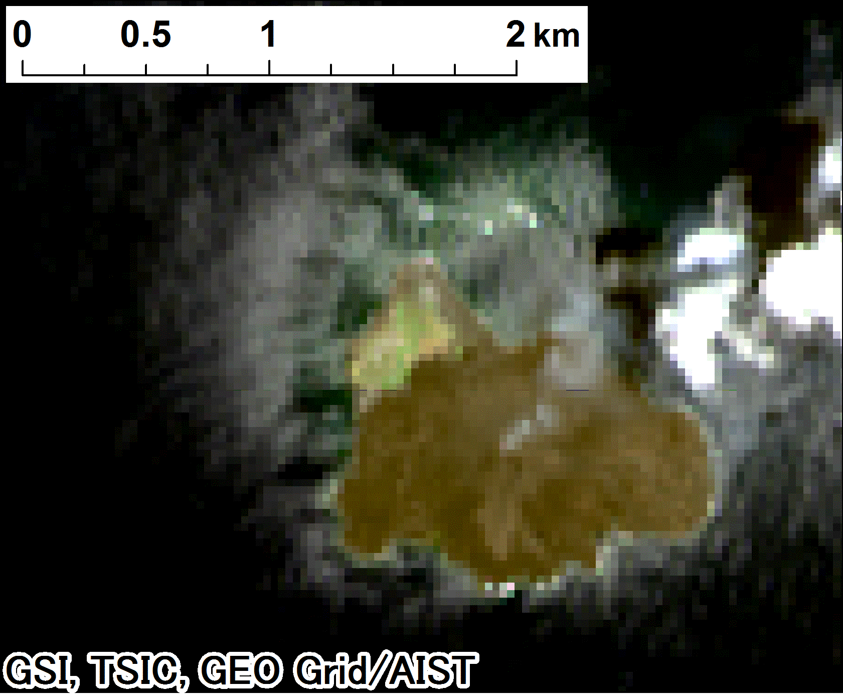
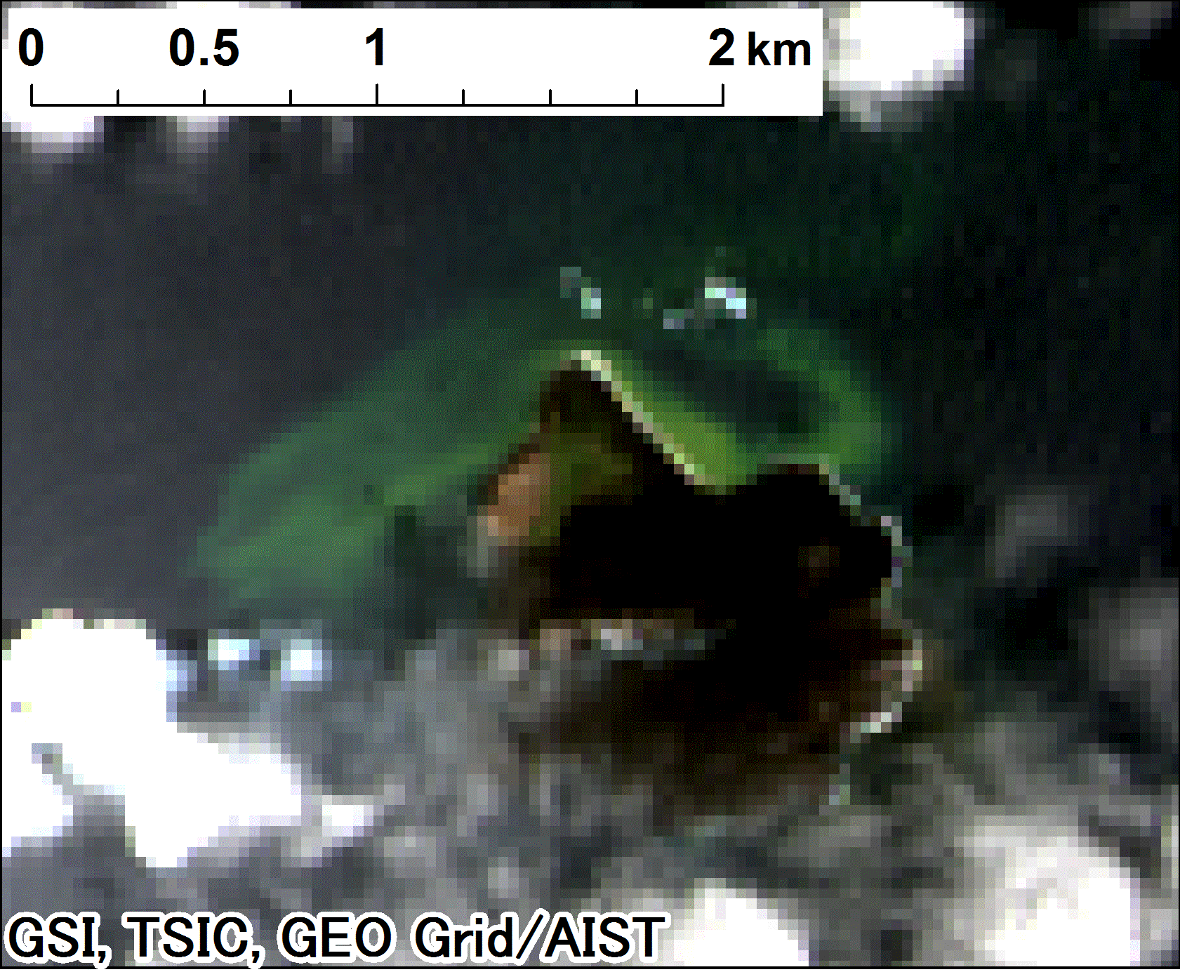
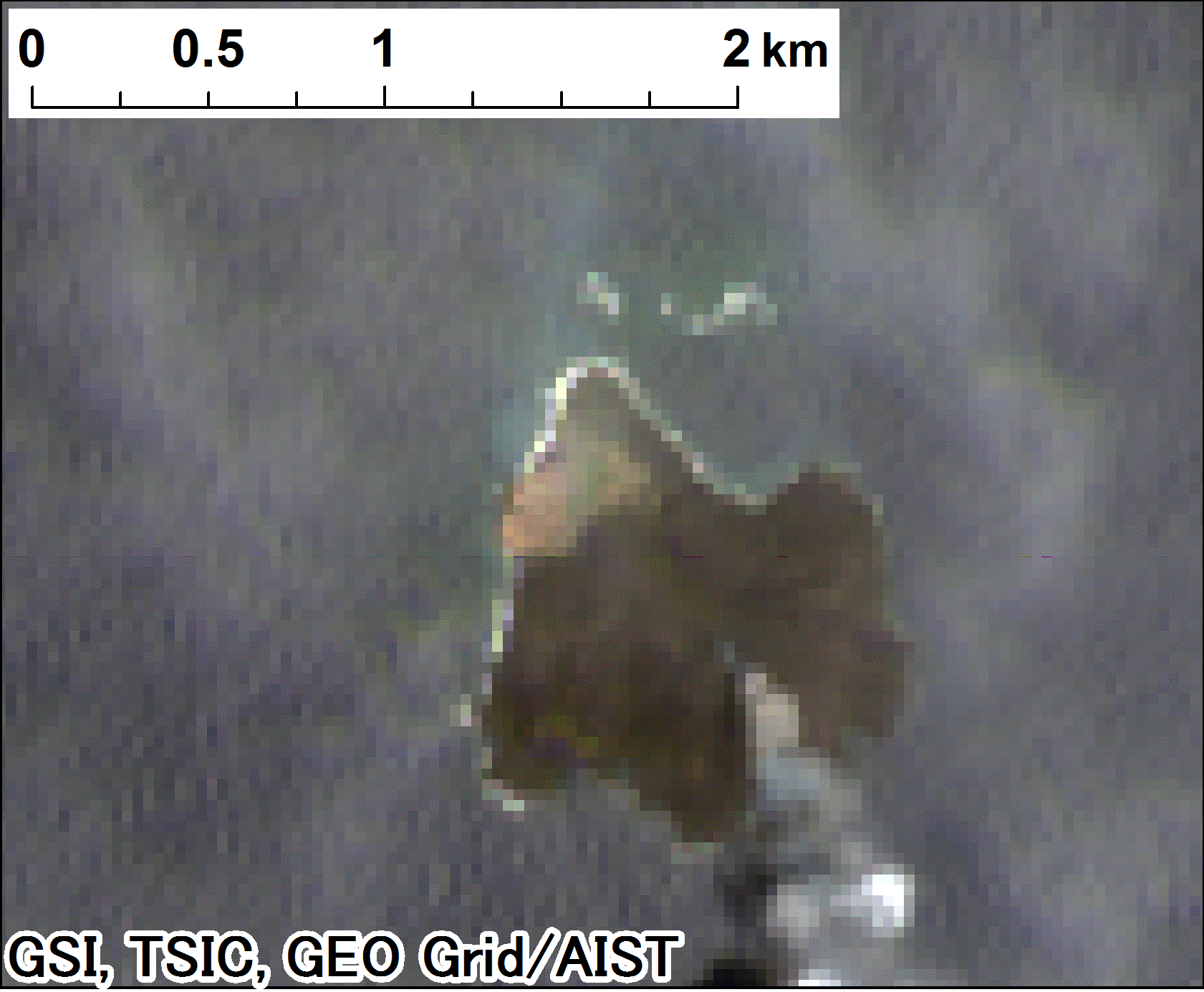
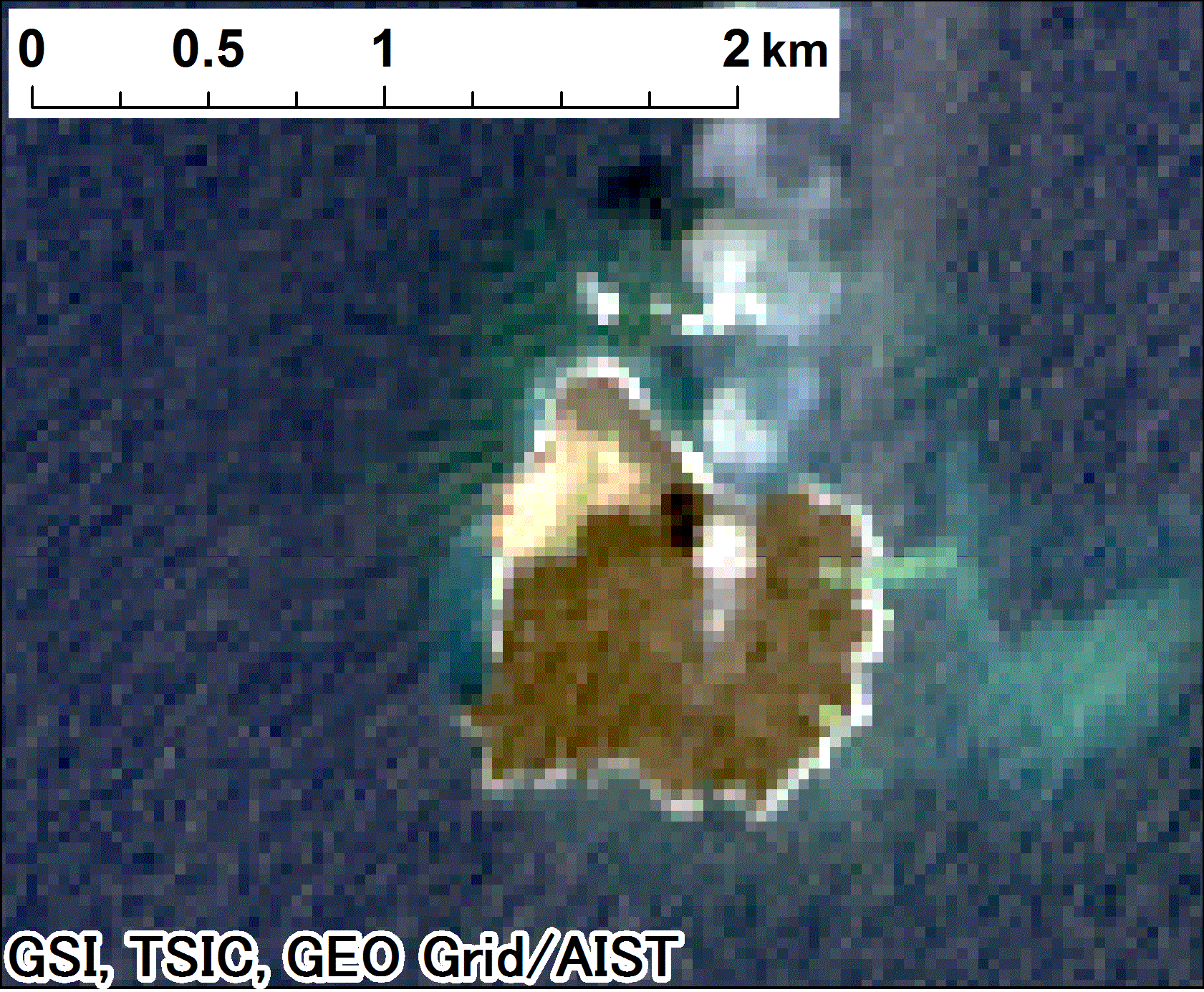
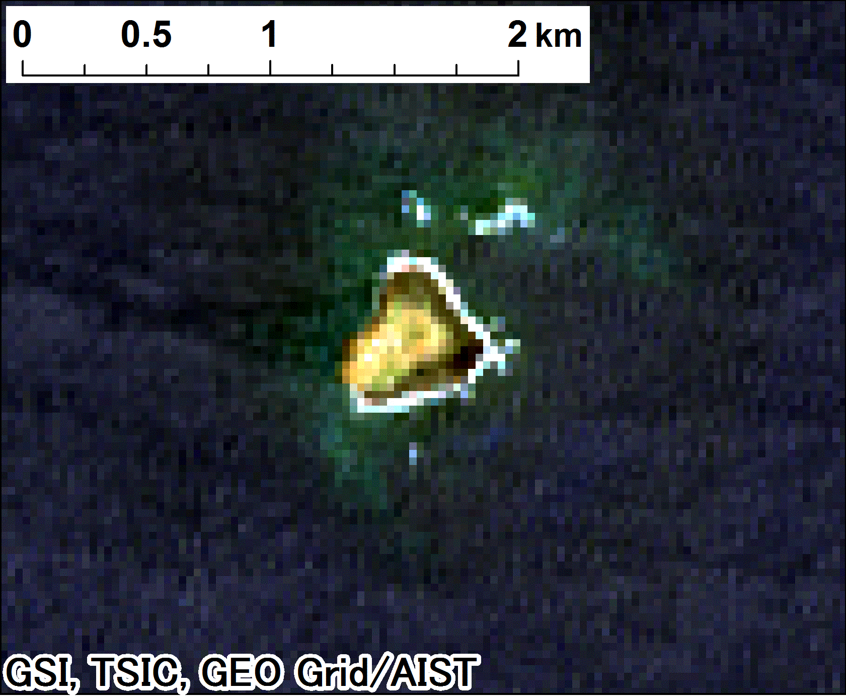
Color-composite Imagery (Spatial Resolution: 30 meters)
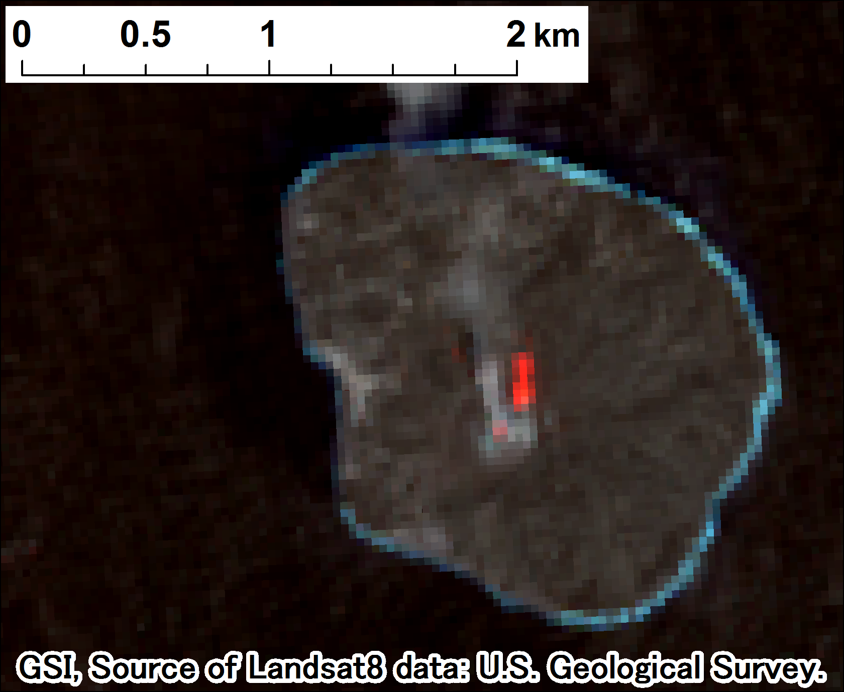
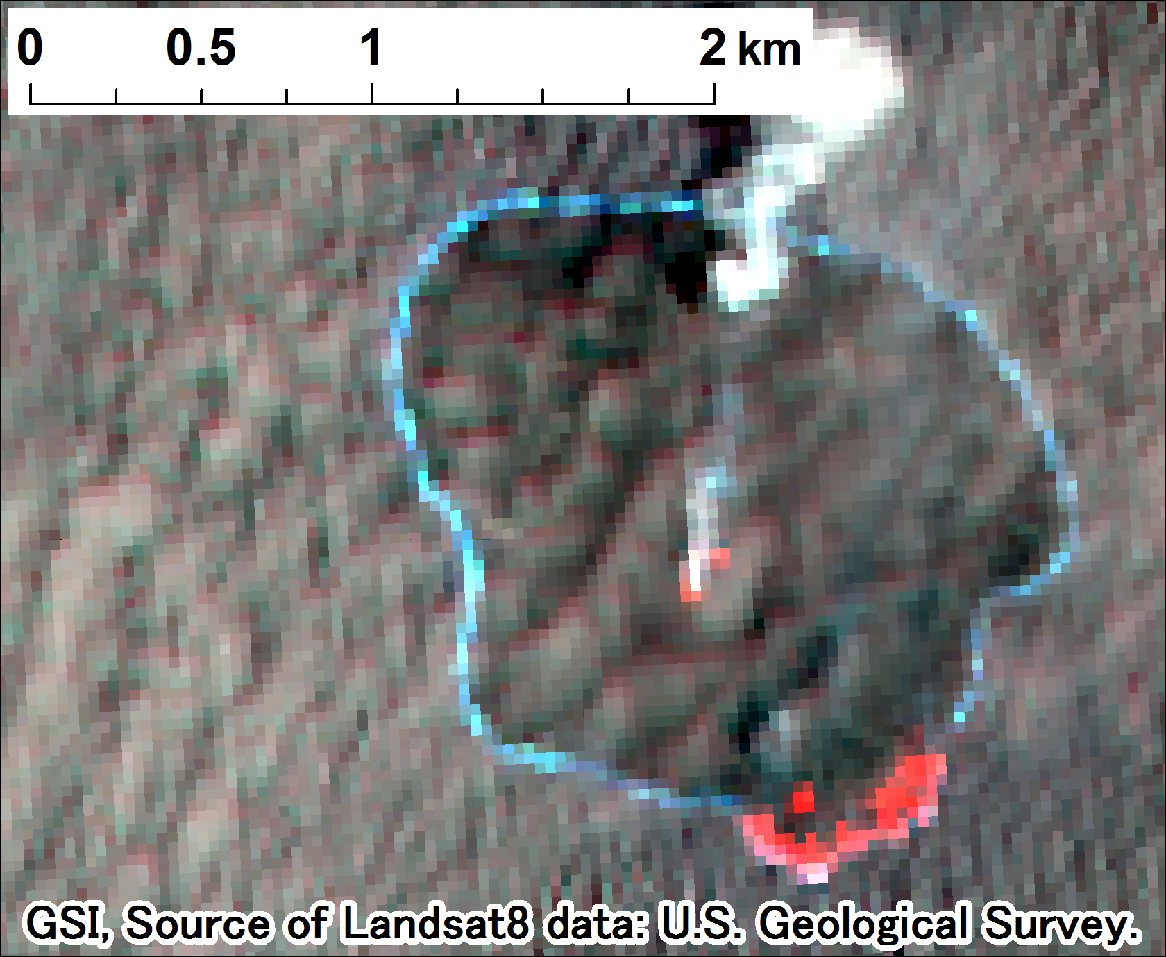
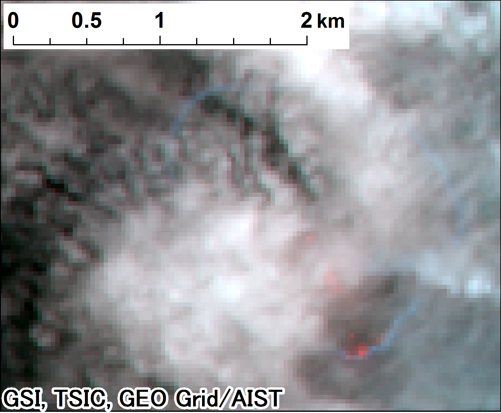
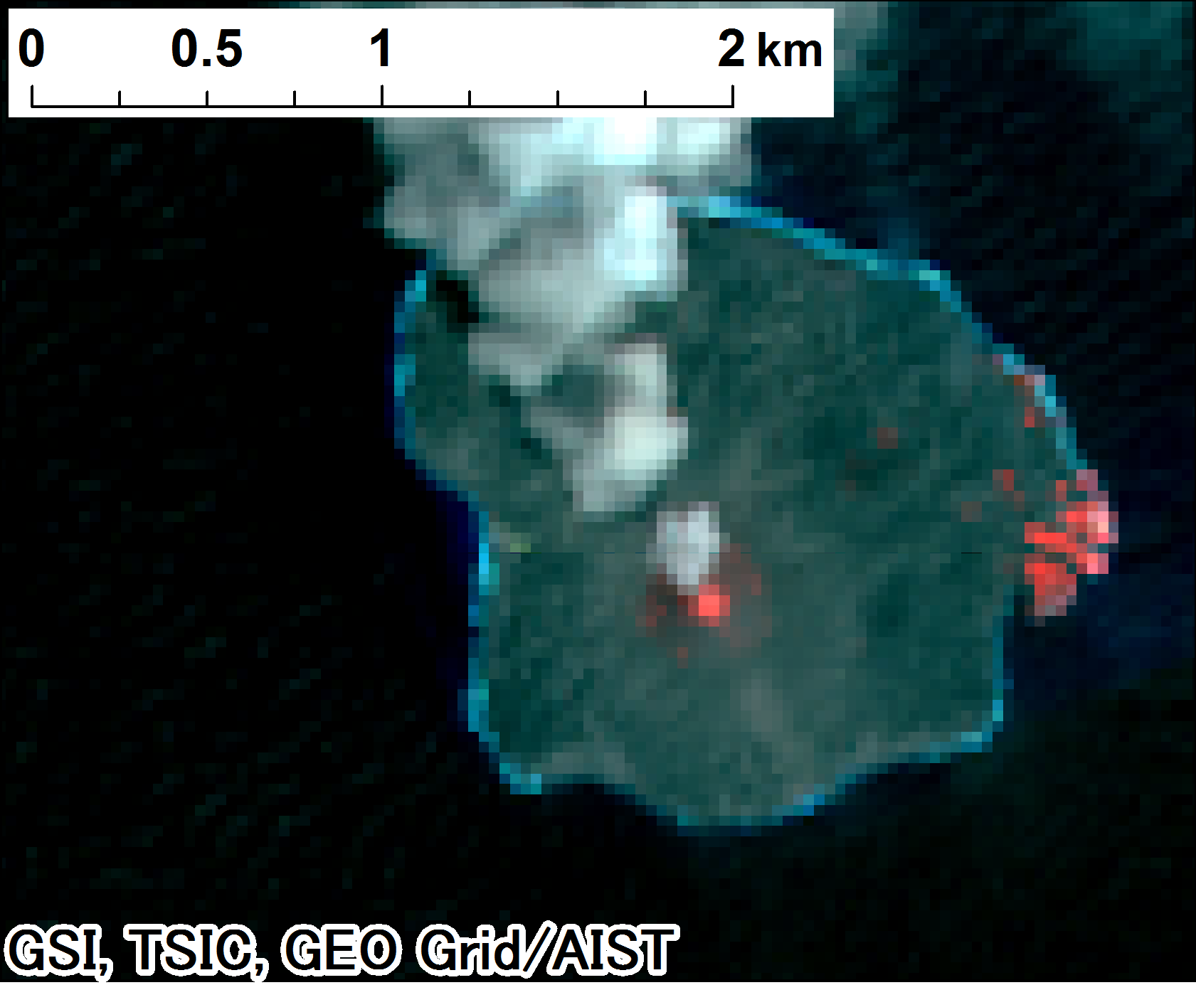
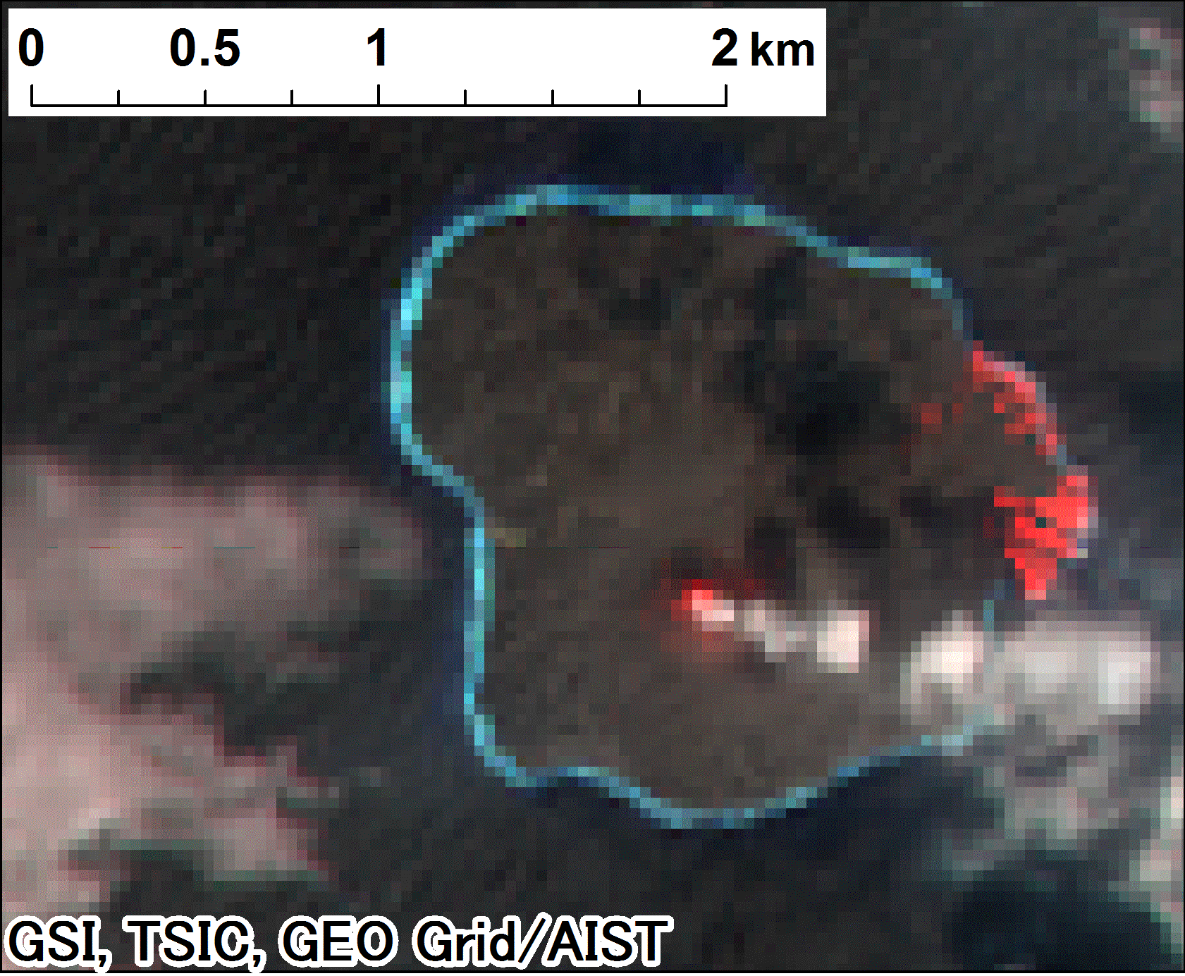
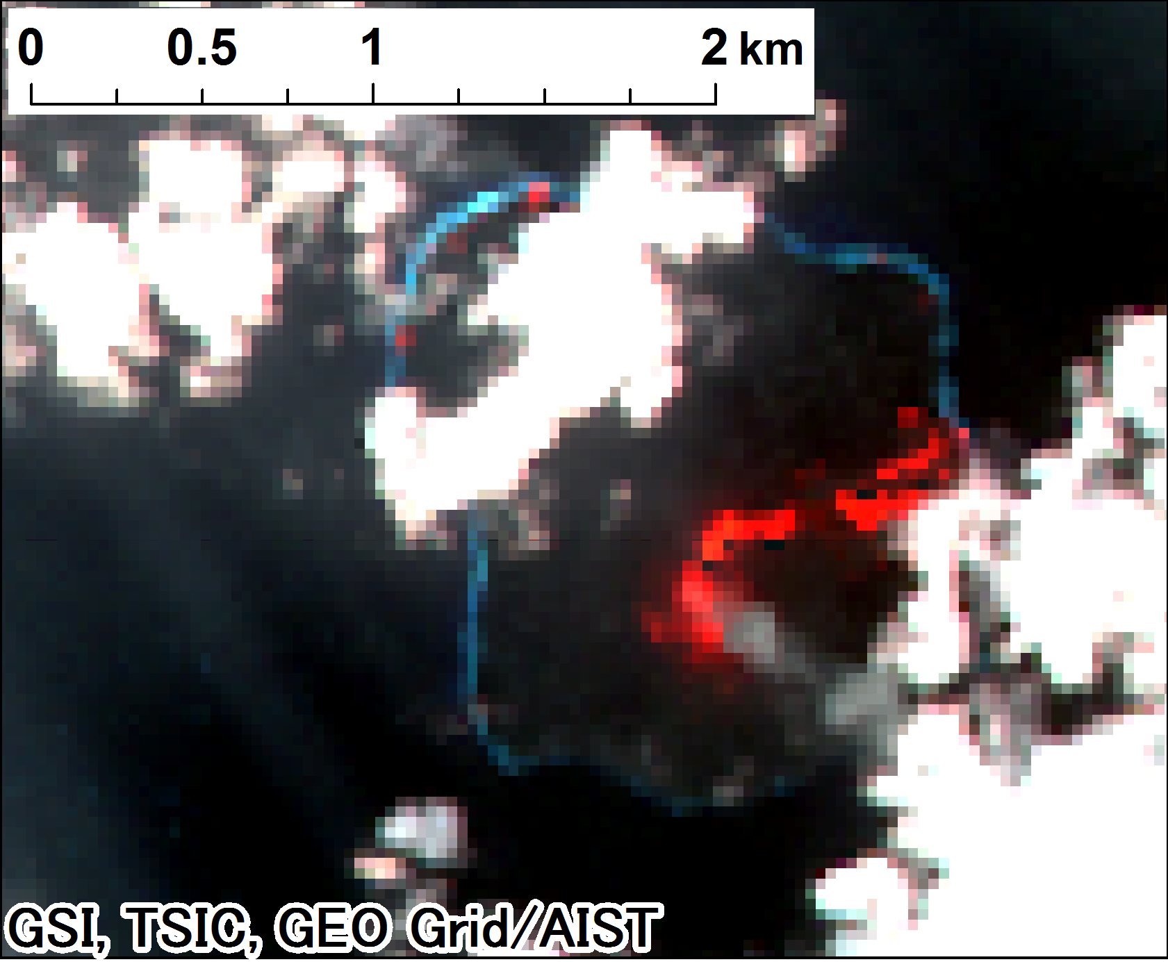
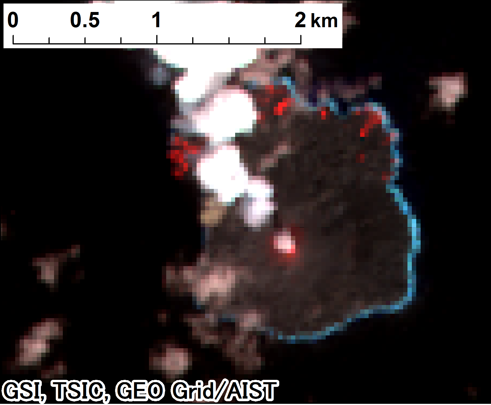
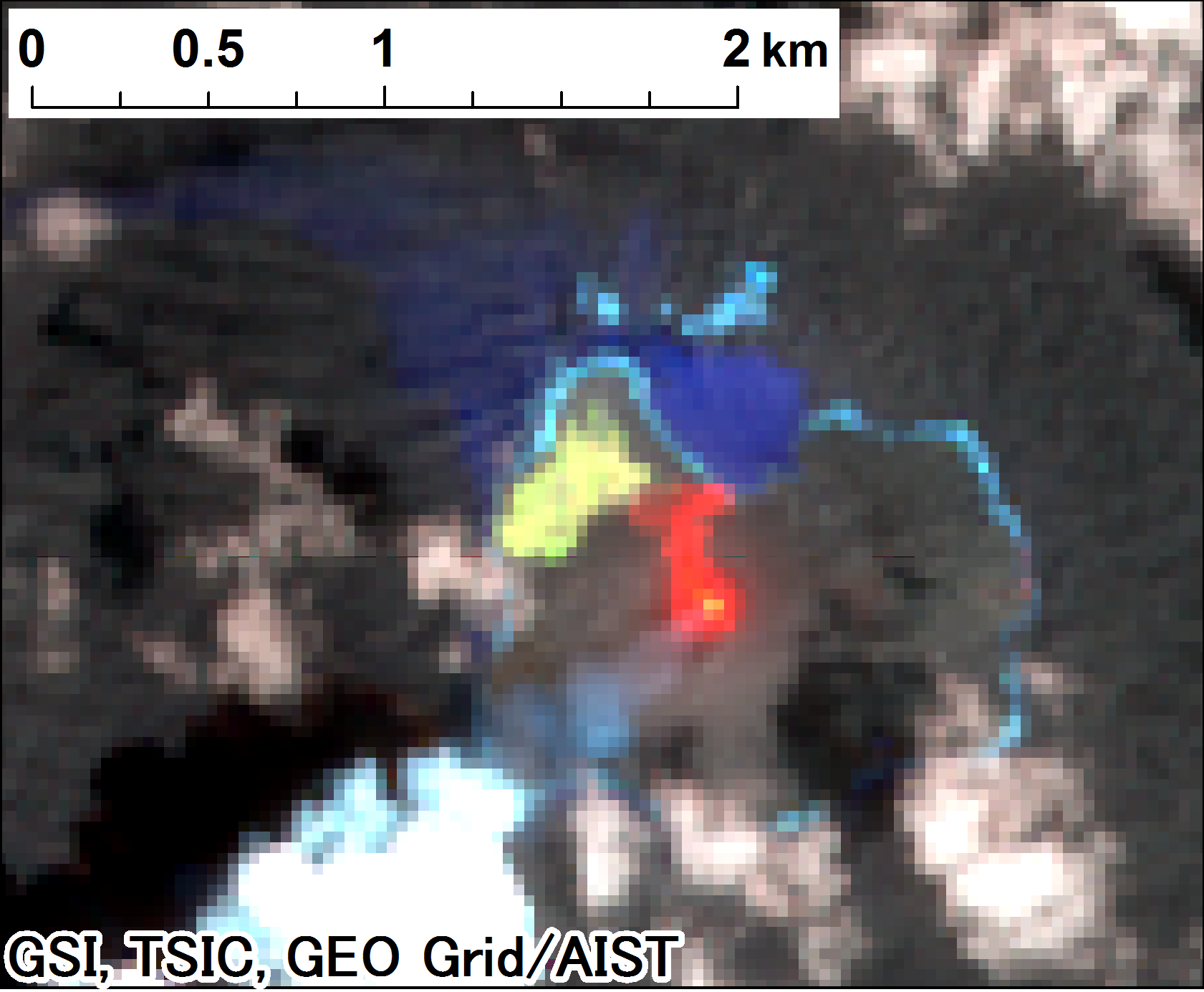
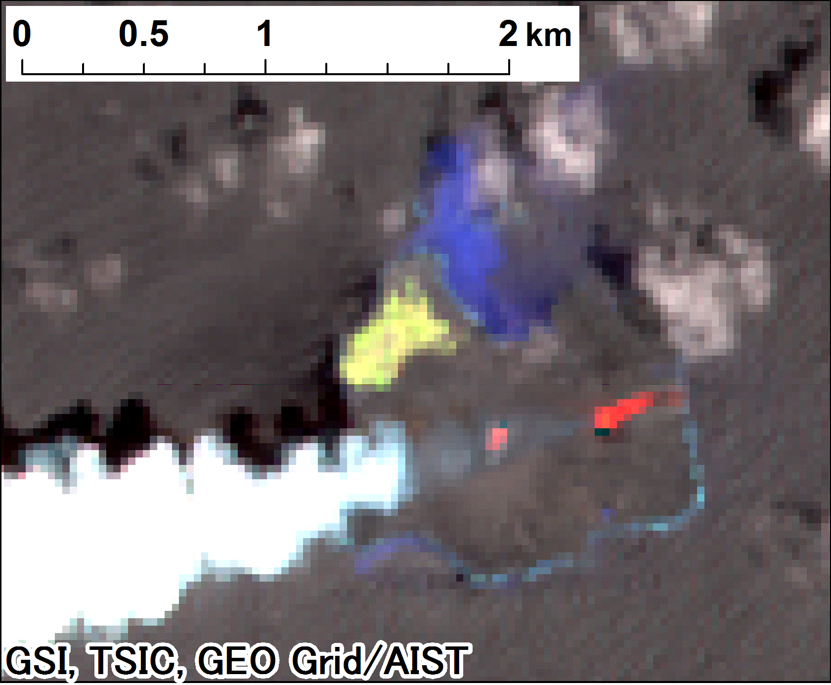
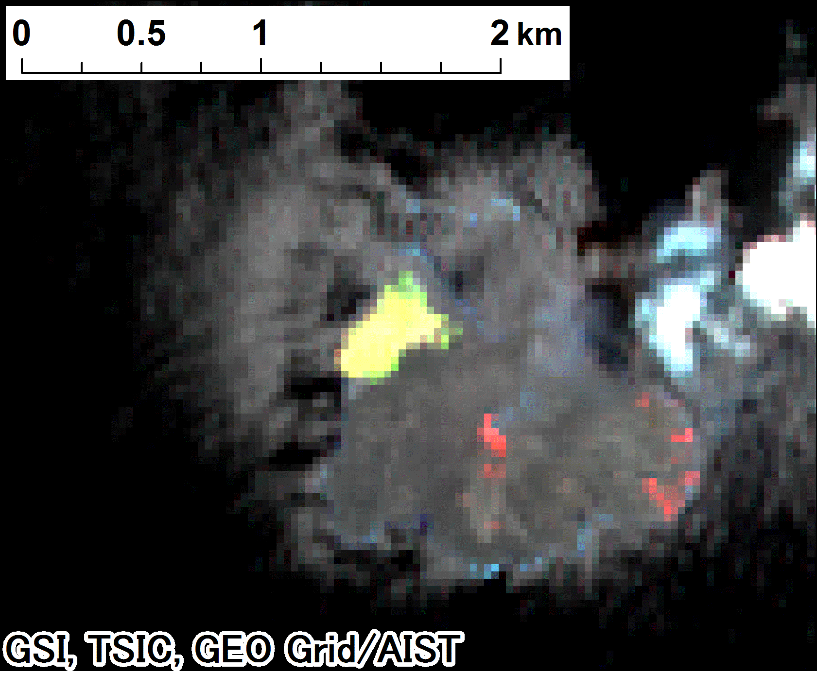
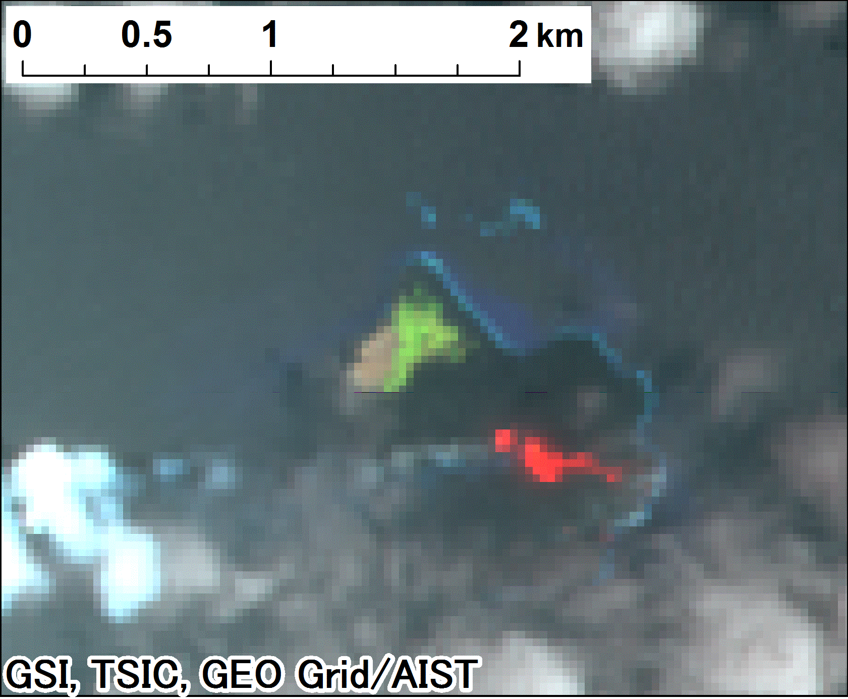
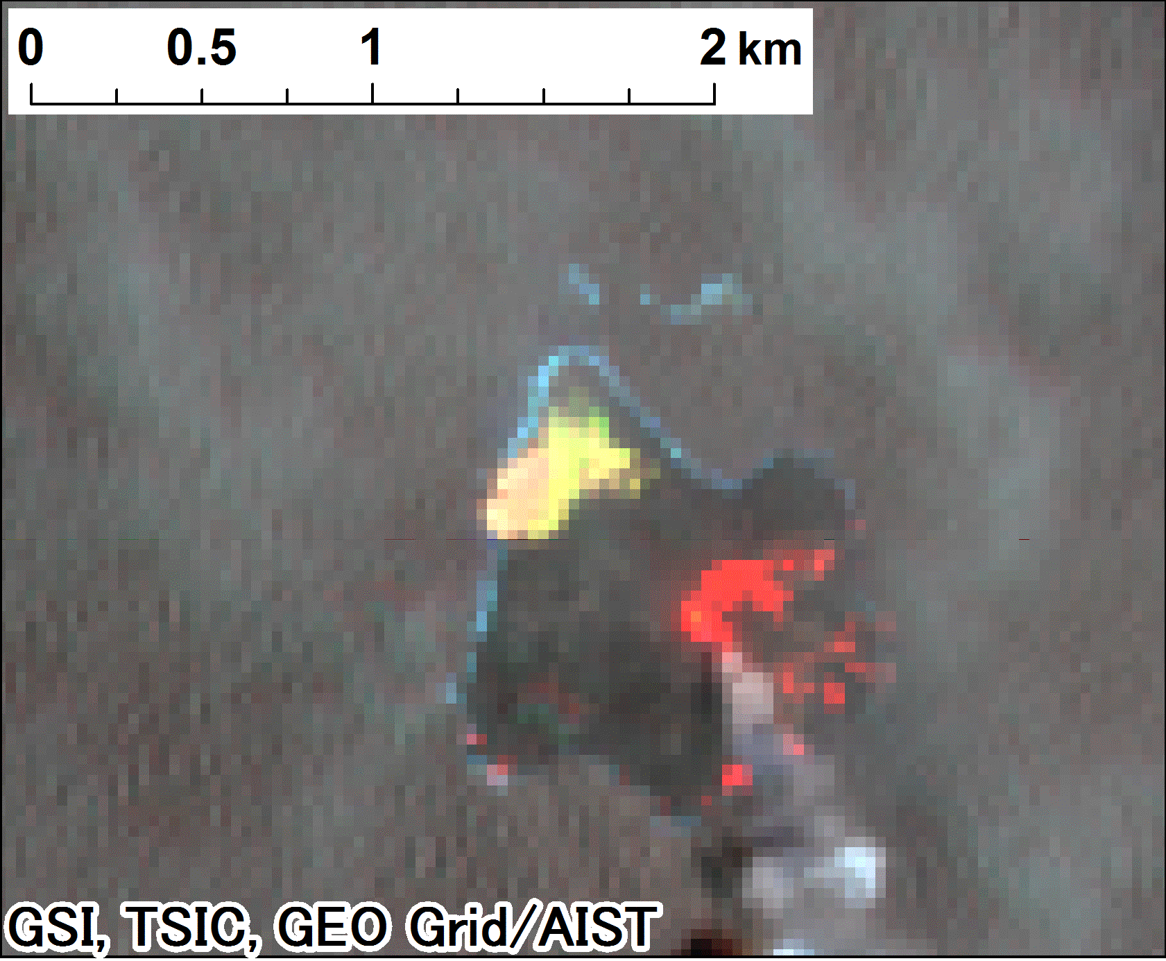
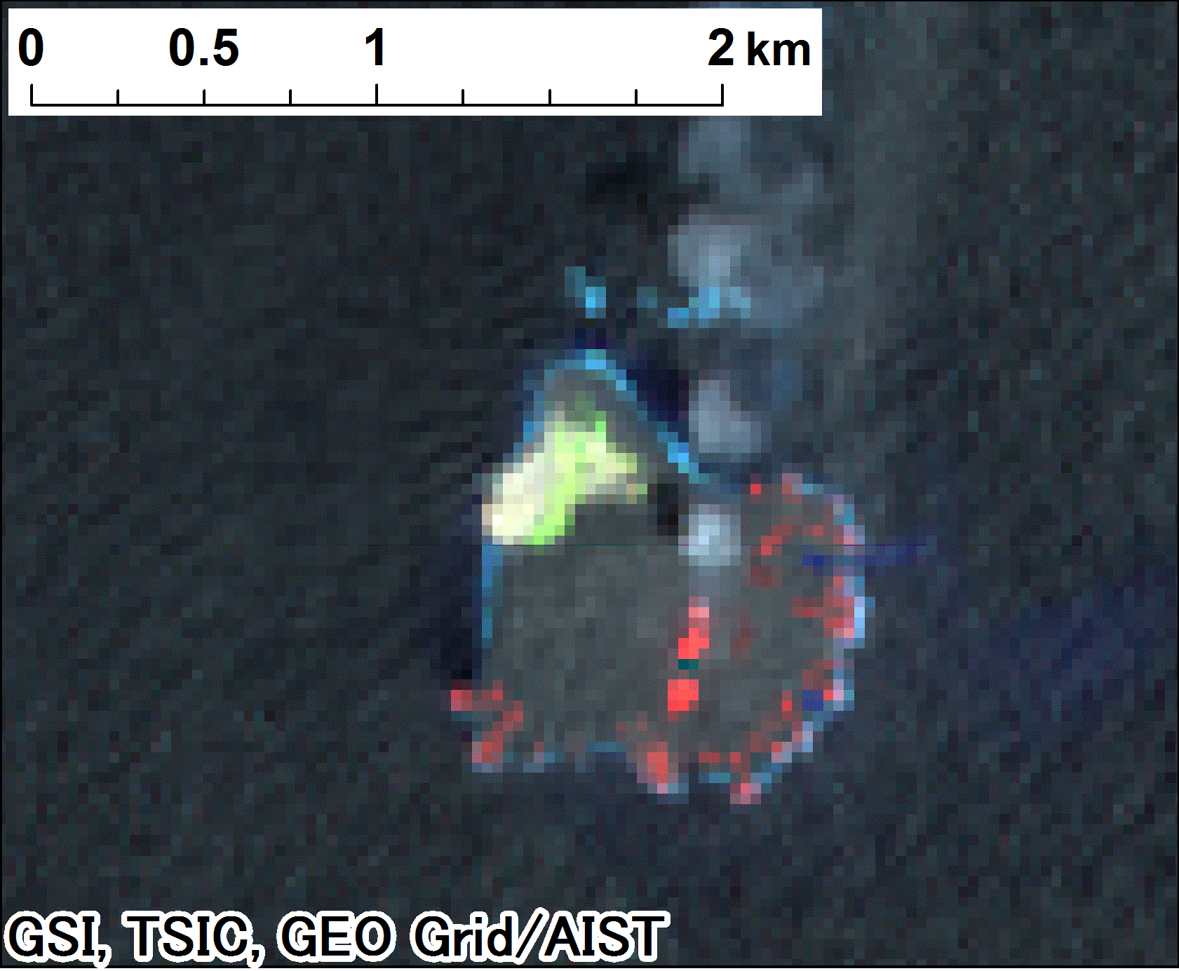
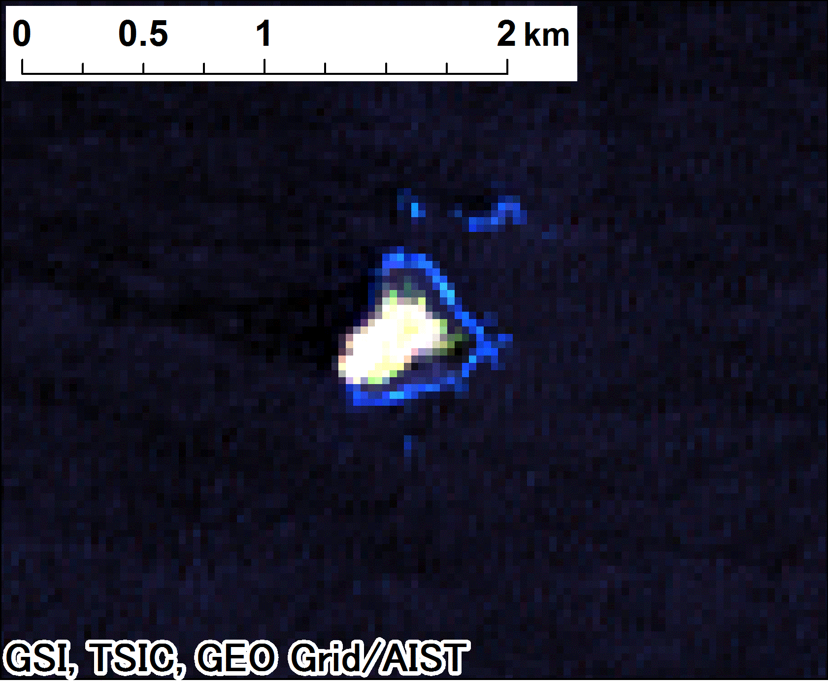
Color-composite Imagery (Spatial Resolution: 30 meters)
true-color imagery
RGB=
band 4 (0.64-0.67 micro meter)
band 3 (0.53-0.59 micro meter)
band 2 (0.45-0.51 micro meter)
color-composite imagery with NIR
RGB=
band 6 (1.57-1.65 micro meter)
band 5 (0.85-0.88 micro meter)
band 4 (0.64-0.67 micro meter)
2016-6-23
2015-12-14
2015-11-12
2015-10-11
2015-09-25
2015-08-24
2015-07-23
2015-07-07
2015-06-21
2015-06-05
2015-05-20
2015-05-04
2015-04-18
2015-04-02
2015-03-17
2015-03-01
2015-02-13
2015-01-12
2014-11-25
2014-10-24
2014-10-08
2014-09-06
2014-08-21
2014-07-04
2014-06-02
2014-05-17
2014-03-30
2014-02-26
2013-12-24
2013-09-03
(before the eruption)
Go to top