How to use "Displacement Vector"
- To change subject, region, period, and scale, select them from the right menu.
- To display a station name and code, put the cursor on the point.
- To display a vector length, click the point.
- To change horizontal or vertical components, select the "DIRECTION" radio button.

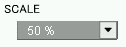
- To change the vector scale, select "SCALE" menu and choose scale.
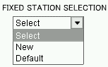
- To fix other observation station, select "New" in the "FIXED STATION SELECTION" menu.
Then click  button, new displacement vector map will be displayed. button, new displacement vector map will be displayed.
To display initial vector map , select "Default" and click button.
- To download numeric files of vector data, click
 button. button.
How to use "Coordinate Change Graph"
- To change subject, district and period, select them from the right menu.
- To display a station name and code, put the cursor on the point.
- To add an observation point, click the point on the map. (Selection is possible up to 5 points)
- To display coordinates change graph, click
 button, after you select observation points. (New window will be opened) button, after you select observation points. (New window will be opened)
- To cancel a selected point in the list box, select the station name in the "Output Observation Station" box and click
 button. button.
- To cancel a selected point on the map, click
 button. button.
- To display a graph for other points, select one from the above pull-down menu.
- To download numeric file of coordinates change graph, click
 button. button.
How to use the Baseline Length Variation Graph
- To change subject, district and period, select them from the right menu.
- To select a baseline, click beginning and end point on the map. Selected baselines are added in the list box.
- To display baseline variation graph, click button, after you select baseline.(New window will be opened)
- To cancel a selected baseline in the list box, select the baseline and click button.
- To cancel a selected point on the map, click button.
- To display a station name and code, put the cursor on the point.
- To display a graph for other baselines, select one from the above pull-down menu.
- To download numeric files of baseline length variation graph, click button.
|

