For full functionality of this site it is necessary to enable JavaScript.
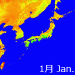
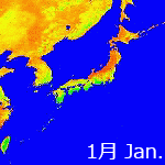
Download for 1km NDVI-data [ From 1997 to 2007 ]
The list of files available for download
Following table shows the data source of NDVI in each period.
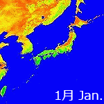
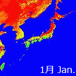
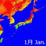
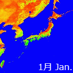
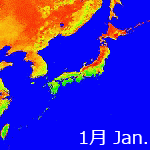
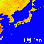
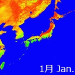
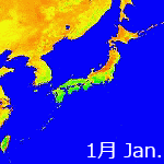
Please click the file name to download NDVI data of each month.
NOAA 12 was used temporarily between NOAA 14 and 16, due to the receiving condition of NOAA 14. We started using NOAA 17 from Apr. 2004.
Period
Using NOAA satellite
From Apr. 1997 to Mar. 2001
NOAA 14
From Apr. 2001 to Oct. 2001
NOAA 12
From Nov. 2001 to Mar. 2004
NOAA 16
From Apr. 2004
NOAA 17
(Accuracy of Jan. 2004's data is slightly low due to the satellite condition.)
(Accuracy of Dec. 1999's and Jan. 2000's NDVI data are slightly low.)
Specifications of the Data Provided
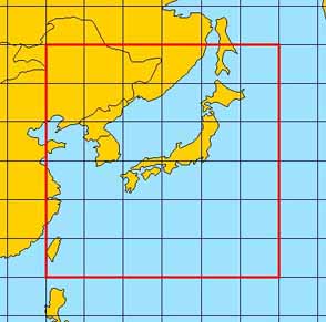
Data Coverage
East - west direction: from long. 120 degrees E. to long. 150 degrees E.
South - north direction: from lat. 20 degrees N. to lat. 50 degrees N.
Data Coverage
Data Size and Format
Grid size a grid of 30 seconds for both longitudinal and latitudinal directions
Data size 3,600 pixels x 3,600 lines x 1 byte (12.96 MB)
Format binary data without header
Data Compression
The volume of NDVI data is approximately 13 MB when downloaded in raw data. The data were compressed in gzip to reduce time for download.
Address for your opinions and questions: