The Mid Niigata prefecture Earthquakes in 2004: Field Report(1)
|
Released:09.11.2004 Last update:17.01.2005
JAPANESE(PDF) SATO P. Hiroshi*, SEKIGUCHI Tatsuo**, SUZUKI Yoshinori***, and IIDA Makoto*** | Report Index | Yamakoshi_Terano | Yamakoshi_Haguro | 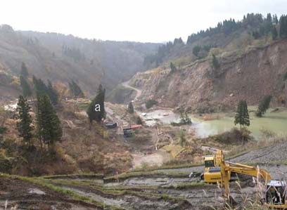
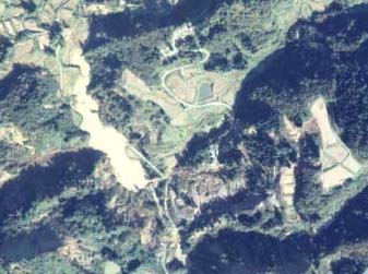
Landslide dam at Terano, Yamakoshi Village. 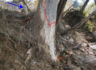
There was the trace of muddy water at the cedar tree, whose location is "a" in the above image. It is surmised that the carried mass was fluidized at the end of the landslide. Knnown Active Fault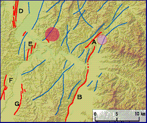
[Legend]
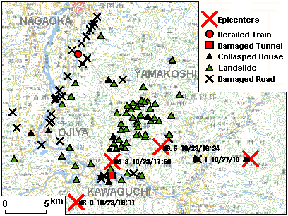
Red line: Known active Ffults Blue line: Lineament by photo-interpretation. Red spot: Mainshock epicenter (23/10) Pale-red spot: Aftershock epicenter ( 27/10) A: Obiro Fault B: Muikamachi Fault D: Katagai Fault E: Yamamotoyama Fault F: Tokamachi-west Fault G: Tokamachi-east Fault * :Geographic Information Analysis Research Div., **: Research Planning Div., ***:Geographic Dept.

|