For full functionality of this site it is necessary to enable JavaScript.
To Page Text
Text Size
Standard
Enlarge
JAPANESE
Sitemap
MENU
GSI HOME
Disaster Measures
GSI copes with natural disasters
Usu Volcano_the 2000 Eruption
Topographic maps of Mt. Usu
Topographic maps of Mt. Usu
GSI Home
GSI Activities
About GSI
Policy Planning
Public Survey
Geodetic Survey
Maps & Geospatial
Information
Disaster Measures
Research & Development
International Activities
The Science Museum of Map and Survey
GSI Web Site
Gazetteer
International Training
Global Map
Bulletin
Crustal Movement
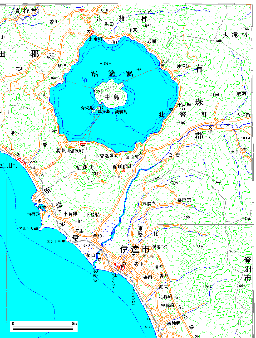
A part of 1:200,000 Regional map "Muroran"
[136KB]
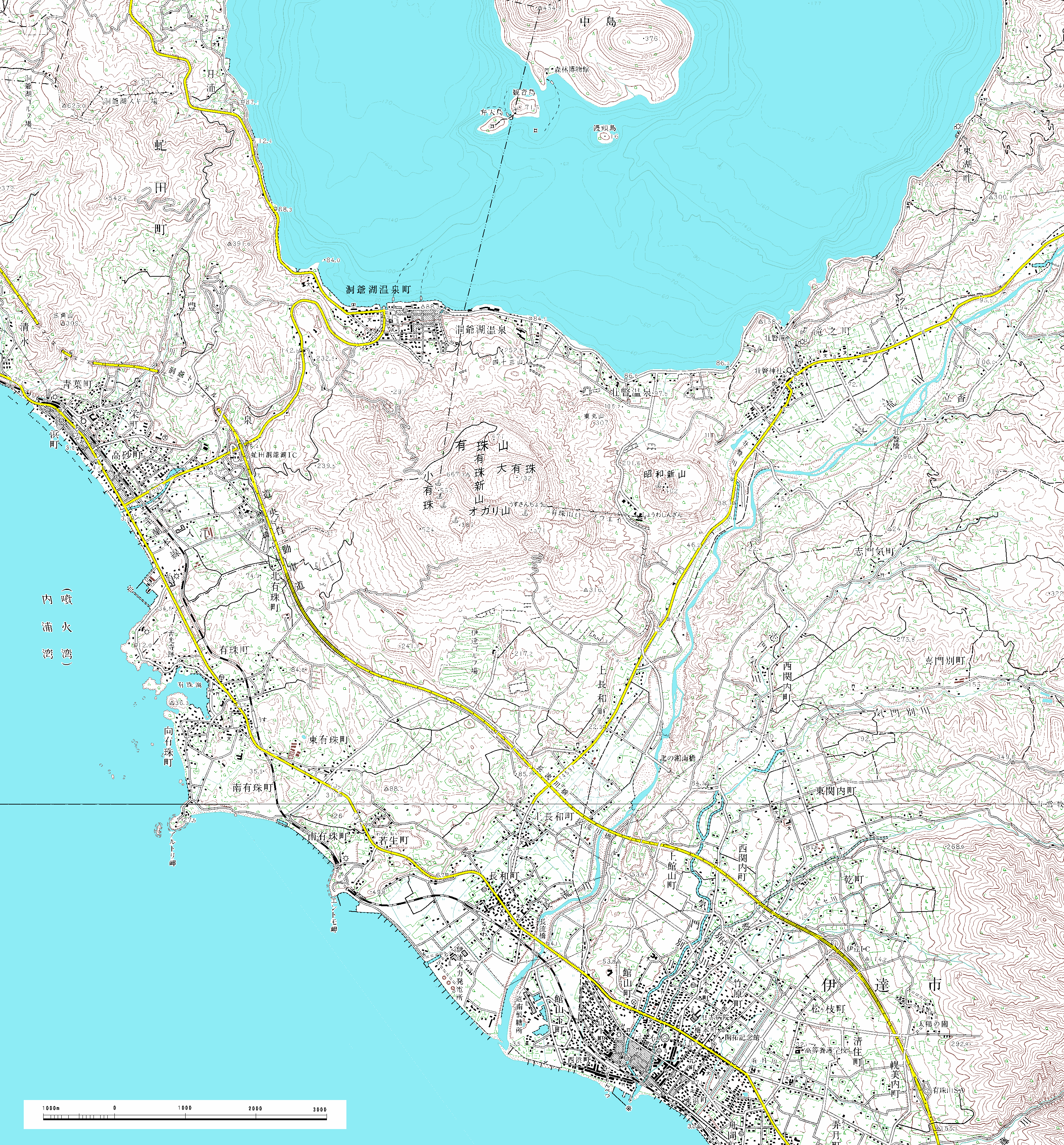
A part of 1:50,000 Topographic map "Abuta and Date"
[778KB]
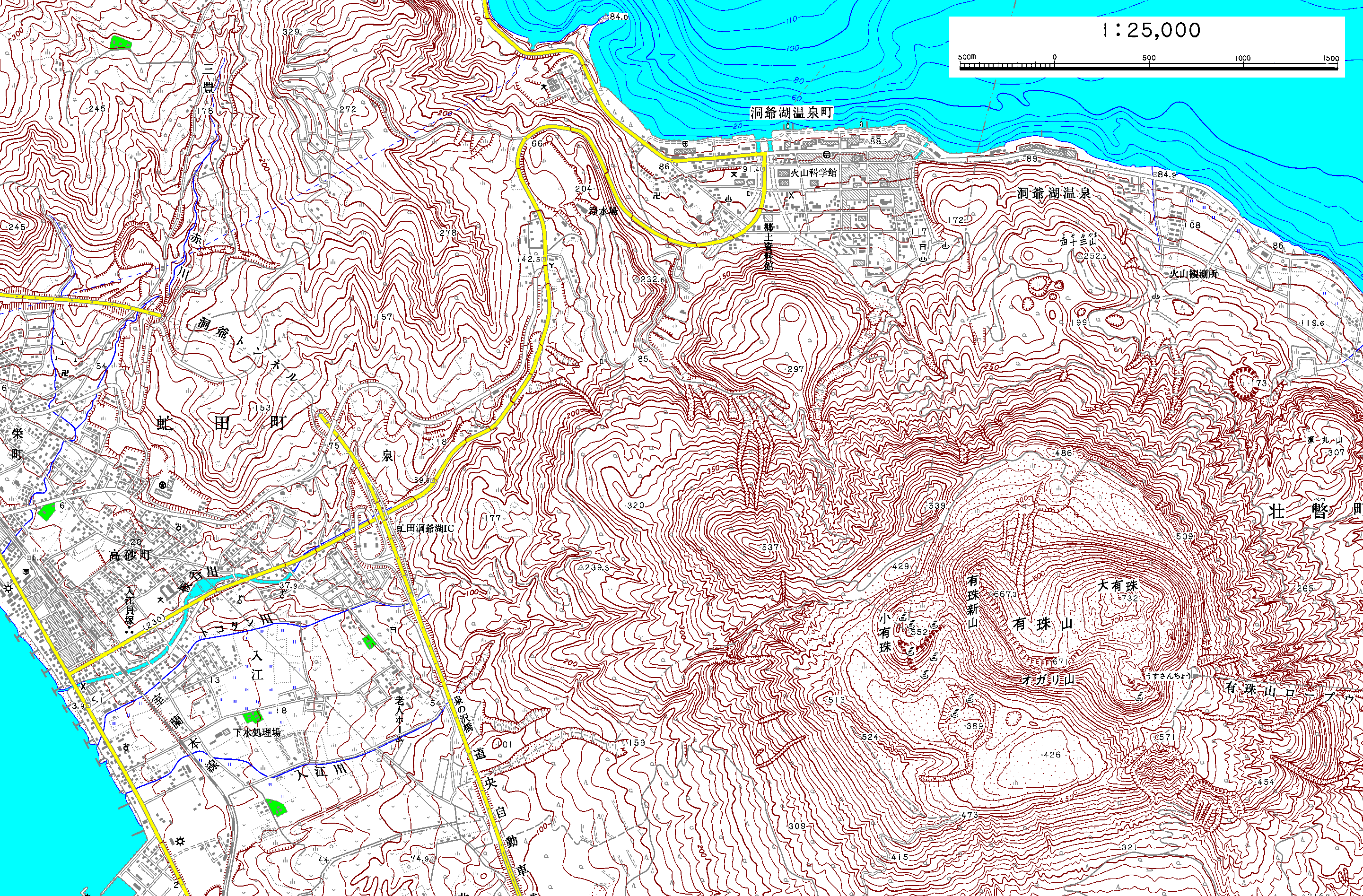
A part of 1:25,000 Topographic map "Abuta"
[554KB]
Go to top

