

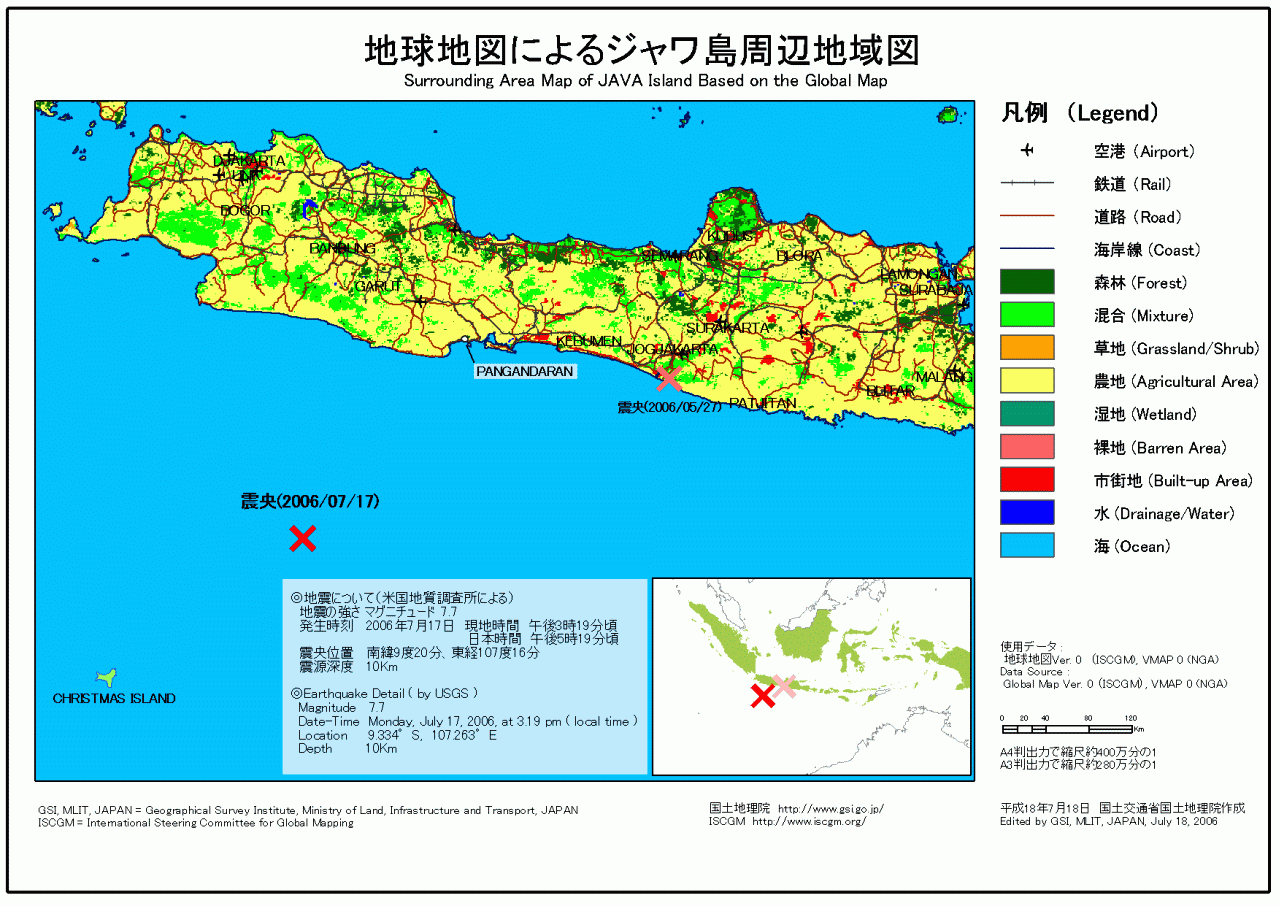
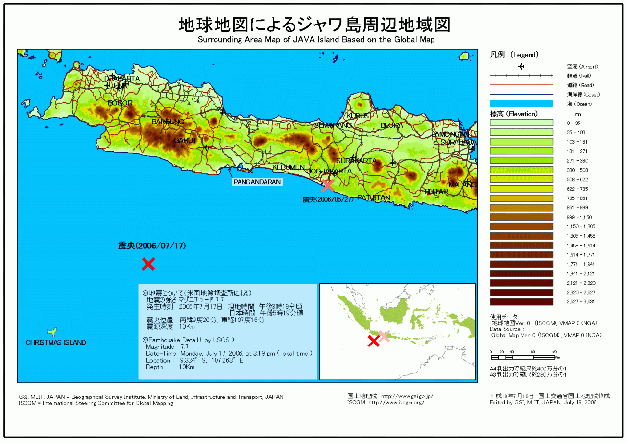
The Earthquake Jul. 2006 at south of Java
Release of a Map of Java Island and its Vicinity by Global Map1. Release of the mapA map of Java Island and its vicinity is released. This map includes Bangandalan City, Indonesia which suffered serious damage from a tsunami triggered by an earthquake of M 7.7 occurred in the southern offing of the Java Island, Indonesia on July 17 at about 5:19 a.m. Japan time (about 3:19 a. m. local time). This map shows the epicenter of the earthquake and geographical status of the Java Island and its vicinity including Bangandalan City. The map is prepared by using Global Map data.
2. Use of this mapThe map is freely available for a use of non-commercial purposes.
3. Global Mapping projectGlobal Mapping project is an endeavor advocated by the Ministry of Construction (present Ministry of Land, Infrastructure and Transport) in 1992 to develop a digital map (Global Map) covering the whole globe to accurately express the status of global environment, implemented in international cooperation of respective National Mapping Organizations (NMOs) of the world. The Global Map can be used for studying global environmental problems, etc.
The Global Map data development is underway steered by the International Steering Committee for Global Mapping (ISCGM). The ISCGM Secretariat is situated in the Geographical Survey Institute (GSI) which takes a central role of the project management. The GSI also provides developing countries with necessary technologies. The details of the project are shown at the following website.
|