

Land Condition Map of Volcano
|
Land condition map of volcano provides basic information for predicting volcanic damage, formulating disaster prevention measures, and so on. Therefore, their scales and depicted information differ slightly by area, but their scales are usually 1:15,000-1:50,000. They depict, in an easily-to-understand format, the distribution of landforms formed by past volcanic activities, erupted substances (lava and pyroclastic flows, scolia cones, debris avalanches, etc.), disaster prevention facilities and organizations, relief and safety facilities, structure for river flow control, tourist facilities, and other pertinent information. 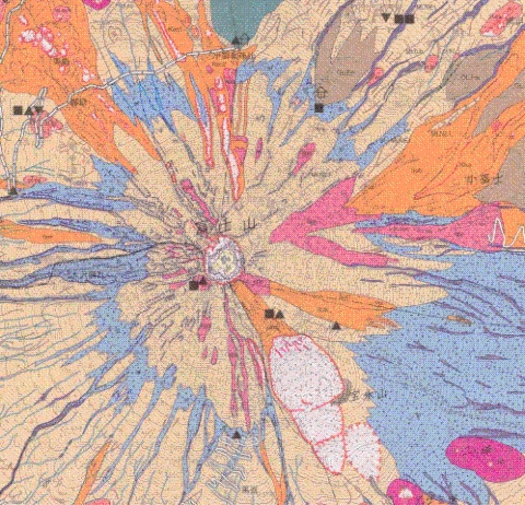
Land Condition Map of Volcano "Mt. Fuji" (Top part) |