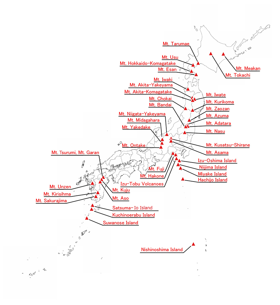
Index of the Volcanic Base Map
List of the Volcanic Base Map
Kanto-Chubu Region and Izu-Ogasawara Islands
| Volcano※1 |
Publication Year |
Category※2 |
Sheets |
Scale |
| Mt. Nasu |
Apr.1990 |
Publication |
1 |
1/10,000 |
| Mt. Kusatsu-Shirane |
Mar.1983 |
Publication |
1 |
1/5,000 |
| Mt. Asama |
Mar.1983 |
Publication |
2 |
1/5,000 |
| Feb.2008 |
Publication |
1 |
1/10,000 |
| Mar.2009 |
Publication |
1 |
1/10,000 |
| Mt.Niigata-Yakeyama |
Mar.2018 |
Data
(Base map) |
11 |
Under25000 |
Data
(Color shaded map) |
Data
(Photo map) |
Data
(DM) |
Data
(Shapefile) |
| Mt.Midagahara |
Mar.2018 |
Data
(Base map) |
6 |
Under25000 |
Data
(Color shaded map) |
Data
(Photo map) |
Data
(DM) |
Data
(Shapefile) |
| Mt.Yakedake |
Mar.2018 |
Data
(Base map) |
9 |
Under25000 |
Data
(Color shaded map) |
Data
(Photo map) |
Data
(DM) |
Data
(Shapefile) |
| Mt. Ontake |
1979 |
Publication |
4 |
1/5,000 |
| Aug.1992 |
Publication |
4 |
1/5,000 |
| Mt. Fuji |
Aug.2002 |
Publication |
4 |
1/10,000 |
| Mt. Hakone |
Mar.2017 |
Data
(Base map) |
3 |
Under25000 |
Data
(Color shaded map) |
3 |
Under25000 |
| Izu-tobu Volcanoes |
Jul.2005 |
Publication |
3 |
1/10,000 |
| Izu-Oshima Island |
Apr.1982 |
Publication |
2 |
1/5,000 |
| Niijima Island |
Jan.2018 |
Data
(Base map) |
3 |
Under25000 |
Data
(Color shaded map) |
Data
(Photo map) |
Data
(DM) |
Data
(Shapefile) |
| Miyake Island |
Aug.1981 |
Publication |
6 |
1/5,000 |
| Mar.1984 |
Publication |
4 |
1/5,000 |
| May.2004 |
Publication |
6 |
1/5,000 |
| Hachijo Island |
Jan.2018 |
Data
(Bade map) |
4 |
Under25000 |
Data
(Color shaded map) |
Data
(Photo map) |
Data
(DM) |
Data
(Shapefile) |
| Nishinoshima Island |
Jun.2017 |
Data
(Base map) |
1 |
2500 |
Data
(Color shaded map) |
1 |
2500 |
Data
(Photo map) |
1 |
2500 |
Data
(DM) |
1 |
2500 |
Data
(Shape) |
1 |
2500 |
※1 You can browse the Volcanic Base Map in the GSI Maps by clicking on the volcano name.
※2 Publication : Volcanic Base Map can be ordered at the Japan Map Center.
Technical Report : You can be available the image data from this website.
※3 DM data is available by request the Technical Report Number to GSI.
Some files are available in PDF format. To view PDF files, Adobe System's free "Adobe Reader" software must be installed. Please visit the following link to download the free software.
|